Cleland, South Australia
Cleland is a suburb in South Australia located in the Adelaide metropolitan area about 10 kilometres (6.2 miles) south-east of the Adelaide city centre.[1][4] Its boundaries were created in October 2001, with additional land being added in 2010 from the adjoining suburb of Crafers. Its name is derived from the Cleland Conservation Park.[1] The principal land use within the locality is conservation with the majority of its land area being occupied by the Cleland Conservation Park.[1] Places within its extent include the summit of Mount Lofty.[1] Cleland is located within the federal Division of Mayo, the state electoral district of Bragg and the local government areas of the Adelaide Hills Council and the City of Burnside.[6][5][1]
| Cleland South Australia | |||||||||||||||
|---|---|---|---|---|---|---|---|---|---|---|---|---|---|---|---|
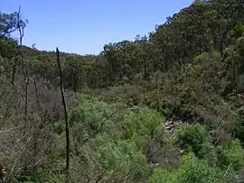 Wilson's bog | |||||||||||||||
 Cleland | |||||||||||||||
| Coordinates | 34°58′06″S 138°41′42″E[1] | ||||||||||||||
| Population | 0 (2011 census)[2] | ||||||||||||||
| Established | 2001[3] | ||||||||||||||
| Postcode(s) | 5152[4] | ||||||||||||||
| Time zone | ACST (UTC+9:30) | ||||||||||||||
| • Summer (DST) | ACST (UTC+10:30) | ||||||||||||||
| Location | 10 km (6 mi) east of Adelaide city centre | ||||||||||||||
| LGA(s) | |||||||||||||||
| State electorate(s) | Bragg[5] | ||||||||||||||
| Federal Division(s) | Mayo[6] | ||||||||||||||
| |||||||||||||||
| |||||||||||||||
| Footnotes | Locations[4][1] Adjoining suburbs[1] | ||||||||||||||
See also
References
- "Search results for 'Cleland, LOCB' with the following datasets selected - 'Suburbs and localities', 'Counties', 'Local Government Areas', 'SA Government Regions' and 'Gazetteer'". Location SA Map Viewer. South Australian Government. Retrieved 28 December 2018.
- Australian Bureau of Statistics (31 October 2012). "Cleland". 2011 Census QuickStats. Retrieved 15 April 2016.

- "Search result for " Cleland (Locality Bounded)" (Record no SA0040499) with the following layers selected - "Suburbs and Localities", "Local Government Areas", "Development Plan Layers", "Development Plan Layers" and "Place names (gazetteer"". Property Location Browser. Department of Planning, Transport and Infrastructure. Archived from the original on 12 October 2016. Retrieved 15 April 2016.
- "Postcode for Cleland, South Australia". postcodes-australia.com. Retrieved 15 April 2016.
- "Bragg, South AustraliaBackground Profile". ELECTORAL COMMISSION SA. Retrieved 15 April 2016.
- "Federal electoral division of Mayo" (PDF). Australian Electoral Commission. Retrieved 15 April 2016.
- "Monthly climate statistics: Summary statistics MOUNT LOFTY (nearest station)". Commonwealth of Australia , Bureau of Meteorology. Retrieved 15 April 2016.
- "Monthly rainfall (Long Ridge (Greenhill) (nearest station)". Commonwealth of Australia , Bureau of Meteorology. Retrieved 15 April 2016.
This article is issued from Wikipedia. The text is licensed under Creative Commons - Attribution - Sharealike. Additional terms may apply for the media files.