Coldwater River (British Columbia)
The Coldwater River is located in south central British Columbia, Canada. It is the largest tributary of the Nicola River, which it joins at the city of Merritt. The river drains a watershed of 917 square kilometres (354 sq mi).[4] Its traditional native name is Ntstlatko ("cold water").[3]
| Coldwater River | |
|---|---|
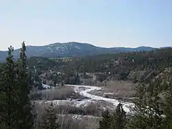 Coldwater River near Merritt, BC | |
| Location | |
| Country | Canada |
| Province | British Columbia |
| Physical characteristics | |
| Source | Zupkios Peak |
| • location | Cascade Mountains |
| • coordinates | 49°37′34″N 121°8′52″W[1] |
| • elevation | 1,344 m (4,409 ft)[2] |
| Mouth | Nicola River |
• location | Merritt, Nicola Valley |
• coordinates | 50°6′53″N 120°48′15″W[3] |
• elevation | 583 m (1,913 ft)[2] |
| Length | 95 km (59 mi) |
| Basin size | 917 km2 (354 sq mi)[4] |
| Discharge | |
| • location | mouth[4] |
| • average | 8.10 m3/s (286 cu ft/s)[4] Search for Station 08LG010 Coldwater River at Merritt</ref> |
| • minimum | 0.0 m3/s (0 cu ft/s) |
| • maximum | 122 m3/s (4,300 cu ft/s) |
Course
The Coldwater River originates in the Cascade Mountains west of Coquihalla Pass. Its headwaters flow from Zupjok Peak and other high mountains such as Llama Peak, Alpaca Peak, Vicuña Peak, and Guanaco Peak. It flows generally north for 95 kilometres (59 mi) before joining the Nicola River at Merritt. Major tributary creeks include Midday, Voght, Brook, Juliet, and July.[5]
The river flows under the Coquihalla Highway at the Kingvale Interchange.[6] The Coquihalla Highway runs through most of the Coldwater's valley, as do gas and oil pipelines. Canadian Pacific Railway tracks run along the northern part of the river.[7]
The river flows through two Nlaka'pamux Indian Reserves belonging to the Coldwater Indian Band: the Coldwater Indian Reserve 1 and Paul's Basin Indian Reserve 2.[8][9]
Ecology
The river passes through two biogeoclimatic zones over its course. In its upper reaches, it passes through the Interior Douglas Fir Zone. As it passes into the Coldwater Valley bottom, the region changes to the drier Ponderosa Pine/Bunch Grass Zone.[5]
Fish species
Several species of Pacific salmon are present, including coho, chinook, and steelhead. Non-salmon species include bull trout, Rocky Mountain whitefish, longnose dace, redside shiner, bridgelip sucker, slimy sculpin, prickly sculpin, Pacific lamprey, leopard dace, longnose sucker, and rainbow trout.[5]
References
- "Canadian 1:50K topographic maps" (map). TopoQuest.com. Retrieved 20 August 2013.
- Elevation derived from ASTER Global Digital Elevation Model, using GeoLocator, and BCGNIS coordinates
- "Coldwater River". BC Geographical Names.
- "Archived Hydrometric Data Search". Water Survey of Canada. Retrieved 19 August 2013. Search for Station 08LG010 Coldwater River at Merritt
- Nelson, Troy; Robert Bocking; Marc Gaboury (2001). Coldwater River Watershed Recovery Plan (PDF). Sidney, British Columbia: LGL Limited. p. 3.
- Nicola Tribal Association (2009). Coldwater River Habitat Education and Awareness 2009 Project Final Report. Merritt, BC: Pacific Salmon Foundation.
- Course information in part from "Merritt, Canadian 1:50K topographic maps" (map). TopoQuest.com. Retrieved 20 August 2013.
- "Coldwater 1 Reserve". Aboriginal Affairs and Northern Development Canada. Archived from the original on 4 March 2016. Retrieved 21 August 2013.
- "Paul's Basin 2 Reserve". Aboriginal Affairs and Northern Development Canada. Archived from the original on 22 August 2013. Retrieved 21 August 2013.