Connecticut Avenue Line
The Connecticut Avenue Line, designated Routes L1 and L2, is a daily bus route in Northwest Washington, D.C., United States. The L1 provides peak-direction rush hour service during weekdays, while the L2 operates seven days a week.
| L1, L2 | |||||||||||||||||||||||||||||||||||||||||||||||||||||||||||||||||||||||||||||||||||||||||||||||||||||||||||||||||||||||||||||||||||||||||||||||||||||||||||||||||||||||||||||||||||||||||||||||||||||||||||||||||||||||||||||||||||||||||||||||||||||||||||||||||||||||||||||||||||||||||||||||||||||||||||||||||||||||||||||||||||||||||||||||||||||||||||||||||||||||||||||||||||||||||||||||||||||||||||||||||||||||||||||||||||||||||||||||||||||||||||||||||||||||||||||||||||||||||||||||||||||||||||||||||||||||||||||||||||||||||||||||||||||||||||||||||||||||||||||||||||||||||||||||||||||||||||||||||||||||||||||||||||||||||||||||||||||||||||||||||||||||||||||||||||||||||||||||||
|---|---|---|---|---|---|---|---|---|---|---|---|---|---|---|---|---|---|---|---|---|---|---|---|---|---|---|---|---|---|---|---|---|---|---|---|---|---|---|---|---|---|---|---|---|---|---|---|---|---|---|---|---|---|---|---|---|---|---|---|---|---|---|---|---|---|---|---|---|---|---|---|---|---|---|---|---|---|---|---|---|---|---|---|---|---|---|---|---|---|---|---|---|---|---|---|---|---|---|---|---|---|---|---|---|---|---|---|---|---|---|---|---|---|---|---|---|---|---|---|---|---|---|---|---|---|---|---|---|---|---|---|---|---|---|---|---|---|---|---|---|---|---|---|---|---|---|---|---|---|---|---|---|---|---|---|---|---|---|---|---|---|---|---|---|---|---|---|---|---|---|---|---|---|---|---|---|---|---|---|---|---|---|---|---|---|---|---|---|---|---|---|---|---|---|---|---|---|---|---|---|---|---|---|---|---|---|---|---|---|---|---|---|---|---|---|---|---|---|---|---|---|---|---|---|---|---|---|---|---|---|---|---|---|---|---|---|---|---|---|---|---|---|---|---|---|---|---|---|---|---|---|---|---|---|---|---|---|---|---|---|---|---|---|---|---|---|---|---|---|---|---|---|---|---|---|---|---|---|---|---|---|---|---|---|---|---|---|---|---|---|---|---|---|---|---|---|---|---|---|---|---|---|---|---|---|---|---|---|---|---|---|---|---|---|---|---|---|---|---|---|---|---|---|---|---|---|---|---|---|---|---|---|---|---|---|---|---|---|---|---|---|---|---|---|---|---|---|---|---|---|---|---|---|---|---|---|---|---|---|---|---|---|---|---|---|---|---|---|---|---|---|---|---|---|---|---|---|---|---|---|---|---|---|---|---|---|---|---|---|---|---|---|---|---|---|---|---|---|---|---|---|---|---|---|---|---|---|---|---|---|---|---|---|---|---|---|---|---|---|---|---|---|---|---|---|---|---|---|---|---|---|---|---|---|---|---|---|---|---|---|---|---|---|---|---|---|---|---|---|---|---|---|---|---|---|---|---|---|---|---|---|---|---|---|---|---|---|---|---|---|---|---|---|---|---|---|---|---|---|---|---|---|---|---|---|---|---|---|---|---|---|---|---|---|---|---|---|---|---|---|---|---|---|---|---|---|---|---|---|---|---|---|---|---|---|---|---|---|---|---|---|---|---|---|---|---|---|---|---|---|---|---|---|---|---|---|---|---|---|---|---|---|---|---|---|---|---|---|---|---|---|---|---|---|---|---|---|---|---|---|---|---|---|---|---|---|---|---|---|---|---|---|---|---|---|---|---|---|---|---|---|---|---|---|---|---|---|---|---|---|---|---|---|---|---|---|---|---|---|---|---|---|---|---|---|---|---|---|---|---|---|---|---|---|---|---|---|---|---|---|---|---|---|---|---|---|---|---|---|---|---|---|---|---|---|---|---|---|---|---|---|---|---|---|---|---|---|---|---|---|---|---|---|---|---|---|---|---|---|---|---|---|---|---|---|---|---|---|---|---|---|---|---|
| Connecticut Avenue Line | |||||||||||||||||||||||||||||||||||||||||||||||||||||||||||||||||||||||||||||||||||||||||||||||||||||||||||||||||||||||||||||||||||||||||||||||||||||||||||||||||||||||||||||||||||||||||||||||||||||||||||||||||||||||||||||||||||||||||||||||||||||||||||||||||||||||||||||||||||||||||||||||||||||||||||||||||||||||||||||||||||||||||||||||||||||||||||||||||||||||||||||||||||||||||||||||||||||||||||||||||||||||||||||||||||||||||||||||||||||||||||||||||||||||||||||||||||||||||||||||||||||||||||||||||||||||||||||||||||||||||||||||||||||||||||||||||||||||||||||||||||||||||||||||||||||||||||||||||||||||||||||||||||||||||||||||||||||||||||||||||||||||||||||||||||||||||||||||||
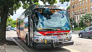 Route L2 at Cleveland Park station | |||||||||||||||||||||||||||||||||||||||||||||||||||||||||||||||||||||||||||||||||||||||||||||||||||||||||||||||||||||||||||||||||||||||||||||||||||||||||||||||||||||||||||||||||||||||||||||||||||||||||||||||||||||||||||||||||||||||||||||||||||||||||||||||||||||||||||||||||||||||||||||||||||||||||||||||||||||||||||||||||||||||||||||||||||||||||||||||||||||||||||||||||||||||||||||||||||||||||||||||||||||||||||||||||||||||||||||||||||||||||||||||||||||||||||||||||||||||||||||||||||||||||||||||||||||||||||||||||||||||||||||||||||||||||||||||||||||||||||||||||||||||||||||||||||||||||||||||||||||||||||||||||||||||||||||||||||||||||||||||||||||||||||||||||||||||||||||||||
| Overview | |||||||||||||||||||||||||||||||||||||||||||||||||||||||||||||||||||||||||||||||||||||||||||||||||||||||||||||||||||||||||||||||||||||||||||||||||||||||||||||||||||||||||||||||||||||||||||||||||||||||||||||||||||||||||||||||||||||||||||||||||||||||||||||||||||||||||||||||||||||||||||||||||||||||||||||||||||||||||||||||||||||||||||||||||||||||||||||||||||||||||||||||||||||||||||||||||||||||||||||||||||||||||||||||||||||||||||||||||||||||||||||||||||||||||||||||||||||||||||||||||||||||||||||||||||||||||||||||||||||||||||||||||||||||||||||||||||||||||||||||||||||||||||||||||||||||||||||||||||||||||||||||||||||||||||||||||||||||||||||||||||||||||||||||||||||||||||||||||
| System | Metrobus | ||||||||||||||||||||||||||||||||||||||||||||||||||||||||||||||||||||||||||||||||||||||||||||||||||||||||||||||||||||||||||||||||||||||||||||||||||||||||||||||||||||||||||||||||||||||||||||||||||||||||||||||||||||||||||||||||||||||||||||||||||||||||||||||||||||||||||||||||||||||||||||||||||||||||||||||||||||||||||||||||||||||||||||||||||||||||||||||||||||||||||||||||||||||||||||||||||||||||||||||||||||||||||||||||||||||||||||||||||||||||||||||||||||||||||||||||||||||||||||||||||||||||||||||||||||||||||||||||||||||||||||||||||||||||||||||||||||||||||||||||||||||||||||||||||||||||||||||||||||||||||||||||||||||||||||||||||||||||||||||||||||||||||||||||||||||||||||||||
| Operator | Washington Metropolitan Area Transit Authority | ||||||||||||||||||||||||||||||||||||||||||||||||||||||||||||||||||||||||||||||||||||||||||||||||||||||||||||||||||||||||||||||||||||||||||||||||||||||||||||||||||||||||||||||||||||||||||||||||||||||||||||||||||||||||||||||||||||||||||||||||||||||||||||||||||||||||||||||||||||||||||||||||||||||||||||||||||||||||||||||||||||||||||||||||||||||||||||||||||||||||||||||||||||||||||||||||||||||||||||||||||||||||||||||||||||||||||||||||||||||||||||||||||||||||||||||||||||||||||||||||||||||||||||||||||||||||||||||||||||||||||||||||||||||||||||||||||||||||||||||||||||||||||||||||||||||||||||||||||||||||||||||||||||||||||||||||||||||||||||||||||||||||||||||||||||||||||||||||
| Garage | Western | ||||||||||||||||||||||||||||||||||||||||||||||||||||||||||||||||||||||||||||||||||||||||||||||||||||||||||||||||||||||||||||||||||||||||||||||||||||||||||||||||||||||||||||||||||||||||||||||||||||||||||||||||||||||||||||||||||||||||||||||||||||||||||||||||||||||||||||||||||||||||||||||||||||||||||||||||||||||||||||||||||||||||||||||||||||||||||||||||||||||||||||||||||||||||||||||||||||||||||||||||||||||||||||||||||||||||||||||||||||||||||||||||||||||||||||||||||||||||||||||||||||||||||||||||||||||||||||||||||||||||||||||||||||||||||||||||||||||||||||||||||||||||||||||||||||||||||||||||||||||||||||||||||||||||||||||||||||||||||||||||||||||||||||||||||||||||||||||||
| Ended service | L4: June 17, 2012 | ||||||||||||||||||||||||||||||||||||||||||||||||||||||||||||||||||||||||||||||||||||||||||||||||||||||||||||||||||||||||||||||||||||||||||||||||||||||||||||||||||||||||||||||||||||||||||||||||||||||||||||||||||||||||||||||||||||||||||||||||||||||||||||||||||||||||||||||||||||||||||||||||||||||||||||||||||||||||||||||||||||||||||||||||||||||||||||||||||||||||||||||||||||||||||||||||||||||||||||||||||||||||||||||||||||||||||||||||||||||||||||||||||||||||||||||||||||||||||||||||||||||||||||||||||||||||||||||||||||||||||||||||||||||||||||||||||||||||||||||||||||||||||||||||||||||||||||||||||||||||||||||||||||||||||||||||||||||||||||||||||||||||||||||||||||||||||||||||
| Route | |||||||||||||||||||||||||||||||||||||||||||||||||||||||||||||||||||||||||||||||||||||||||||||||||||||||||||||||||||||||||||||||||||||||||||||||||||||||||||||||||||||||||||||||||||||||||||||||||||||||||||||||||||||||||||||||||||||||||||||||||||||||||||||||||||||||||||||||||||||||||||||||||||||||||||||||||||||||||||||||||||||||||||||||||||||||||||||||||||||||||||||||||||||||||||||||||||||||||||||||||||||||||||||||||||||||||||||||||||||||||||||||||||||||||||||||||||||||||||||||||||||||||||||||||||||||||||||||||||||||||||||||||||||||||||||||||||||||||||||||||||||||||||||||||||||||||||||||||||||||||||||||||||||||||||||||||||||||||||||||||||||||||||||||||||||||||||||||||
| Locale | Northwest, Montgomery County, Maryland | ||||||||||||||||||||||||||||||||||||||||||||||||||||||||||||||||||||||||||||||||||||||||||||||||||||||||||||||||||||||||||||||||||||||||||||||||||||||||||||||||||||||||||||||||||||||||||||||||||||||||||||||||||||||||||||||||||||||||||||||||||||||||||||||||||||||||||||||||||||||||||||||||||||||||||||||||||||||||||||||||||||||||||||||||||||||||||||||||||||||||||||||||||||||||||||||||||||||||||||||||||||||||||||||||||||||||||||||||||||||||||||||||||||||||||||||||||||||||||||||||||||||||||||||||||||||||||||||||||||||||||||||||||||||||||||||||||||||||||||||||||||||||||||||||||||||||||||||||||||||||||||||||||||||||||||||||||||||||||||||||||||||||||||||||||||||||||||||||
| Communities served | Foggy Bottom, Downtown, Dupont Circle, Adams Morgan, Woodley Park, Cleveland Park, Forest Hills, Wakefield, Chevy Chase, Bethesda | ||||||||||||||||||||||||||||||||||||||||||||||||||||||||||||||||||||||||||||||||||||||||||||||||||||||||||||||||||||||||||||||||||||||||||||||||||||||||||||||||||||||||||||||||||||||||||||||||||||||||||||||||||||||||||||||||||||||||||||||||||||||||||||||||||||||||||||||||||||||||||||||||||||||||||||||||||||||||||||||||||||||||||||||||||||||||||||||||||||||||||||||||||||||||||||||||||||||||||||||||||||||||||||||||||||||||||||||||||||||||||||||||||||||||||||||||||||||||||||||||||||||||||||||||||||||||||||||||||||||||||||||||||||||||||||||||||||||||||||||||||||||||||||||||||||||||||||||||||||||||||||||||||||||||||||||||||||||||||||||||||||||||||||||||||||||||||||||||
| Landmarks served | Farragut Square, Farragut West station, Farragut North station, West Potomac Park, GWU, Foggy Bottom-GWU station, Washington Circle, Dupont Circle station, Woodley Park station, National Zoo, Cleveland Park station, UDC, Van Ness-UDC station, Chevy Chase Circle, Friendship Heights station (Friday and Saturday late nights only), Bethesda station (Friday and Saturday late nights only) | ||||||||||||||||||||||||||||||||||||||||||||||||||||||||||||||||||||||||||||||||||||||||||||||||||||||||||||||||||||||||||||||||||||||||||||||||||||||||||||||||||||||||||||||||||||||||||||||||||||||||||||||||||||||||||||||||||||||||||||||||||||||||||||||||||||||||||||||||||||||||||||||||||||||||||||||||||||||||||||||||||||||||||||||||||||||||||||||||||||||||||||||||||||||||||||||||||||||||||||||||||||||||||||||||||||||||||||||||||||||||||||||||||||||||||||||||||||||||||||||||||||||||||||||||||||||||||||||||||||||||||||||||||||||||||||||||||||||||||||||||||||||||||||||||||||||||||||||||||||||||||||||||||||||||||||||||||||||||||||||||||||||||||||||||||||||||||||||||
| Start | West Potomac Park (L1) Farragut Square (L2) | ||||||||||||||||||||||||||||||||||||||||||||||||||||||||||||||||||||||||||||||||||||||||||||||||||||||||||||||||||||||||||||||||||||||||||||||||||||||||||||||||||||||||||||||||||||||||||||||||||||||||||||||||||||||||||||||||||||||||||||||||||||||||||||||||||||||||||||||||||||||||||||||||||||||||||||||||||||||||||||||||||||||||||||||||||||||||||||||||||||||||||||||||||||||||||||||||||||||||||||||||||||||||||||||||||||||||||||||||||||||||||||||||||||||||||||||||||||||||||||||||||||||||||||||||||||||||||||||||||||||||||||||||||||||||||||||||||||||||||||||||||||||||||||||||||||||||||||||||||||||||||||||||||||||||||||||||||||||||||||||||||||||||||||||||||||||||||||||||
| Via | Connecticut Avenue | ||||||||||||||||||||||||||||||||||||||||||||||||||||||||||||||||||||||||||||||||||||||||||||||||||||||||||||||||||||||||||||||||||||||||||||||||||||||||||||||||||||||||||||||||||||||||||||||||||||||||||||||||||||||||||||||||||||||||||||||||||||||||||||||||||||||||||||||||||||||||||||||||||||||||||||||||||||||||||||||||||||||||||||||||||||||||||||||||||||||||||||||||||||||||||||||||||||||||||||||||||||||||||||||||||||||||||||||||||||||||||||||||||||||||||||||||||||||||||||||||||||||||||||||||||||||||||||||||||||||||||||||||||||||||||||||||||||||||||||||||||||||||||||||||||||||||||||||||||||||||||||||||||||||||||||||||||||||||||||||||||||||||||||||||||||||||||||||||
| End | Chevy Chase Circle Bethesda station | ||||||||||||||||||||||||||||||||||||||||||||||||||||||||||||||||||||||||||||||||||||||||||||||||||||||||||||||||||||||||||||||||||||||||||||||||||||||||||||||||||||||||||||||||||||||||||||||||||||||||||||||||||||||||||||||||||||||||||||||||||||||||||||||||||||||||||||||||||||||||||||||||||||||||||||||||||||||||||||||||||||||||||||||||||||||||||||||||||||||||||||||||||||||||||||||||||||||||||||||||||||||||||||||||||||||||||||||||||||||||||||||||||||||||||||||||||||||||||||||||||||||||||||||||||||||||||||||||||||||||||||||||||||||||||||||||||||||||||||||||||||||||||||||||||||||||||||||||||||||||||||||||||||||||||||||||||||||||||||||||||||||||||||||||||||||||||||||||
| Length | L1 (inbound): 6.4 miles (10.30 km) L2 (inbound): 5.4 miles (8.69 km) | ||||||||||||||||||||||||||||||||||||||||||||||||||||||||||||||||||||||||||||||||||||||||||||||||||||||||||||||||||||||||||||||||||||||||||||||||||||||||||||||||||||||||||||||||||||||||||||||||||||||||||||||||||||||||||||||||||||||||||||||||||||||||||||||||||||||||||||||||||||||||||||||||||||||||||||||||||||||||||||||||||||||||||||||||||||||||||||||||||||||||||||||||||||||||||||||||||||||||||||||||||||||||||||||||||||||||||||||||||||||||||||||||||||||||||||||||||||||||||||||||||||||||||||||||||||||||||||||||||||||||||||||||||||||||||||||||||||||||||||||||||||||||||||||||||||||||||||||||||||||||||||||||||||||||||||||||||||||||||||||||||||||||||||||||||||||||||||||||
| Service | |||||||||||||||||||||||||||||||||||||||||||||||||||||||||||||||||||||||||||||||||||||||||||||||||||||||||||||||||||||||||||||||||||||||||||||||||||||||||||||||||||||||||||||||||||||||||||||||||||||||||||||||||||||||||||||||||||||||||||||||||||||||||||||||||||||||||||||||||||||||||||||||||||||||||||||||||||||||||||||||||||||||||||||||||||||||||||||||||||||||||||||||||||||||||||||||||||||||||||||||||||||||||||||||||||||||||||||||||||||||||||||||||||||||||||||||||||||||||||||||||||||||||||||||||||||||||||||||||||||||||||||||||||||||||||||||||||||||||||||||||||||||||||||||||||||||||||||||||||||||||||||||||||||||||||||||||||||||||||||||||||||||||||||||||||||||||||||||||
| Level | Daily | ||||||||||||||||||||||||||||||||||||||||||||||||||||||||||||||||||||||||||||||||||||||||||||||||||||||||||||||||||||||||||||||||||||||||||||||||||||||||||||||||||||||||||||||||||||||||||||||||||||||||||||||||||||||||||||||||||||||||||||||||||||||||||||||||||||||||||||||||||||||||||||||||||||||||||||||||||||||||||||||||||||||||||||||||||||||||||||||||||||||||||||||||||||||||||||||||||||||||||||||||||||||||||||||||||||||||||||||||||||||||||||||||||||||||||||||||||||||||||||||||||||||||||||||||||||||||||||||||||||||||||||||||||||||||||||||||||||||||||||||||||||||||||||||||||||||||||||||||||||||||||||||||||||||||||||||||||||||||||||||||||||||||||||||||||||||||||||||||
| Frequency | 15-20 minutes Weekday Peak Hours 20 minutes Weekday Midday 20-30 minutes Weekends | ||||||||||||||||||||||||||||||||||||||||||||||||||||||||||||||||||||||||||||||||||||||||||||||||||||||||||||||||||||||||||||||||||||||||||||||||||||||||||||||||||||||||||||||||||||||||||||||||||||||||||||||||||||||||||||||||||||||||||||||||||||||||||||||||||||||||||||||||||||||||||||||||||||||||||||||||||||||||||||||||||||||||||||||||||||||||||||||||||||||||||||||||||||||||||||||||||||||||||||||||||||||||||||||||||||||||||||||||||||||||||||||||||||||||||||||||||||||||||||||||||||||||||||||||||||||||||||||||||||||||||||||||||||||||||||||||||||||||||||||||||||||||||||||||||||||||||||||||||||||||||||||||||||||||||||||||||||||||||||||||||||||||||||||||||||||||||||||||
| Journey time | L1: 55 minutes L2: 40 minutes | ||||||||||||||||||||||||||||||||||||||||||||||||||||||||||||||||||||||||||||||||||||||||||||||||||||||||||||||||||||||||||||||||||||||||||||||||||||||||||||||||||||||||||||||||||||||||||||||||||||||||||||||||||||||||||||||||||||||||||||||||||||||||||||||||||||||||||||||||||||||||||||||||||||||||||||||||||||||||||||||||||||||||||||||||||||||||||||||||||||||||||||||||||||||||||||||||||||||||||||||||||||||||||||||||||||||||||||||||||||||||||||||||||||||||||||||||||||||||||||||||||||||||||||||||||||||||||||||||||||||||||||||||||||||||||||||||||||||||||||||||||||||||||||||||||||||||||||||||||||||||||||||||||||||||||||||||||||||||||||||||||||||||||||||||||||||||||||||||
| Operates | Weekdays (L1 only) 6:40 AM - 8:46 AM 3:50 PM - 6:34 PM Weekdays (L2 only) 5:05 AM - 1:00AM (Monday-Thursday) 5:05 AM - 2:00 AM (Friday) Weekends (L2 only) 5:42 AM - 2:00 AM (Saturday) 6:00 AM - 12:30 AM (Sunday) | ||||||||||||||||||||||||||||||||||||||||||||||||||||||||||||||||||||||||||||||||||||||||||||||||||||||||||||||||||||||||||||||||||||||||||||||||||||||||||||||||||||||||||||||||||||||||||||||||||||||||||||||||||||||||||||||||||||||||||||||||||||||||||||||||||||||||||||||||||||||||||||||||||||||||||||||||||||||||||||||||||||||||||||||||||||||||||||||||||||||||||||||||||||||||||||||||||||||||||||||||||||||||||||||||||||||||||||||||||||||||||||||||||||||||||||||||||||||||||||||||||||||||||||||||||||||||||||||||||||||||||||||||||||||||||||||||||||||||||||||||||||||||||||||||||||||||||||||||||||||||||||||||||||||||||||||||||||||||||||||||||||||||||||||||||||||||||||||||
| Transfers | SmarTrip only | ||||||||||||||||||||||||||||||||||||||||||||||||||||||||||||||||||||||||||||||||||||||||||||||||||||||||||||||||||||||||||||||||||||||||||||||||||||||||||||||||||||||||||||||||||||||||||||||||||||||||||||||||||||||||||||||||||||||||||||||||||||||||||||||||||||||||||||||||||||||||||||||||||||||||||||||||||||||||||||||||||||||||||||||||||||||||||||||||||||||||||||||||||||||||||||||||||||||||||||||||||||||||||||||||||||||||||||||||||||||||||||||||||||||||||||||||||||||||||||||||||||||||||||||||||||||||||||||||||||||||||||||||||||||||||||||||||||||||||||||||||||||||||||||||||||||||||||||||||||||||||||||||||||||||||||||||||||||||||||||||||||||||||||||||||||||||||||||||
| Timetable | Connecticut Avenue Line | ||||||||||||||||||||||||||||||||||||||||||||||||||||||||||||||||||||||||||||||||||||||||||||||||||||||||||||||||||||||||||||||||||||||||||||||||||||||||||||||||||||||||||||||||||||||||||||||||||||||||||||||||||||||||||||||||||||||||||||||||||||||||||||||||||||||||||||||||||||||||||||||||||||||||||||||||||||||||||||||||||||||||||||||||||||||||||||||||||||||||||||||||||||||||||||||||||||||||||||||||||||||||||||||||||||||||||||||||||||||||||||||||||||||||||||||||||||||||||||||||||||||||||||||||||||||||||||||||||||||||||||||||||||||||||||||||||||||||||||||||||||||||||||||||||||||||||||||||||||||||||||||||||||||||||||||||||||||||||||||||||||||||||||||||||||||||||||||||
| |||||||||||||||||||||||||||||||||||||||||||||||||||||||||||||||||||||||||||||||||||||||||||||||||||||||||||||||||||||||||||||||||||||||||||||||||||||||||||||||||||||||||||||||||||||||||||||||||||||||||||||||||||||||||||||||||||||||||||||||||||||||||||||||||||||||||||||||||||||||||||||||||||||||||||||||||||||||||||||||||||||||||||||||||||||||||||||||||||||||||||||||||||||||||||||||||||||||||||||||||||||||||||||||||||||||||||||||||||||||||||||||||||||||||||||||||||||||||||||||||||||||||||||||||||||||||||||||||||||||||||||||||||||||||||||||||||||||||||||||||||||||||||||||||||||||||||||||||||||||||||||||||||||||||||||||||||||||||||||||||||||||||||||||||||||||||||||||||
The current routing also incorporates Route L4, which operated with the L1 and L2 until 2012.[1][2]
Route description
The L1 begins at the West Potomac Park apartments at 18th and C Streets. It jogs to Constitution Avenue via 18th and 20th Streets, and turns right on 23rd Street. The route proceeds through Foggy Bottom and the campus of the George Washington University until Washington Circle, where it switches to New Hampshire Avenue for just a few blocks. The route turns north onto 20th Street to avoid Dupont Circle, and eventually reaches Connecticut Avenue by way of Massachusetts Avenue and Florida Avenue. The L2 starts at Farragut Square, which is also the southern terminus of Connecticut Avenue, and proceeds north along the avenue. It passes underneath Dupont Circle via the Connecticut Avenue underpass, and is joined by the L1 at an intersection with Florida Avenue and S Street.
Now together, the two routes continue north along the avenue. The L1 crosses Rock Creek Park via the Taft Bridge, while the L2 takes a brief detour into Adams Morgan via Columbia Road, Calvert Street, and the Duke Ellington Bridge. Following Connecticut Avenue northbound, the routes serve multiple stations of the Red Line––namely, Woodley Park, Cleveland Park, and Van Ness, until the Red Line diverts from Connecticut Avenue. The routes also pass through the Woodley Park and Cleveland Park neighborhoods, of which the former also includes the National Zoological Park. In the Forest Hills neighborhood, the routes also provide access to the Van Ness Campus of the University of the District of Columbia, the district's only public university.
Both routes terminate at Chevy Chase Circle, just south of Western Avenue and the Maryland state line. Here, the two routes provide transfers to the L8, also known as the Connecticut Avenue–Maryland Line. Essentially the L1 and L2's continuation into Maryland, the L8 begins at the nearby Friendship Heights station and serves Connecticut Avenue in Chevy Chase, Kensington, and Aspen Hill.
L1 stops
| Bus stop | Direction | Connections |
|---|---|---|
| Washington, D.C. | ||
| C Street NW / 17th Street NW (North) 18th Street NW / E Street NW (South) Potomac Park |
Northbound stop, Southbound terminal |
|
| Constitution Avenue NW / 21st Street NW | Bidirectional | |
| Constitution Avenue NW / 22nd Street NW | Southbound | |
| 23rd Street NW / C Street NW | Bidirectional | |
| 23rd Street NW / Virginia Avenue NW | Northbound | |
| 23rd Street NW / E Street NW | Southbound | |
| 23rd Street NW / G Street NW | Bidirectional | |
| 23rd Street NW / I Street NW | Bidirectional | |
| New Hampshire Avenue NW / M Street NW | Bidirectional | |
| New Hampshire Avenue NW / N Street NW | Bidirectional | |
| 20th Street NW / New Hampshire Avenue NW | Southbound | |
| 20th Street NW / P Street NW | Northbound | |
| H Street NW / 18th Street NW | Bidirectional | |
| Massachusetts Avenue NW / 20th Street NW Dupont Circle station |
Bidirectional | |
| Connecticut Avenue NW / R Street NW | Southbound | |
| Connecticut Avenue NW / Florida Avenue NW | Northbound | |
| Connecticut Avenue NW / Leroy Place NW | Southbound | |
| Connecticut Avenue NW / California Street NW | Northbound | |
| Connecticut Avenue NW / Wyoming Avenue NW | Southbound | |
| Connecticut Avenue NW / Kalorama Road NW | Bidirectional | |
| Rock Creek / Taft Bridge | ||
| Connecticut Avenue NW / Calvert Street NW | Bidirectional | |
| Connecticut Avenue NW / 24th Street NW | Southbound | |
| Connecticut Avenue NW / Woodley Road NW Woodley Park station |
Bidirectional | |
| Connecticut Avenue NW / Cathedral Avenue NW | Bidirectional | |
| Connecticut Avenue NW / Smithsonian's National Zoo | Bidirectional | |
| Connecticut Avenue NW / Devonshire Place NW | Bidirectional | |
| Connecticut Avenue NW / Macomb Street NW | Bidirectional | |
| Connecticut Avenue NW / Ordway Street NW |
Bidirectional | |
| Connecticut Avenue NW / Porter Street NW | Bidirectional | |
| Connecticut Avenue NW / Rodman Street NW | Southbound | |
| Connecticut Avenue NW / Sedgwick Street NW | Bidirectional | |
| Connecticut Avenue NW / Tilden Street NW | Bidirectional | |
| Connecticut Avenue NW / Van Ness Street NW | Bidirectional | |
| Connecticut Avenue NW / Veazey Terrace NW Van Ness–UDC station |
Bidirectional | |
| Connecticut Avenue NW / Yuma Street NW | Southbound | |
| Connecticut Avenue NW / Albemarle Street NW | Bidirectional | |
| Connecticut Avenue NW / Brandywine Street NW | Bidirectional | |
| Connecticut Avenue NW / Chesapeake Street NW | Bidirectional | |
| Connecticut Avenue NW / Cumberland Street NW | Southbound | |
| Connecticut Avenue NW / Davenport Street NW | Northbound | |
| Connecticut Avenue NW / Ellicott Street NW | Southbound | |
| Connecticut Avenue NW / Everett Street NW | Northbound | |
| Connecticut Avenue NW / Nebraska Avenue NW | Bidirectional | |
| Connecticut Avenue NW / Huntington Street NW | Bidirectional | |
| Connecticut Avenue NW / Jocelyn Street NW | Bidirectional | |
| Connecticut Avenue NW / Military Road NW | Bidirectional | |
| Connecticut Avenue NW / Legation Street NW | Southbound | |
| Connecticut Avenue NW / Livingston Street NW | Bidirectional | |
| Connecticut Avenue NW / McKinley Street NW | Bidirectional | |
| Chevy Chase, Maryland | ||
| Chevy Chase Circle / Connecticut Avenue | Southbound stop, Northbound terminal |
|
L2 stops
| Bus stop | Direction | Connections |
|---|---|---|
| Washington, D.C. | ||
| 17th Street NW / I Street NW Farragut Square |
Northbound stop, Southbound terminal |
|
| Connecticut Avenue NW / L Street NW | Bidirectional | |
| Connecticut Avenue NW / M Street NW | Bidirectional | |
| Connecticut Avenue NW / N Street NW | Southbound | |
| Connecticut Avenue NW / 18th Street NW | Northbound | |
| Connecticut Avenue NW / R Street NW | Southbound | |
| Connecticut Avenue NW / S Street NW | Northbound | |
| Connecticut Avenue NW / Florida Avenue NW | Northbound | |
| Connecticut Avenue NW / Leroy Place NW | Southbound | |
| Columbia Road NW / California Street NW | Bidirectional | |
| Columbia Road NW / 19th Street NW | Bidirectional | |
| Columbia Road NW / Mintwood Place NW | Bidirectional | |
| Columbia Road NW / Biltmore Street NW | Southbound | |
| Adams Mill Road NW / Columbia Road NW | Northbound | |
| Calvert Street NW / Lanier Place NW | Southbound | |
| Calvert Street NW / Biltmore Street NW | Bidirectional | |
| Rock Creek / Duke Ellington Bridge | ||
| Calvert Street NW / Connecticut Avenue NW | Southbound | |
| Connecticut Avenue NW / Calvert Street NW | Northbound | |
| 24th Street NW / Connecticut Avenue NW Woodley Park station |
Southbound | |
| Connecticut Avenue NW / Woodley Road NW Woodley Park station |
Bidirectional | |
| Connecticut Avenue NW / Cathedral Avenue NW | Bidirectional | |
| Connecticut Avenue NW / Smithsonian's National Zoo | Bidirectional | |
| Connecticut Avenue NW / Devonshire Place NW | Bidirectional | |
| Connecticut Avenue NW / Macomb Street NW | Bidirectional | |
| Connecticut Avenue NW / Ordway Street NW Cleveland Park station |
Bidirectional | |
| Connecticut Avenue NW / Porter Street NW | Bidirectional | |
| Connecticut Avenue NW / Rodman Street NW | Southbound | |
| Connecticut Avenue NW / Sedgwick Street NW | Bidirectional | |
| Connecticut Avenue NW / Tilden Street NW | Bidirectional | |
| Connecticut Avenue NW / Van Ness Street NW | Bidirectional | |
| Connecticut Avenue NW / Veazey Terrace NW Van Ness–UDC station |
Bidirectional | |
| Connecticut Avenue NW / Yuma Street NW | Southbound | |
| Connecticut Avenue NW / Albemarle Street NW | Bidirectional | |
| Connecticut Avenue NW / Brandywine Street NW | Bidirectional | |
| Connecticut Avenue NW / Chesapeake Street NW | Bidirectional | |
| Connecticut Avenue NW / Cumberland Street NW | Southbound | |
| Connecticut Avenue NW / Davenport Street NW | Northbound | |
| Connecticut Avenue NW / Ellicott Street NW | Southbound | |
| Connecticut Avenue NW / Everett Street NW | Northbound | |
| Connecticut Avenue NW / Nebraska Avenue NW | Bidirectional | |
| Connecticut Avenue NW / Huntington Street NW | Bidirectional | |
| Connecticut Avenue NW / Jocelyn Street NW | Bidirectional | |
| Connecticut Avenue NW / Military Road NW | Bidirectional | |
| Connecticut Avenue NW / Legation Street NW | Southbound | |
| Connecticut Avenue NW / Livingston Street NW | Bidirectional | |
| Connecticut Avenue NW / McKinley Street NW | Bidirectional | |
| Chevy Chase (Washington, D.C.) / Chevy Chase, Maryland | ||
| Chevy Chase Circle / Connecticut Avenue | Southbound stop, Northbound terminal |
|
| Western Avenue NW / Oliver Street NW | Bidirectional | |
| Western Avenue / Cedar Parkway | Northbound | |
| Western Avenue NW / 41st Street NW | Southbound | |
| Western Avenue NW / Livingston Street NW | Bidirectional | |
| Friendship Heights Station Bus Bay D (South) Bus Bay K (North) |
Bidirectional | |
| Bethesda, Maryland | ||
| Wisconsin Avenue / South Park Avenue | Bidirectional | |
| Wisconsin Avenue / Somerset Terrace | Bidirectional | |
| Wisconsin Avenue / Grafton Street | Northbound | |
| Wisconsin Avenue / Dorset Avenue | Southbound | |
| Wisconsin Avenue / Drummond Lane | Northbound | |
| Wisconsin Avenue / Langdrum Lane NW | Bidirectional | |
| Wisconsin Avenue / Chevy Chase Boulevard | Bidirectional | |
| Wisconsin Avenue / Norwood Drive | Bidirectional | |
| Wisconsin Avenue / Bradley Boulevard | Northbound | |
| Wisconsin Avenue / Nottingham Drive | Southbound | |
| Wisconsin Avenue / Stanford Street | Bidirectional | |
| Wisconsin Avenue / Leland Street | Northbound | |
| Wisconsin Avenue / Miller Avenue | Southbound | |
| Wisconsin Avenue / Waverly Street | Northbound | |
| Wisconsin Avenue / Elm Street | Southbound | |
| Bethesda Station Bus Bay B |
Southbound stop, Northbound terminal |
|
Notes:
| ||
History
At different points, the Connecticut Avenue Line was al operated by the L1, L2, L3, L4, L5, L7, L8, and L9. Eventually, the lines were converted into the Connecticut Avenue Line as the L1, L2, and L4, and then the Connecticut Avenue–Maryland Line as the L7 and L8.[3][4]
Until June 17, 2012, the Connecticut Avenue Line was also served by the L4. The route operated from Dupont Circle to Chevy Chase Circle via Connecticut Avenue, of which the whole route overlapped with the L1 and L2.
2012 Changes
On June 17, 2012, the line was restructured where the L1 would operate along Virginia Avenue NW, between 23rd and C streets NW. Route L2 would operate directly along Connecticut Avenue between Chevy Chase Circle and Farragut Square, while using the underpass at Dupont Circle, except for a diversion via Calvert Street and Columbia Road. Route L4 would be discontinued and replaced by routes L1 and L2 as the route was a duplicate to both the routes.[5]
2016 Changes
On December 18, 2016, route L2 late night trips on Fridays and Saturdays were extended to both Friendship Heights station and Bethesda station due to earlier closure of Metrorail.[6]
2018 Proposed Changes
In 2018, WMATA released a study on the L1 and L2. Proposals sets goes as follows:[7]
- Convert all route L1 trips to route L2 in order to simplify service options and increase weekday frequency between Chevy Chase Circle and Farragut Square
- During weekends, terminate every other Route L2 trip at Woodley Park. Between Chevy Chase Circle to Woodley Park, buses would run every 20 minutes instead of every 30 minutes, BUT between Woodley Park and Farragut Square, buses would run every 60 minutes instead of every 30 minutes.
- Have route L1 operate daily service terminate at 21st Street and Virginia Avenue NW instead of continuing south on 23rd Street and east on Constitution Avenue NW and northbound L1 trips be rerouted to operate along to go around Dupont Circle and north on Connecticut Ave NW instead of its current route via Massachusetts and Florida Avenues NW.
2020 Proposed changes
On September 26, 2020, WMATA proposed to eliminate all route L1 service due to low federal funding. Route L1 has not operated since March 13, 2020 due to Metro's response to the COVID-19 pandemic.[10]
References
- Robert Thomson (February 19, 2009). "First Look at Possible Metro Service Cuts". The Washington Post. Retrieved December 4, 2016.
- "WASHINGTON DC TRANSIT ROUTES". www.chicagorailfan.com. Retrieved 2019-11-16.
- "New Subway Stops Bring Metrobus Service Changes". The Washington Post. Retrieved 25 January 2021.
- "WASHINGTON DC TRANSIT ROUTES". www.chicagorailfan.com. Retrieved 25 January 2021.
- "Metro News Release". wmata.com. Archived from the original on December 14, 2018. Retrieved 12 May 2020.
- "Metrobus Service Changes, December 18 | WMATA". www.wmata.com. Retrieved 27 May 2020.
- "ANC 3F resolution: L1/L2 bus proposals need more explanation and more community input | Forest Hills Connection || News and Life in Our DC Neighborhood". 18 May 2018. Retrieved 25 January 2021.
- "Metrobus Service Evaluation Summary" (PDF). Retrieved 25 January 2021.
- "Metro changes plans for L1 and L2 bus routes after riders push back | Forest Hills Connection || News and Life in Our DC Neighborhood". 25 June 2018. Retrieved 25 January 2021.
- "Proposed Service Adjustments by Jurisdiction" (PDF). Retrieved 27 September 2020.