Coolidge, Kansas
Coolidge is a city in Hamilton County, Kansas, United States. As of the 2010 census, the city population was 95.[6]
Coolidge, Kansas | |
|---|---|
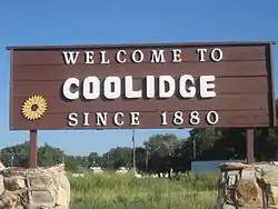 Welcome Sign (2010) | |
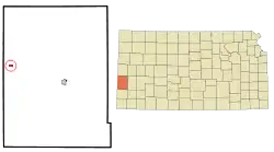 Location within Hamilton County and Kansas | |
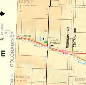 KDOT map of Hamilton County (legend) | |
| Coordinates: 38°2′32″N 102°0′37″W | |
| Country | United States |
| State | Kansas |
| County | Hamilton |
| Founded | 1880 |
| Incorporated | 1886 |
| Named for | Thomas Coolidge |
| Area | |
| • Total | 0.46 sq mi (1.20 km2) |
| • Land | 0.46 sq mi (1.20 km2) |
| • Water | 0.00 sq mi (0.00 km2) |
| Elevation | 3,356 ft (1,023 m) |
| Population | |
| • Total | 95 |
| • Estimate (2019)[3] | 90 |
| • Density | 194.81/sq mi (75.24/km2) |
| Time zone | UTC-7 (Mountain (MST)) |
| • Summer (DST) | UTC-6 (MDT) |
| ZIP code | 67836 |
| Area code | 620 |
| FIPS code | 20-15400 [4] |
| GNIS ID | 0485265 [5] |
History
The city of Coolidge was named after Thomas Jefferson Coolidge, the former president of the Atchison, Topeka and Santa Fe Railway.[7][8]
The first post office in Coolidge was established in July 1881.[9]
Geography
Coolidge is located at 38°2′32″N 102°0′37″W (38.042318, -102.010210).[10] According to the United States Census Bureau, the city has a total area of 0.46 square miles (1.19 km2), all of it land.[11]
Climate
According to the Köppen Climate Classification system, Coolidge has a semi-arid climate, abbreviated "BSk" on climate maps.[12]
Demographics
| Historical population | |||
|---|---|---|---|
| Census | Pop. | %± | |
| 1890 | 472 | — | |
| 1900 | 288 | −39.0% | |
| 1910 | 145 | −49.7% | |
| 1920 | 144 | −0.7% | |
| 1930 | 135 | −6.2% | |
| 1940 | 132 | −2.2% | |
| 1950 | 168 | 27.3% | |
| 1960 | 117 | −30.4% | |
| 1970 | 102 | −12.8% | |
| 1980 | 82 | −19.6% | |
| 1990 | 90 | 9.8% | |
| 2000 | 86 | −4.4% | |
| 2010 | 95 | 10.5% | |
| 2019 (est.) | 90 | [3] | −5.3% |
| U.S. Decennial Census | |||
2010 census
As of the census[2] of 2010, there were 95 people, 43 households, and 26 families residing in the city. The population density was 206.5 inhabitants per square mile (79.7/km2). There were 49 housing units at an average density of 106.5 per square mile (41.1/km2). The racial makeup of the city was 82.1% White and 17.9% from other races. Hispanic or Latino of any race were 33.7% of the population.
There were 43 households, of which 30.2% had children under the age of 18 living with them, 41.9% were married couples living together, 9.3% had a female householder with no husband present, 9.3% had a male householder with no wife present, and 39.5% were non-families. 32.6% of all households were made up of individuals, and 18.6% had someone living alone who was 65 years of age or older. The average household size was 2.21 and the average family size was 2.88.
The median age in the city was 42.1 years. 25.3% of residents were under the age of 18; 2% were between the ages of 18 and 24; 27.4% were from 25 to 44; 28.4% were from 45 to 64; and 16.8% were 65 years of age or older. The gender makeup of the city was 50.5% male and 49.5% female.
2000 census
As of the census[4] of 2000, there were 86 people, 36 households, and 25 families residing in the city. The population density was 187.4 people per square mile (72.2/km2). There were 41 housing units at an average density of 89.3 per square mile (34.4/km2). The racial makeup of the city was 70.93% White, 26.74% from other races, and 2.33% from two or more races. Hispanic or Latino of any race were 33.72% of the population.
There were 36 households, out of which 33.3% had children under the age of 18 living with them, 66.7% were married couples living together, 5.6% had a female householder with no husband present, and 27.8% were non-families. 27.8% of all households were made up of individuals, and 22.2% had someone living alone who was 65 years of age or older. The average household size was 2.39 and the average family size was 2.88.
In the city, the population was spread out, with 19.8% under the age of 18, 8.1% from 18 to 24, 24.4% from 25 to 44, 19.8% from 45 to 64, and 27.9% who were 65 years of age or older. The median age was 43 years. For every 100 females, there were 83.0 males. For every 100 females age 18 and over, there were 86.5 males.
The median income for a household in the city was $36,250, and the median income for a family was $36,250. Males had a median income of $22,000 versus $26,250 for females. The per capita income for the city was $17,485. There were no families and 3.0% of the population living below the poverty line, including no under eighteens and 6.3% of those over 64.
Cultural references
In the 1983 movie National Lampoon's Vacation starring Chevy Chase as Clark Griswold, the Griswolds visits Cousin Eddie and his family, who live on a farm outside Coolidge.[13]
Gallery
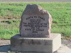 Santa Fe Trail marker in Coolidge.
 Grain elevator in Coolidge.
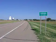 Looking westward on U.S. Highway 50/400.
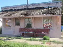 "Cactus Café" in Coolidge. It has reopened as "Western Trail Cafe".
See also
References
- "2019 U.S. Gazetteer Files". United States Census Bureau. Retrieved July 24, 2020.
- "U.S. Census website". United States Census Bureau. Retrieved 2012-07-06.
- "Population and Housing Unit Estimates". United States Census Bureau. May 24, 2020. Retrieved May 27, 2020.
- "U.S. Census website". United States Census Bureau. Retrieved 2008-01-31.
- "US Board on Geographic Names". United States Geological Survey. 2007-10-25. Retrieved 2008-01-31.
- "2010 City Population and Housing Occupancy Status". U.S. Census Bureau. Retrieved August 31, 2011.
- Atchison, Topeka, and Santa Fe Railway : Annual Meetings, and Directors and Officers : Volumes 7; AT&SF Railway; 1902. (12MB PDF)
- "Profile for Coolidge, Kansas". ePodunk. Archived from the original on 15 May 2019. Retrieved 11 June 2014.
- "Kansas Post Offices, 1828-1961 (archived)". Kansas Historical Society. Archived from the original on October 9, 2013. Retrieved 11 June 2014.
- "US Gazetteer files: 2010, 2000, and 1990". United States Census Bureau. 2011-02-12. Retrieved 2011-04-23.
- "US Gazetteer files 2010". United States Census Bureau. Archived from the original on 2012-01-25. Retrieved 2012-07-06.
- Climate Summary for Coolidge, Kansas
- Bickel, Amy (18 April 2014). Cousin Eddie’s Coolidge, The Hutchinson News
Further reading
External links
| Wikimedia Commons has media related to Coolidge, Kansas. |
- City
- Schools
- USD 494, local school district
- Maps
- Coolidge City Map, KDOT
Municipalities and communities of Hamilton County, Kansas, United States | ||
|---|---|---|
| Cities | 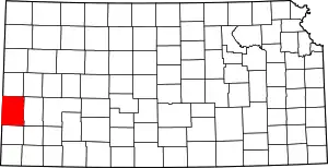 Map of Kansas highlighting Hamilton County | |
| Unincorporated community | ||
| Townships | ||
| ||