Cope Butte
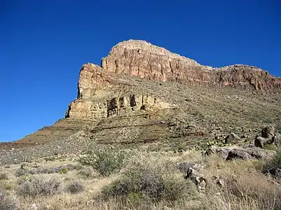
Cope Butte is a 3,754-foot (1,144 m) prominence adjacent the course of the Colorado River, in the Grand Canyon and sitting on the south side of Granite Gorge. The butte is roughly 4.5 miles (7.2 km) northwest of Grand Canyon Village of the central Grand Canyon. The butte has a triangular footprint, and contains a northwest-by-south slightly arcuate ridgeline spire. The prominence is near the north terminus of the sharp ridgeline, and is composed of white Surprise Canyon Formation.
| Cope Butte | |
|---|---|
.jpg.webp) (view due-north)-Cope Butte on Granite Gorge, opposite Ninetyfour Mile Creek & Canyon, and Tower of Set | |
| Highest point | |
| Elevation | 4,528 ft (1,380 m) [1] |
| Prominence | 388 ft (118 m) [1] |
| Parent peak | Whites Butte |
| Isolation | 2.02 |
| Coordinates | 36.0875°N 112.1074°W |
| Geography | |
 Cope Butte | |
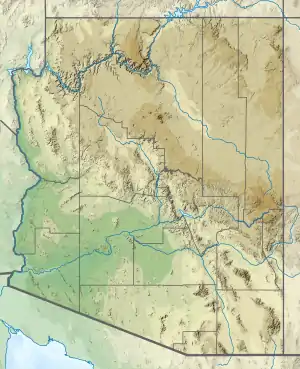
| Location | Grand Canyon Coconino County, Arizona. U.S. |
| Topo map | USPS Grand Canyon |
| Geology | |
| Age of rock | Pennsylvanian down to Proterozoic |
| Mountain type | sedimentary rock: |
| Type of rock | Surprise Canyon Formation? Redwall Limestone Tonto Group _3-Muav Limestone _2-Bright Angel Shale _1-Tapeats Sandstone Vishnu Basement Rocks |
Cope Butte drains west into the Hermit Canyon watershed (Hermit Creek); the east side of the butte sits on the terminus canyon of Monument Creek (Grand Canyon). Because Cope Butte sits on Granite Gorge (Tonto Platform, south side) the Tonto Trail traverses northwest-to-southeast around the butte’s base. The Hermit Trail, from the south, and from Hermits Rest viewpoint (South Rim), excursions down Cathedral Stairs (red Supai Group units), and courses down the southwest base of the butte, to enter Lower Hermit Canyon.
This feature honors American paleontologist Edward Drinker Cope
References
| Wikimedia Commons has media related to Cope Butte. |
- "Cope Butte, AZ - 4,528' AZ". Lists of John. Retrieved January 15, 2021.