Copeland, North Carolina
Copeland is a small unincorporated community in the Rockford Township of Surry County, North Carolina.
Geography
The community is centered on the intersection of Stony Knoll Road and Copeland School Road/Double Creek Road and generally lies near the head of East Double Creek (Powell 1968, pp. 477–478). Copeland has an elevation of 1,172 feet above sea level. Area landmarks near the center of the community include Copeland Elementary School, the local masonic lodge, Ruritan club, and area churches.
References
Powell, William S. (1968), The North Carolina Gazetteer: A Dictionary of Tar Heel Places, Chapel Hill: University of North Carolina Press, ISBN 0-8078-1247-1
External links
Municipalities and communities of Surry County, North Carolina, United States | ||
|---|---|---|
| City | 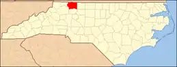 Map of North Carolina highlighting Surry County | |
| Towns | ||
| Townships | ||
| CDPs | ||
| Unincorporated communities |
| |
| Footnotes | ‡This populated place also has portions in an adjacent county or counties | |
| ||
This article is issued from Wikipedia. The text is licensed under Creative Commons - Attribution - Sharealike. Additional terms may apply for the media files.