Copperton, Utah
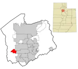
Copperton is a metro township in Salt Lake County, Utah, United States,[3] located at the mouth of Bingham Canyon, approximately 17 miles southwest of Salt Lake City. The metro township boundaries include a smaller area than that of both the former CDP (designated by the U.S. Census) and the former township. Much of the town is included in the Copperton Historic District, which is listed on the National Register of Historic Places.
Copperton, Utah | |
|---|---|
Metro Township | |
 | |
| Country | United States |
| State | Utah |
| County | Salt Lake |
| Founded | 1926 |
| Given Township Status | 1996 or 1997 |
| Incorporated as a Metro Township | January, 2017 |
| Government | |
| • Mayor/Council Chair | Sean Clayton |
| Area | |
| • Total | 0.31 sq mi (0.81 km2) |
| • Land | 0.31 sq mi (0.81 km2) |
| • Water | 0.00 sq mi (0.00 km2) |
| Population (2010) | |
| • Total | 826 |
| • Estimate (2019)[2] | 835 |
| • Density | 2,676.28/sq mi (1,034.58/km2) |
| Time zone | Mountain (MST) |
| • Summer (DST) | MDT |
| FIPS code | 49-15720 |
| Website | coppertonutah |
Demographics
History
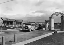
Copperton was established in 1926, by the Utah Copper Company as a residential area and "model city" for its employees. It emerged as a "showplace for company-subsidized family life." Construction of housing ended in the 1930s and company furnished housing ended in 1955. After that a private real estate developer managed the homes for employees.[5] A rather large park was also built in the small town.
As of the 2010 Census, Copperton has a population of 826. Copperton is the only mining town remaining for the Bingham Canyon Mine after Lark was torn down in 1980. Currently, only a handful of residents work for the mine. The town's history is directly linked to the mine.
The 2017 American Community Survey reported the population at 579.
In 2015, the township's residents voted to incorporate and become a metro township.
Climate
Climate is characterized by relatively high temperatures and evenly distributed precipitation throughout the year. The Köppen Climate Classification subtype for this climate is "Cfa" (Humid Subtropical Climate).[6]
References
- "2019 U.S. Gazetteer Files". United States Census Bureau. Retrieved August 7, 2020.
- "Population and Housing Unit Estimates". United States Census Bureau. May 24, 2020. Retrieved May 27, 2020.
- "Copperton, Utah". Geographic Names Information System. United States Geological Survey.
- "Census of Population and Housing". Census.gov. Retrieved June 4, 2016.
- Charles Caldwell Hawley (2014). A Kennecott Story. The University of Utah Press. p. 120.
- Climate Summary for Copperton, Utah
External links
![]() Media related to Copperton, Utah at Wikimedia Commons
Media related to Copperton, Utah at Wikimedia Commons
Places adjacent to Copperton, Utah | |
|---|---|
Municipalities and communities of Salt Lake County, Utah, United States | ||
|---|---|---|
| Cities | 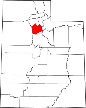 Map of Utah highlighting Salt Lake County | |
| Towns | ||
| Metro Townships | ||
| CDPs | ||
| Unincorporated communities | ||
| Ghost towns | ||
| Footnotes | ‡This populated place also has portions in an adjacent county or counties | |
| ||
