County of Banks, Queensland
The county of Banks is one of the counties of Queensland, Australia, that existed before 1901. It is located in Far North Queensland, and is named for Sir Joseph Banks, who with Captain James Cook landed in 1770 at a location within the county. Banks includes the towns of Cooktown, Lakeland and Laura.[1]
| Banks Queensland | |||||||||||||||
|---|---|---|---|---|---|---|---|---|---|---|---|---|---|---|---|
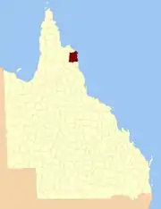 Location within Queensland | |||||||||||||||
| |||||||||||||||
Parishes
| Parish | LGA | Coordinates | Notes |
|---|---|---|---|
| Annan | Cook | 15°35′S 145°15′E | |
| Battle Camp | Cook | 15°22′S 144°39′E | |
| Bullhead | Cook | 15°50′S 144°49′E | Lakeland |
| Cahir | Cook | 15°12′S 144°39′E | |
| Cook | Cook | 15°30′S 145°14′E | Cooktown |
| Cowton | Cook | 14°59′S 144°52′E | |
| Deighton | Cook | 15°30′S 144°33′E | Laura |
| Discovery | Hope Vale (A) | 15°13′S 145°11′E | |
| Emla | Cook | 15°20′S 144°31′E | |
| Endeavour | Hope Vale (A) | 15°21′S 145°15′E | |
| Flattery | Hope Vale (A) | 14°54′S 145°11′E | |
| Gore | Cook | 15°52′S 145°04′E | |
| Green | Cook | 15°32′S 144°56′E | |
| Gresley | Cook | 15°47′S 144°30′E | |
| Hann | Hope Vale (A) | 15°20′S 145°07′E | Hope Vale |
| Hicks | Cook | 15°34′S 145°05′E | |
| Lythe | Cook | 14°57′S 144°40′E | |
| Macquarie | Cook | 15°39′S 144°34′E | |
| McIvor | Cook | 15°07′S 145°03′E | |
| Melsonby | Cook | 15°07′S 144°51′E | |
| Monkhouse | Cook | 15°45′S 145°17′E | |
| Munburra | Cook | 14°53′S 145°04′E | |
| Ninda | Cook | 15°38′S 144°46′E | |
| Pickersgill | Cook | 15°18′S 144°56′E | |
| Pryde | Cook | 15°10′S 145°01′E | |
| Ruby | Cook | 15°29′S 144°47′E | |
| Saunders | Cook | 15°39′S 144°54′E | |
| Solander | Cook | 15°27′S 145°06′E | |
| Tayeto | Hope Vale (A) | 15°03′S 145°12′E | |
| Tupia | Cook | 15°02′S 145°03′E | |
| Welbury | Cook | 15°06′S 144°39′E | |
| Yarico | Cook | 15°18′S 144°48′E |
This article is issued from Wikipedia. The text is licensed under Creative Commons - Attribution - Sharealike. Additional terms may apply for the media files.