County of Cardwell, Queensland

The County of Cardwell is a county (a cadastral division) in Far North Queensland, Queensland, Australia, between Cairns and Townsville. It was named and bounded by the Governor in Council on 7 March 1901 under the Land Act 1897.[1][2] Its name likely honours Edward Cardwell, who was Secretary of State for the Colonies in 1864–1866 and later served as a reformist Secretary of State for War.
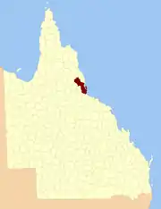
Cardwell
Queensland
Location within Queensland
Lands administrative divisions around Cardwell:
Hodgkinson Nares Coral Sea
Lynd Cardwell Coral Sea
Gunnawarra Wairuna Wilkie Gray

Parishes

Cardwell is divided into parishes, as listed below:

ParishLGACoordinatesTowns
AlcockCassowary Coast17°48′S 145°45′E
ArmstrongTablelands18°05′S 145°23′E
AshtonHinchinbrook18°37′S 145°50′E
BanktonCassowary Coast18°01′S 145°38′E
BerwickHinchinbrook18°46′S 146°02′E
BlencoeTablelands18°07′S 145°35′EKirrama
CoolgarraTablelands17°35′S 145°10′E
CordeliaHinchinbrook18°38′S 146°15′EIngham, Halifax, Lucinda
DunkalliCassowary Coast17°59′S 146°10′EDunk Island
EllerbeckCassowary Coast18°19′S 146°03′ECardwell
GarrawaltHinchinbrook18°28′S 145°50′EAbergowrie
GlenboraCassowary Coast18°16′S 145°54′E
GoshenTablelands18°11′S 145°24′E
HecateCassowary Coast18°13′S 146°12′E
HerbertonTablelands17°26′S 145°25′EHerberton
IsmailiaTablelands17°48′S 145°30′E
KirramaCassowary Coast18°10′S 145°43′E
LannercostHinchinbrook18°36′S 145°59′ELong Pocket
LeachHinchinbrook18°27′S 146°00′E
LeefeCassowary Coast18°21′S 145°55′E
MarathonHinchinbrook18°34′S 146°10′EMacknade
MeungaCassowary Coast18°09′S 145°54′EKennedy
MillstreamTablelands17°43′S 145°20′E
MorecambeTablelands17°50′S 145°05′E
MullaburraTablelands17°42′S 145°07′EMount Garnet
NiagaraTablelands18°19′S 145°45′E
OngeraTablelands17°43′S 145°37′E
PalmHinchinbrook18°42′S 146°33′EPalm Island
PittCassowary Coast18°26′S 146°09′E
RamlehTablelands17°53′S 145°38′E
RavenshoeTablelands17°38′S 145°30′ERavenshoe, Tumoulin
RockinghamCassowary Coast17°56′S 145°57′ETully
Silver ValleyCharters Towers17°28′S 145°17′E
StoneHinchinbrook18°48′S 145°53′EUpper Stone
StralochCassowary Coast18°25′S 146°18′E
TimsahTablelands17°57′S 145°30′E
TirrabellaTablelands17°49′S 145°19′E
TrebonneHinchinbrook18°43′S 146°12′EIngham, Trebonne, Toobanna
TysonCassowary Coast18°03′S 145°53′EEuramo
WaterviewHinchinbrook18°54′S 146°11′EPaluma, Bambaroo
WoodleighTablelands17°35′S 145°24′E
WoomundaTablelands17°38′S 145°16′EInnot Hot Springs
YourkaTablelands17°56′S 145°20′E

References

  1. "Cardwell (entry 6215)". Queensland Place Names. Queensland Government. Retrieved 8 September 2015.
  2. North Kennedy District, County of Cardwell Maps – L2 Series at Queensland Archives.

This article is issued from Wikipedia. The text is licensed under Creative Commons - Attribution - Sharealike. Additional terms may apply for the media files.