Abergowrie, Queensland
Abergowrie is a rural town and locality in the Shire of Hinchinbrook, Queensland, Australia.[2][3] In the 2016 census, Abergowrie had a population of 438 people.[1]
| Abergowrie Queensland | |||||||||||||||
|---|---|---|---|---|---|---|---|---|---|---|---|---|---|---|---|
 Abergowrie | |||||||||||||||
| Coordinates | 18.4755°S 145.8861°E | ||||||||||||||
| Population | 438 (2016 census)[1] | ||||||||||||||
| • Density | 1.4300/km2 (3.704/sq mi) | ||||||||||||||
| Postcode(s) | 4850 | ||||||||||||||
| Area | 306.3 km2 (118.3 sq mi) | ||||||||||||||
| Time zone | AEST (UTC+10:00) | ||||||||||||||
| LGA(s) | Shire of Hinchinbrook | ||||||||||||||
| State electorate(s) | Hinchinbrook | ||||||||||||||
| Federal Division(s) | Kennedy | ||||||||||||||
| |||||||||||||||
Geography
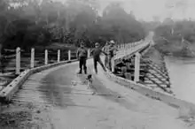
The town is located near the confluence of the Herbert River and Gowrie Creek.[4]
History
Gugu Badhun (also known as Koko-Badun and Kokopatun) is an Australian Aboriginal language of North Queensland. The language region includes areas within the local government area of Charters Towers Region, particularly the localities of Greenvale and the Valley of Lagoons, and in the Upper Burdekin River area and in Abergowrie.[5]
The town is named after the Abergowrie property, selected by James Atkinson in 1883. He coined the name from the Celtic word aber (confluence) and gowrie for Gowrie Creek, reflecting the location.[2]
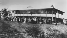
On 22 October 1933, St Teresa's Agricultural College was opened by the Christian Brothers.[4][6]
Abergowrie Post Office opened on 1 May 1953 and closed in 1974.[7]
Abergowrie State School opened on 23 February 1953.[6]
Education
St Teresa's College is a Catholic secondary (7-12) school for boys at 3819 Abergowrie Road (18.4803°S 145.8995°E).[8][9] In 2017, the school had an enrolment of 201 students with 36 teachers (34 full-time equivalent) and 31 non-teaching staff (25 full-time equivalent).[10]
Abergowrie State School is a government primary (Prep-6) school for boys and girls at 5 Venables Road (18.4746°S 145.8835°E).[8][11] In 2017, the school had an enrolment of 4 students with 2 teachers (1 full-time equivalent) and 5 non-teaching staff (2 full-time equivalent).[10]
Community groups
The Abergowrie-Long Pocket branch of the Queensland Country Women's Association meets at 1571 Abergowrie Road, Long Pocket.[12]
References
- Australian Bureau of Statistics (27 June 2017). "Abergowrie (SSC)". 2016 Census QuickStats. Retrieved 20 October 2018.

- "Abergowrie – town in Shire of Hinchinbrook (entry 37)". Queensland Place Names. Queensland Government. Retrieved 16 November 2019.
- "Abergowrie – locality in Shire of Hinchinbrook (entry 42509)". Queensland Place Names. Queensland Government. Retrieved 16 November 2019.
- "Abergowrie". Queensland Places. Centre for the Government of Queensland, University of Queensland. Retrieved 8 January 2014.
-
 This Wikipedia article incorporates CC-BY-4.0 licensed text from: "Gugu Badhun". Queensland Aboriginal and Torres Strait Islander languages map. State Library of Queensland. Retrieved 28 January 2020.
- Queensland Family History Society (2010), Queensland schools past and present (Version 1.01 ed.), Queensland Family History Society, ISBN 978-1-921171-26-0
- Premier Postal History. "Post Office List". Premier Postal Auctions. Retrieved 10 May 2014.
- "State and non-state school details". Queensland Government. 9 July 2018. Archived from the original on 21 November 2018. Retrieved 21 November 2018.
- "St Teresa's College". Retrieved 21 November 2018.
- "ACARA School Profile 2017". Archived from the original on 22 November 2018. Retrieved 22 November 2018.
- "Abergowrie State School". Retrieved 21 November 2018.
- "Branch Locations". Queensland Country Women's Association. Retrieved 26 December 2018.
External links
| Wikimedia Commons has media related to Abergowrie, Queensland. |
- "Abergowrie". Queensland Places. Centre for the Government of Queensland, University of Queensland.
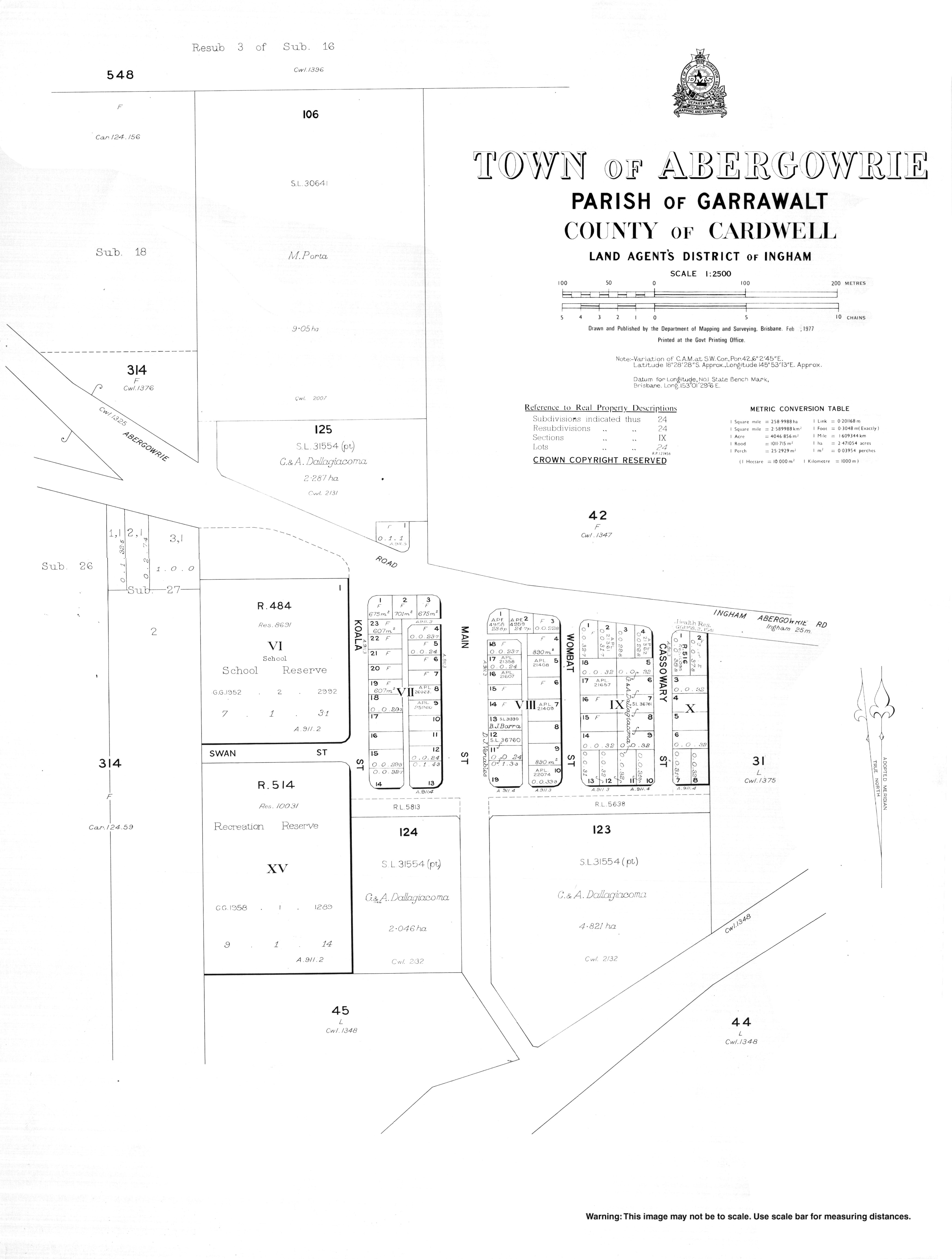
- Town map of Abergowrie, 1977