Crevasse Canyon Formation
The Crevasse Canyon Formation is a coal-bearing Cretaceous geologic formation in New Mexico and Arizona.
| Crevasse Canyon Formation Stratigraphic range: Santonian | |
|---|---|
| Type | Formation |
| Unit of | Mesaverde Group |
| Sub-units | Dilco Coal, Dalton Sandstone & Gibson Coal Members |
| Underlies | Point Lookout Sandstone |
| Overlies | Gallup Sandstone |
| Thickness | 700 ft (210 m) |
| Lithology | |
| Primary | Sandstone, mudstone, coal |
| Location | |
| Coordinates | 35.7916°N 108.9446°W |
| Region | New Mexico, Arizona |
| Country | |
| Extent | San Juan Basin |
| Type section | |
| Named for | Crevasse Canyon |
| Named by | Allen and Balk |
| Year defined | 1954[1] |
 Crevasse Canyon Formation (the United States) 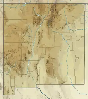 Crevasse Canyon Formation (New Mexico) | |
Description
The formation is divided into three members, in ascending stratigraphic order: Dilco Coal Member, Dalton Sandstone Member, and Gibson Coal Member. The Dilco Coal Member is described by Cather (2010) as "Drab mudstone, fine- to medium-grained sandstone, and coal. Sandstone is commonly crossbedded or ripple laminated." The Dalton Sandstone Member is described as "Gray to yellowish gray, fine- to medium-grained, cliff-forming sandstone." The Gibson Coal Member is described as "Drab mudstone, buff, brown, and greenish gray sandstone (commonly cross-bedded), and coal," with the coals typically less than 0.5 m thick.[2] Thickness is 700 feet (210 m) at the type section.[1]
Fossil content
Dinosaur remains are among the fossils that have been recovered from the formation, although none have yet been referred to a specific genus.[3]
Petrified wood is common in the Gibson Coal Member.[2]
Age
Tschudy (1976) identified the Crevasse Canyon formation as Coniacian and Santonian by palynology of coal and shale.[4]
History of investigation
The formation was originally described in 1954 by Allen and Balk as part of the Mesaverde Group.[1]
See also
- List of dinosaur-bearing rock formations
References
- Allen & Balk 1954.
- Cather 2010.
- Weishampel, Dodson & Osmólska 2004, pp. 517-607.
- Tschudy 1976.
Bibliography
- Allen, J.E.; Balk, Robert (1954). "Mineral Resources of Fort Defiance and Tohatchi quadrangles, Arizona and New Mexico" (PDF). New Mexico Bureau of Mines and Mineral Resources Bulletin. 36. Retrieved 11 September 2020.
- Cather, Steven (2010). "Preliminary geologic map of the San Lucas Dam quadrangle, McKinley County, New Mexico". New Mexico Bureau of Geology and Mineral Resources, Open-File Geologic Map. OF-GM 212. Retrieved 11 September 2020.
- Tschudy, R.H. (1976). "Palynology of Crevasse Canyon and Menefee Formation of San Juan basin, New Mexico" (PDF). New Mexico Bureau of Mines and Mineral Resources Circular. 154: 48–55. Retrieved 11 September 2020.
- Weishampel, David B.; Dodson, Peter; Osmólska, Halszka, eds. (2004). The dinosauria (2nd ed.). Berkeley, Calif.: University of California Press. ISBN 0-520-24209-2.