Dallas Township, Crawford County, Ohio
Dallas Township is one of the sixteen townships of Crawford County, Ohio, United States. As of the 2010 census the population was 485.[3]
Dallas Township, Crawford County, Ohio | |
|---|---|
 Fire station in Monnett | |
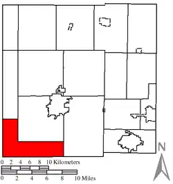 Location of Dallas Township in Crawford County | |
| Coordinates: 40°43′12″N 83°3′3″W | |
| Country | United States |
| State | Ohio |
| County | Crawford |
| Area | |
| • Total | 22.1 sq mi (57.3 km2) |
| • Land | 22.1 sq mi (57.3 km2) |
| • Water | 0.0 sq mi (0.0 km2) |
| Elevation | 971 ft (296 m) |
| Population (2010) | |
| • Total | 485 |
| • Density | 22/sq mi (8.5/km2) |
| Time zone | UTC-5 (Eastern (EST)) |
| • Summer (DST) | UTC-4 (EDT) |
| FIPS code | 39-19932[2] |
| GNIS feature ID | 1085936[1] |
Geography
Located in the southwestern corner of the county, it borders the following townships:
- Tod Township - north
- Bucyrus Township - northeast
- Whetstone Township - east
- Tully Township, Marion County - southeast corner
- Scott Township, Marion County - south
- Grand Prairie Township, Marion County - southwest
- Antrim Township, Wyandot County - west
No municipalities are located in Dallas Township.
Name and history
Dallas Township was organized in 1845. It was named for George M. Dallas, a U.S. Senator from Pennsylvania.[4]
It is the only Dallas Township statewide.[5]
Government
The township is governed by a three-member board of trustees, who are elected in November of odd-numbered years to a four-year term beginning on the following January 1. Two are elected in the year after the presidential election and one is elected in the year before it. There is also an elected township fiscal officer,[6] who serves a four-year term beginning on April 1 of the year after the election, which is held in November of the year before the presidential election. Vacancies in the fiscal officership or on the board of trustees are filled by the remaining trustees.
References
- "US Board on Geographic Names". United States Geological Survey. 2007-10-25. Retrieved 2008-01-31.
- "U.S. Census website". United States Census Bureau. Retrieved 2008-01-31.
- "Geographic Identifiers: 2010 Demographic Profile Data (G001): Dallas township, Crawford County, Ohio". U.S. Census Bureau, American Factfinder. Archived from the original on February 3, 2015. Retrieved February 3, 2015.
- History of Crawford County and Ohio. Baskin & Battey. 1881. pp. 677.
- "Detailed map of Ohio" (PDF). United States Census Bureau. 2000. Retrieved 2007-02-16.
- §503.24, §505.01, and §507.01 of the Ohio Revised Code. Accessed 4/30/2009.
External links
Municipalities and communities of Crawford County, Ohio, United States | ||
|---|---|---|
| Cities | 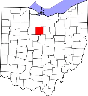 Map of Ohio highlighting Crawford County | |
| Villages | ||
| Townships | ||
| CDPs | ||
| Unincorporated communities | ||
| Footnotes | ‡This populated place also has portions in an adjacent county or counties | |
| ||
