Dalwhinnie
Dalwhinnie (/dælˈhwɪni/ dal-WHIN-ee; Scottish Gaelic: Dail Chuinnidh "meeting place") is a small village in the Scottish Highlands.[1] Dalwhinnie is located at the head of Glen Truim and the north-east end of Loch Ericht, on the western edge of the Cairngorms National Park.
Dalwhinnie
| |
|---|---|
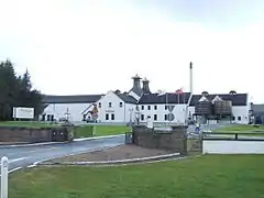
 Dalwhinnie distillery | |
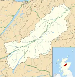
 Dalwhinnie Location within the Badenoch and Strathspey area | |
| OS grid reference | NN634849 |
| Council area | |
| Country | Scotland |
| Sovereign state | United Kingdom |
| Post town | Dalwhinnie |
| Postcode district | PH19 |
| Dialling code | 015282 |
| Police | Scotland |
| Fire | Scottish |
| Ambulance | Scottish |
| UK Parliament | |
| Scottish Parliament | |
Location
Dalwhinnie sits at an altitude of 351 m (1,152 ft). It is one of the coldest villages in the UK, having an average annual temperature of 6.6 °C (43.9 °F), making it suitable for winter walking and mountaineering.
It is north of Drumochter, just off the A9 road from Perth to Inverness and has been bypassed since 1975. It is about 75 miles (120 km) from both Edinburgh and Glasgow, 25 miles (40 km) from Aviemore, 13 miles (21 km) from Newtonmore and 17 miles (27 km) from Kingussie. Dalwhinnie railway station lies on the Highland Main Line from Perth to Inverness.
Tourism
The area is walking destination along the River Truim and in Cairngorm and Monadhliath Mountains in the Cairngorm National Park.[2]
Dalwhinnie is on the Sustrans National Cycle Route No. 7, Glasgow to Inverness. There are several cycle routes in the area including one alongside Loch Ericht.
Distillery
Diageo owns the local distillery, the highest-elevation working distillery in Scotland. Dalwhinnie Single Malt is a light, heathery whisky.[3]
Climate
Dalwhinnie experiences a subpolar oceanic climate (Cfc) that very closely borders a humid continental climate (Dfb) with strong influences of an oceanic climate (Cfb), a climate very rare for a UK town.
Skies are frequently overcast with cool temperatures and rainfall throughout the year. Sunshine here averages only 1,032 hours, which is one of the lowest in the United Kingdom.
Dalwhinnie holds the UK low temperature records for the months of June, September and October.[4] In addition, it also holds Scotland's record for the lowest April daytime maximum temperature of −1.0 °C (30.2 °F) in 1975, and the record lowest October temperature for the United Kingdom of −11.7 °C (10.9 °F).[5]
For the 1951–1980 observation period, it averaged a temperature of 6.3 °C (43.3 °F) compared to Braemar's 6.4 °C (43.5 °F),[6] making Dalwhinnie one of the coldest inhabited places in the British Isles.
According to the 1981–2010 observation period, Dalwhinnie is the coldest place in the UK below 500 metres above sea level, with a mean temperature of 6.6 °C (43.9 °F),[7] lower than Leadhills and Braemar which both have mean temperatures of 6.8 °C (44.2 °F) for this period.
The lowest temperatures in recent years have been −15.8 °C (3.6 °F) in January 2010[8] and −16.1 °C (3.0 °F) during December 2010. Winter snowfall can be heavy, with accumulations often exceeding 30 cm (12 in).[9]
| Climate data for Dalwhinnie (359 m asl, averages 1951–1980, sunshine 1931–1960, extremes 1951–present) | |||||||||||||
|---|---|---|---|---|---|---|---|---|---|---|---|---|---|
| Month | Jan | Feb | Mar | Apr | May | Jun | Jul | Aug | Sep | Oct | Nov | Dec | Year |
| Record high °C (°F) | 13.3 (55.9) |
11.7 (53.1) |
17.2 (63.0) |
19.4 (66.9) |
25.6 (78.1) |
28.8 (83.8) |
30.0 (86.0) |
27.2 (81.0) |
23.3 (73.9) |
20.6 (69.1) |
15.6 (60.1) |
13.3 (55.9) |
30.0 (86.0) |
| Average high °C (°F) | 2.7 (36.9) |
3.4 (38.1) |
6.2 (43.2) |
9.3 (48.7) |
12.8 (55.0) |
15.8 (60.4) |
16.7 (62.1) |
16.4 (61.5) |
13.7 (56.7) |
9.8 (49.6) |
6.2 (43.2) |
4.0 (39.2) |
9.8 (49.6) |
| Daily mean °C (°F) | 0.3 (32.5) |
0.7 (33.3) |
2.8 (37.0) |
5.1 (41.2) |
7.9 (46.2) |
10.9 (51.6) |
12.5 (54.5) |
12.2 (54.0) |
10 (50) |
6.8 (44.2) |
3.7 (38.7) |
1.9 (35.4) |
6.2 (43.2) |
| Average low °C (°F) | −2.1 (28.2) |
−2.0 (28.4) |
−0.7 (30.7) |
0.8 (33.4) |
3.1 (37.6) |
6.1 (43.0) |
8.2 (46.8) |
8.0 (46.4) |
6.2 (43.2) |
3.8 (38.8) |
1.2 (34.2) |
−0.3 (31.5) |
2.7 (36.9) |
| Record low °C (°F) | −20.6 (−5.1) |
−21.7 (−7.1) |
−17.8 (0.0) |
−10 (14) |
−7.2 (19.0) |
−5.6 (21.9) |
−1.7 (28.9) |
−2.8 (27.0) |
−6.7 (19.9) |
−11.7 (10.9) |
−17.2 (1.0) |
−18.3 (−0.9) |
−21.7 (−7.1) |
| Average precipitation mm (inches) | 133 (5.2) |
97 (3.8) |
70 (2.8) |
78 (3.1) |
69 (2.7) |
66 (2.6) |
90 (3.5) |
85 (3.3) |
103 (4.1) |
143 (5.6) |
125 (4.9) |
158 (6.2) |
1,217 (47.9) |
| Mean monthly sunshine hours | 27 | 51 | 92 | 118 | 158 | 150 | 121 | 115 | 91 | 61 | 31 | 17 | 1,032 |
| Source 1: Globalbioclimatics/Salvador Rivas-Martínez[10] | |||||||||||||
| Source 2: DMI/Danish Meteorology Institute - page 254[11] | |||||||||||||
See also
- Centre points of the United Kingdom
- Battle of Invernahavon - the remnants of a party of Clan Cameron raiders escaped via Dalwhinnie after their defeat by the Chattan Confederation south west of Newtonmore in this 14th century battle.
References
- "Dalwhinnie". The Gazetteer for Scotland. School of GeoSciences, University of Edinburgh and The Royal Scottish Geographical Society. Retrieved 17 June 2018.
- "Cairngorms National Park". Cairngorms National Park Authority. Retrieved 16 July 2015.
- "Dalwhinnie Distillery". Whisky.com Database. Retrieved 8 January 2019.
- "Monthly Cold records". TORRO.org. Retrieved 24 April 2012.
- "Monthly records". UKMO. Archived from the original on 6 February 2012. Retrieved 24 April 2012.
- "Average Temperature". Scotclim. Retrieved 24 April 2012.
- "Dalwhinnie climate information". Met Office. 1 May 2014. Retrieved 16 July 2015.
- Rogers, Simon (7 January 2010). "Jan2010 temperature". The Guardian. London. Retrieved 24 April 2012.
- "Dec2010 temperature". UKMO. Retrieved 24 April 2012.
- "Temp/Rain 1901-1950". Globalbioclimatics. April 2012. Retrieved 24 April 2012.
- "Sunshine 1931-1960" (PDF). DMI.DK. April 2012. Archived from the original (PDF) on 16 January 2013. Retrieved 24 April 2012.