Danilovgrad Municipality
Danilovgrad Municipality is one of the municipalities of Montenegro. The administrative center is town of Danilovgrad. The municipality is located in the central region of Montenegro in the valley of Zeta river, sometimes called also the Bjelopavlići plain, after the name of the local tribe.[1]
Danilovgrad Municipality
Opština Danilovgrad | |
|---|---|
 Coat of arms | |
.svg.png.webp) Danilovgrad Municipality in Montenegro | |
| Country | Montenegro |
| Seat | Danilovgrad |
| Area | |
| • Total | 501 km2 (193 sq mi) |
| Postal code | 81410 |
| Area code | +382 20 |
| ISO 3166-2 code | ME-07 |
| Car plates | DG |
| Climate | Cfa |
| Website | danilovgrad.me |
Tourism and location
Main tourist attraction within Danilovgrad municipality is Ostrog Monastery, famous orthodox pilgrimage site visited by believers from afar. It is located on an almost vertical cliff overseeing Bjelopavlići plain, approximately 15 km (9.3 mi) from Danilovgrad in the direction of Nikšić. Other notable points of interest are Ždrebaonik Monastery and well of Glava Zete. Municipality lies along the main route between Montenegro's two largest cities, Podgorica and Nikšić. Via villages, Danilovgrad forms part of a conurbation with Podgorica.
Local parliament
| Parties and coalitions | Seats | Gov't. |
|---|---|---|
| Democratic Party of Socialists (DPS) | 19 | Yes |
| Democrats and URA Coalition | 6 | No |
| Social Democrats (SD) | 3 | Yes |
| SNP - DNP - JKP Coalition | 2 | No |
| New Serb Democracy (NSD) | 2 | No |
| True Montenegro (PCG) | 1 | No |
Demographics
Town of Danilovgrad is the center of the Danilovgrad Municipality, which in 2003 had a population of 16,523.[2]
|
Population of Danilovgrad:
|
Ethnic groups (2003 census):
|
|
Gallery
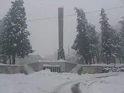
 World War II monument
.jpg.webp)
 Holy Trinity Church
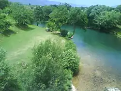
 Zeta river near Spuž
References
- Opštine, MJU, Vlada Crne Gore
- Popis 2011, MONSTAT (2011)