De Kalb, Mississippi
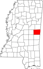
De Kalb is a town in and the county seat of Kemper County, Mississippi, United States.[4] The population was 1,164 at the 2010 census.[5] De Kalb is named after General Johann de Kalb, a Franconian-French military officer who served as a major general in the Continental Army during the American Revolutionary War.
De Kalb, Mississippi | |
|---|---|
| Nickname(s): Dynamite City of the South | |
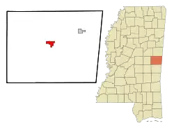
 Location of De Kalb, Mississippi | |
 De Kalb, Mississippi Location in the United States | |
| Coordinates: 32°46′11″N 88°39′1″W | |
| Country | United States |
| State | Mississippi |
| County | Kemper |
| Government | |
| • Mayor | Clark Adams[1] |
| Area | |
| • Total | 3.33 sq mi (8.61 km2) |
| • Land | 3.32 sq mi (8.60 km2) |
| • Water | 0.01 sq mi (0.02 km2) |
| Elevation | 466 ft (142 m) |
| Population (2010) | |
| • Total | 1,164 |
| • Estimate (2019)[3] | 1,007 |
| • Density | 303.40/sq mi (117.16/km2) |
| Time zone | UTC-6 (Central (CST)) |
| • Summer (DST) | UTC-5 (CDT) |
| ZIP code | 39328 |
| Area code(s) | 601 |
| FIPS code | 28-18340 |
| GNIS feature ID | 0669159 |
De Kalb is the home of former Lieutenant Governor of Mississippi Eddie Briggs.
Geography
De Kalb is located in central Kemper County at 32°46′11″N 88°39′1″W (32.769751, -88.650407).[6] Mississippi Highway 16 passes through the north side of the town, leading east 11 miles (18 km) to Scooba and west 28 miles (45 km) to Philadelphia. Mississippi Highway 39 (Main Avenue) passes through the center of De Kalb, leading north 19 miles (31 km) to Shuqualak and south 30 miles (48 km) to Meridian.
According to the United States Census Bureau, De Kalb has a total area of 3.3 square miles (8.6 km2), of which 0.01 square miles (0.02 km2), or 0.22%, are water.[5]
Demographics
| Historical population | |||
|---|---|---|---|
| Census | Pop. | %± | |
| 1920 | 554 | — | |
| 1930 | 888 | 60.3% | |
| 1940 | 866 | −2.5% | |
| 1950 | 953 | 10.0% | |
| 1960 | 880 | −7.7% | |
| 1970 | 1,072 | 21.8% | |
| 1980 | 1,159 | 8.1% | |
| 1990 | 1,073 | −7.4% | |
| 2000 | 972 | −9.4% | |
| 2010 | 1,164 | 19.8% | |
| 2019 (est.) | 1,007 | [3] | −13.5% |
| U.S. Decennial Census[7] | |||
As of the census[8] of 2000, there were 972 people, 388 households, and 233 families residing in the town. The population density was 293.5 people per square mile (113.4/km2). There were 444 housing units at an average density of 134.1 per square mile (51.8/km2). The racial makeup of the town was 70.31% African American, 18.56% White, 0.21% Native American, and 0.93% from two or more races. Hispanic or Latino of any race were 0.93% of the population.
There were 388 households, out of which 26.5% had children under the age of 18 living with them, 35.8% were married couples living together, 20.9% had a female householder with no husband present, and 39.7% were non-families. 37.6% of all households were made up of individuals, and 20.9% had someone living alone who was 65 years of age or older. The average household size was 2.28 and the average family size was 3.03.
In the town, the population was spread out, with 22.6% under the age of 18, 9.0% from 18 to 24, 23.0% from 25 to 44, 19.5% from 45 to 64, and 25.8% who were 65 years of age or older. The median age was 42 years. For every 100 females, there were 83.7 males. For every 100 females age 18 and over, there were 73.3 males.
The median income for a household in the town was $21,000, and the median income for a family was $24,886. Males had a median income of $26,477 versus $16,964 for females. The per capita income for the town was $11,171. About 23.3% of families and 28.1% of the population were below the poverty line, including 38.9% of those under age 18 and 21.0% of those age 65 or over.
Education
De Kalb is served by the Kemper County School District.
References
- "Town of DeKalb open, mayor advocates social distancing". WTOK-TV. Meridian, Mississippi. 24 March 2020. Retrieved 23 May 2020.
- "2019 U.S. Gazetteer Files". United States Census Bureau. Retrieved July 26, 2020.
- "Population and Housing Unit Estimates". United States Census Bureau. May 24, 2020. Retrieved May 27, 2020.
- "Find a County". National Association of Counties. Archived from the original on 2011-05-31. Retrieved 2011-06-07.
- "Geographic Identifiers: 2010 Census Summary File 1 (G001), De Kalb town, Mississippi". American FactFinder. U.S. Census Bureau. Archived from the original on February 13, 2020. Retrieved April 9, 2019.
- "US Gazetteer files: 2010, 2000, and 1990". United States Census Bureau. 2011-02-12. Retrieved 2011-04-23.
- "Census of Population and Housing". Census.gov. Retrieved June 4, 2015.
- "U.S. Census website". United States Census Bureau. Retrieved 2008-01-31.
