De Soto, Missouri
De Soto is a city in Jefferson County, Missouri, United States. The population was 6,400 at the 2010 census and the city is part of the St. Louis metropolitan area. The Van Metre family were first to settle in 1803. The town was organized in 1857 and is named for the explorer Hernando De Soto, who claimed the Louisiana Territory for Spain.[7] De Soto was the city closest to the mean center of U.S. population in 1980. The city celebrated its Bicentennial in 2003. The city made national news on and after May 6, 2003, when straight-line winds and a tornado struck.
De Soto, Missouri | |
|---|---|
 Location of De Soto, Missouri | |
| Coordinates: 38°8′26″N 90°33′27″W | |
| Country | United States |
| State | Missouri |
| County | Jefferson |
| Incorporated | 1869 |
| Area | |
| • Total | 4.38 sq mi (11.35 km2) |
| • Land | 4.38 sq mi (11.35 km2) |
| • Water | 0.00 sq mi (0.00 km2) |
| Elevation | 503 ft (153 m) |
| Population | |
| • Total | 6,400 |
| • Estimate (2019)[4] | 6,345 |
| • Density | 1,447.64/sq mi (558.96/km2) |
| Time zone | UTC-6 (Central (CST)) |
| • Summer (DST) | UTC-5 (CDT) |
| ZIP code | 63020 |
| Area code(s) | 636 314 |
| FIPS code | 29-19252[5] |
| GNIS feature ID | 0716761[6] |
| Website | City website |
History
De Soto was platted in 1857 and named after Hernando de Soto (c. 1496/1497–1542), Spanish conquistador.[8] A post office has been in operation at De Soto since 1858.[9]
The city is known as "Fountain City" because of the numerous artesian wells. Water from these wells and springs was bottled and shipped by tank car to the 1904 World Fair in St. Louis.[10]
The Central School Campus and Louis J. and Harriet Rozier House are listed on the National Register of Historic Places.[11]
Tornado activity
On December 21, 1967, an F4 tornado 16.8 miles away from the city center killed three people and injured 52 people and caused between $500,000 and $5,000,000 in damages.[12]
On June 22, 1969, an F4 (max. wind speeds 207-260 mph) tornado 13.5 miles away from the De Soto city center killed two people and injured 22 people and caused between $500,000 and $5,000,000 in damages.[12]
On April 22, 1981, a tornado destroyed the Joachim Savings & Loan, the offices of the Republic and Press newspaper, and a tire store. One person was killed in the Savings & Loan.[13]
On May 6, 2003, at approximately 3:45 pm, a tornado outbreak began in Kansas, Missouri, and Tennessee. At 5:14pm, a tornado touched down two miles northwest of De Soto. Fourteen minutes later, the tornado sirens went off in Jefferson County. The tornado hit De Soto at F3 intensity, causing $12,800,000 in damage. The tornado destroyed the junior high gymnasium, caused significant damage to the high school and Vineland Elementary, destroyed 58 houses and a local grocery store. It injured 23 and killed nine inside De Soto.[14]
Local Attractions
- Melba Theater
- De Soto Public Library
- Spross Park
- Walther's Park
- Richter Park
Geography
According to the United States Census Bureau, the city has a total area of 4.30 square miles (11.14 km2), all land.[15]
Demographics
| Historical population | |||
|---|---|---|---|
| Census | Pop. | %± | |
| 1880 | 1,989 | — | |
| 1890 | 3,960 | 99.1% | |
| 1900 | 5,611 | 41.7% | |
| 1910 | 4,721 | −15.9% | |
| 1920 | 5,003 | 6.0% | |
| 1930 | 5,069 | 1.3% | |
| 1940 | 5,121 | 1.0% | |
| 1950 | 5,357 | 4.6% | |
| 1960 | 5,804 | 8.3% | |
| 1970 | 5,984 | 3.1% | |
| 1980 | 5,993 | 0.2% | |
| 1990 | 5,993 | 0.0% | |
| 2000 | 6,375 | 6.4% | |
| 2010 | 6,400 | 0.4% | |
| 2019 (est.) | 6,345 | [4] | −0.9% |
| U.S. Decennial Census[16] | |||
2010 census
As of the census[3] of 2010, there were 6,400 people, 2,629 households, and 1,633 families residing in the city. The population density was 1,488.4 inhabitants per square mile (574.7/km2). There were 2,927 housing units at an average density of 680.7 per square mile (262.8/km2). The racial makeup of the city was 95.8% White, 1.6% African American, 0.4% Native American, 0.4% Asian, 0.3% from other races, and 1.4% from two or more races. Hispanic or Latino of any race were 0.8% of the population.
There were 2,629 households, of which 33.5% had children under the age of 18 living with them, 41.0% were married couples living together, 14.6% had a female householder with no husband present, 6.5% had a male householder with no wife present, and 37.9% were non-families. 31.6% of all households were made up of individuals, and 13.5% had someone living alone who was 65 years of age or older. The average household size was 2.38 and the average family size was 2.97.
The median age in the city was 36.8 years. 24.8% of residents were under the age of 18; 8.9% were between the ages of 18 and 24; 26% were from 25 to 44; 24.2% were from 45 to 64; 16.1% were 65 years of age or older. The gender makeup of the city was 47.2% male and 52.8% female.
2000 census
As of the census[5] of 2000, there were 6,375 people, 2,544 households, and 1,656 families residing in the city. The population density was 1,673.6 people per square mile (646.0/km2). There were 2,741 housing units at an average density of 719.6 per square mile (277.8/km2). The racial makeup of the city was 96.71% White, 1.71% African American, 0.31% Native American, 0.19% Asian, 0.02% Pacific Islander, 0.27% from other races, and 0.80% from two or more races. Hispanic or Latino of any race were 1.02% of the population.
There were 2,544 households, out of which 31.7% had children under the age of 18 living with them, 48.3% were married couples living together, 12.9% had a female householder with no husband present, and 34.9% were non-families. 29.8% of all households were made up of individuals, and 15.0% had someone living alone who was 65 years of age or older. The average household size was 2.42 and the average family size was 2.99.
In the city, the population was spread out, with 25.3% under the age of 18, 8.8% from 18 to 24, 27.1% from 25 to 44, 20.2% from 45 to 64, and 18.6% who were 65 years of age or older. The median age was 37 years. For every 100 females, there were 87.3 males. For every 100 females age 18 and over, there were 82.0 males.
The median income for a household in the city was $30,725, and the median income for a family was $37,486. Males had a median income of $33,163 versus $20,039 for females. The per capita income for the city was $14,971. About 11.4% of families and 14.7% of the population were below the poverty line, including 19.1% of those under age 18 and 12.1% of those age 65 or over.
Economy
The local economy is fueled by Union Pacific Railroad which operates a car repair shop on the east side of Main Street. Wal-Mart and De Soto School District #73 are the largest employers.
Education
Public schools are run by the De Soto School District #73:
- De Soto Senior High School
- De Soto Junior High
- Vineland Elementary
- Athena Elementary
St. Rose of Lima School is the only private school in town run by St. Rose of Lima Catholic Church.
The closest institution of higher education is in Hillsboro, Missouri at Jefferson College.
The town has a lending library, the De Soto Public Library.[17]
Notable people
- Jay Nixon, 55th Governor of Missouri and former state Attorney General
- Mel Bay, musician, music teacher, and publisher of music instructional manuals and sheet music[18]
- Thomas Clement Fletcher, Governor of Missouri
- Whitey Ford, comedian known as "The Duke of Paducah"
- Michael H. Hall, Wisconsin State Assemblyman
- Juanita Hamel, newspaper illustrator and writer
- Burdette Johnson, numismatist
- William E. Lewis, Missouri state representative
- Frank Wilcox, actor
References
- "2019 U.S. Gazetteer Files". United States Census Bureau. Retrieved July 26, 2020.
- De Soto, Missouri (City-Data.com)
- "U.S. Census website". United States Census Bureau. Retrieved 2012-07-08.
- "Population and Housing Unit Estimates". United States Census Bureau. May 24, 2020. Retrieved May 27, 2020.
- "U.S. Census website". United States Census Bureau. Retrieved 2008-01-31.
- "US Board on Geographic Names". United States Geological Survey. 2007-10-25. Retrieved 2008-01-31.
- Eaton, David Wolfe (1916). How Missouri Counties, Towns and Streams Were Named. The State Historical Society of Missouri. pp. 180.
- "Jefferson County Place Names, 1928–1945 (archived)". The State Historical Society of Missouri. Archived from the original on 24 June 2016. Retrieved 19 October 2016.CS1 maint: bot: original URL status unknown (link)
- "Post Offices". Jim Forte Postal History. Archived from the original on 19 October 2016. Retrieved 19 October 2016.
- "Archived copy". Archived from the original on 2010-03-29. Retrieved 2010-10-03.CS1 maint: archived copy as title (link)
- "National Register Information System". National Register of Historic Places. National Park Service. July 9, 2010.
- http://www.city-data.com/city/De-Soto-Missouri.html
- https://news.google.com/newspapers?nid=799&dat=19810423&id=_LVPAAAAIBAJ&sjid=V1IDAAAAIBAJ&pg=4368,2023484
- http://www.cnn.com/2003/WEATHER/05/06/tornadoes/
- "US Gazetteer files 2010". United States Census Bureau. Archived from the original on 2012-07-02. Retrieved 2012-07-08.
- "Census of Population and Housing". Census.gov. Retrieved June 4, 2015.
- "Missouri Public Libraries". PublicLibraries.com. Archived from the original on 10 June 2017. Retrieved 25 March 2018.
- "Archived copy". Archived from the original on 2010-01-18. Retrieved 2010-06-26.CS1 maint: archived copy as title (link)
External links
- City website
- De Soto Railroad Employee's Memorial Park
- RootsWeb history of De Soto
- De Soto Public School District #73
- Historic maps of De Soto in the Sanborn Maps of Missouri Collection at the University of Missouri
Municipalities and communities of Jefferson County, Missouri, United States | ||
|---|---|---|
| Cities | 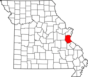 Map of Missouri highlighting Jefferson County | |
| Villages | ||
| Townships | ||
| CDPs | ||
| Unincorporated communities | ||
| ||
| Authority control |
|---|