Dedham, Iowa
Dedham is a city in Carroll County, Iowa, United States. The population was 266 at the 2010 census.
Dedham, Iowa | |
|---|---|
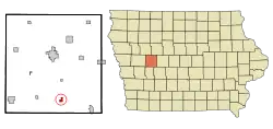 Location of Dedham, Iowa | |
| Coordinates: 41°54′31″N 94°49′22″W | |
| Country | |
| State | |
| County | Carroll |
| Government | |
| • Mayor | Robert Sporrer |
| • City Council | Council List
|
| • Senate | Mark Segebart (R) |
| • House | Brian Best (R) |
| Area | |
| • Total | 0.58 sq mi (1.50 km2) |
| • Land | 0.58 sq mi (1.50 km2) |
| • Water | 0.00 sq mi (0.00 km2) |
| Elevation | 1,332 ft (406 m) |
| Population | |
| • Total | 266 |
| • Estimate (2019)[3] | 256 |
| • Density | 442.14/sq mi (170.70/km2) |
| Time zone | UTC-6 (Central (CST)) |
| • Summer (DST) | UTC-5 (CDT) |
| ZIP code | 51440 |
| Area code(s) | 712 |
| FIPS code | 19-19450 |
| GNIS feature ID | 0455840 |
History
Dedham got its start in the year 1881, following construction of the Chicago, Milwaukee and St. Paul Railway through that territory.[4] It was named for Dedham, Massachusetts.[5]
St. Joseph Parish was founded in 1891 by German and English Catholics.[6] They built the first church in 1892 with a new, larger church coming in 1904.[6] The present church was dedicated on October 1, 1940, by Bishop Edmond Heelan.[6]
Geography
Dedham is located at 41°54′31″N 94°49′22″W (41.908650, -94.822832)[7] at the junction of Brushy and Dedham Creeks.
According to the United States Census Bureau, the city has a total area of 0.58 square miles (1.50 km2), all land.[8]
Government and politics
Dedham operates under a mayor-council government. The Mayor is Robert Sporrer. Along with the mayor is the five person city council. Councilpersons are: Christopher John Hoffman, Mike Heinrichs, Rod Smith, Tony Derner, and Tony Seidl. The City Clerk is Heather Badding. City elections are held every two odd numbered years. The mayor serves a two-year term, while the members of the council serve four-year terms. The next city election will be held on Tuesday, November 5, 2019.[9]
| Name | Years Serving | First elected | Notes |
|---|---|---|---|
| Robert Sporrer | 2018–Present | 2017 | Eligible for re-election in 2019 |
| Mike Heinrichs | 2008–Present | 2007 | Eligible for re-election in 2019 |
| Tony Derner | 2015–Present | 2017 | Eligible for re-election in 2021 |
| Chris Hoffman | 2018–Present | 2017 | Eligible for re-election in 2021 |
| Rod Smith | 2016–Present | 2015 | Eligible for re-election in 2019 |
| Tony Seidl | 2013–Present | 2013 | Eligible for re-election in 2021 |
Past mayors
| No. | Name | Years | Length of term | Notes |
|---|---|---|---|---|
| 1 | Charles Shefford | 1883 | 1 year | Resigned; was a federal officer |
| 2 | W.A. Lytton | 1883-1884 | 2 years | |
| 3 | J.A. Edgett | 1884-1885 | 2 years | |
| 4 | N.B. Coder | 1885-1886 | 2 years | |
| 5 | J.A. Edgett | 1886-1887 | 2 years | Second Mayorship |
| 6 | John W. Niman | 1887-1888 | 2 years | |
| 7 | J.A. Edgett | 1888-1889 | 2 years | Third Mayorship |
| 8 | J.A. Horton | 1889-1890 | 2 years | |
| 9 | A.W. Basom | 1890-1892 | 3 years | |
| 10 | J.A. Edgett | 1893-1897 | 5 years | Fourth Mayorship |
| 11 | J.G. Caton | 1897-1898 | 2 years | |
| 12 | J.A. Edgett | 1898-1900 | 2 years | Fifth Mayorship |
| 13 | Fred A. Toovey | 1900-1910 | 10 years | |
| 14 | M. Slife | 1910-1911 | 1 year | |
| 15 | Fred A. Toovey | 1911-1922 | 11 years | Second Mayorship |
| 16 | Reed McMurray | 1922-1924 | 2 years | |
| 17 | A.J. Ayrhart | 1924-1926 | 2 years | |
| 18 | H.E. Qualheim | 1926-1927 | 1 year | |
| 19 | J.J. Klingseis | 1927-1932 | 5 years | |
| 20 | L.W. Chain | 1932-1934 | 2 years | |
| 21 | Fred A. Toovey | 1934-1936 | 2 years | Third Mayorship |
| 22 | F.F. Schreck | 1936-1940 | 4 years | |
| 23 | Ben Roderick | 1940-1942 | 3 years | |
| 24 | Fred A. Toovey | 1943-1945 | 2 years | Fourth Mayorship |
| 25 | J.T. Stangl | 1945-1948 | 3 years | |
| 26 | Norbert Koester | 1948-1953 | 5 years | City elections were moved from even numbered years to odd numbered years (1951) |
| 27 | Ed Soppe | 1954-1963 | 10 years | |
| 28 | John Werner | 1964-1965 | 2 years | |
| 29 | Merlin Nair | 1966-1969 | 4 years | |
| 30 | Herman Hathcock | 1970-1973 | 4 years | |
| 31 | Merlin Nair | 1974-December 31, 1975 | 2 years | Second Mayorship |
| 32 | Clarence J. Rothmeyer | January 1, 1976 – May 1, 1992 | 16 years | Resigned due to health issues |
| 33 | Russell W. Axman | May 1, 1992 – December 31, 2017 | 26 years | Longest-serving mayor in Dedham history |
| 34 | Robert Sporrer | January 1, 2018 – Present | Current Mayor |
Demographics
| Year | Pop. | ±% |
|---|---|---|
| 1890 | 273 | — |
| 1900 | 374 | +37.0% |
| 1910 | 355 | −5.1% |
| 1920 | 360 | +1.4% |
| 1930 | 327 | −9.2% |
| 1940 | 392 | +19.9% |
| 1950 | 360 | −8.2% |
| 1960 | 322 | −10.6% |
| 1970 | 325 | +0.9% |
| 1980 | 321 | −1.2% |
| 1990 | 264 | −17.8% |
| 2000 | 280 | +6.1% |
| 2010 | 266 | −5.0% |
| 2019 | 256 | −3.8% |
| Source:"U.S. Census website". United States Census Bureau. Retrieved 2020-03-29. and Iowa Data Center Source: | ||
2010 census
As of the census[2] of 2010, there were 266 people, 101 households, and 65 families residing in the city. The population density was 458.6 inhabitants per square mile (177.1/km2). There were 107 housing units at an average density of 184.5 per square mile (71.2/km2). The racial makeup of the city was 100.0% White. Hispanic or Latino of any race were 0.4% of the population.
There were 101 households, of which 36.6% had children under the age of 18 living with them, 55.4% were married couples living together, 5.0% had a female householder with no husband present, 4.0% had a male householder with no wife present, and 35.6% were non-families. 30.7% of all households were made up of individuals, and 14.8% had someone living alone who was 65 years of age or older. The average household size was 2.63 and the average family size was 3.32.
The median age in the city was 32.3 years. 29.7% of residents were under the age of 18; 9.1% were between the ages of 18 and 24; 24.4% were from 25 to 44; 21.4% were from 45 to 64; and 15.4% were 65 years of age or older. The gender makeup of the city was 48.5% male and 51.5% female.
2000 census
As of the census[11] of 2000, there were 270 people, 112 households, and 68 families residing in the city. The population density was 483.5 people per square mile (186.4/km2). There were 117 housing units at an average density of 202.1 per square mile (77.9/km2). The racial makeup of the city was 100.00% White. Hispanic or Latino of any race were 1.07% of the population.
There were 113 households, out of which 31.9% had children under the age of 18 living with them, 51.3% were married couples living together, 7.1% had a female householder with no husband present, and 38.9% were non-families. 36.3% of all households were made up of individuals, and 19.5% had someone living alone who was 65 years of age or older. The average household size was 2.48 and the average family size was 3.23.
In the city, the population was spread out, with 28.2% under the age of 18, 8.2% from 18 to 24, 24.6% from 25 to 44, 18.6% from 45 to 64, and 20.4% who were 65 years of age or older. The median age was 36 years. For every 100 females, there were 105.9 males. For every 100 females age 18 and over, there were 103.0 males.
The median income for a household in the city was $33,125, and the median income for a family was $37,639. Males had a median income of $25,000 versus $15,417 for females. The per capita income for the city was $13,505. About 7.9% of families and 9.9% of the population were below the poverty line, including 15.3% of those under the age of eighteen and 9.4% of those 65 or over.
Education
The public school district is the Carroll Community School District.[12]
References
- "2019 U.S. Gazetteer Files". United States Census Bureau. Retrieved July 17, 2020.
- "U.S. Census website". United States Census Bureau. Retrieved 2012-05-11.
- "Population and Housing Unit Estimates". United States Census Bureau. May 24, 2020. Retrieved May 27, 2020.
- Maclean 1912, p. 247.
- Maclean 1912, p. 227.
- "DEDHAM NOTES 125TH". The Catholic Globe. September 7, 2017. Retrieved September 7, 2017.
- "US Gazetteer files: 2010, 2000, and 1990". United States Census Bureau. 2011-02-12. Retrieved 2011-04-23.
- "US Gazetteer files 2010". United States Census Bureau. Archived from the original on 2012-01-25. Retrieved 2012-05-11.
- "3 Year Election Calendar". sos.iowa.gov. Retrieved 2017-12-24.
- "Census of Population and Housing". Census.gov. Retrieved June 4, 2015.
- "U.S. Census website". United States Census Bureau. Retrieved 2008-01-31.
- "Carroll." Iowa Department of Education. Retrieved on July 18, 2018.
Works cited
- Maclean, Paul (1912). History of Carroll County, Iowa: A Record of Settlement, Organization, Progress and Achievement, Volume 1. S. J. Clarke Publishing Company.
Municipalities and communities of Carroll County, Iowa, United States | ||
|---|---|---|
| Cities | Map of Iowa highlighting Carroll County | |
| Townships | ||
| Unincorporated communities | ||
| Footnotes | ‡This populated place also has portions in an adjacent county or counties | |
| ||
| Authority control |
|
|---|