Deerfield, Kansas
Deerfield is a city in Kearny County, Kansas, United States. As of the 2010 census, the city population was 700.[6]
Deerfield, Kansas | |
|---|---|
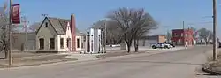 Old Highway 50 in Deerfield (2015) | |
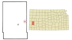 Location within Kearny County and Kansas | |
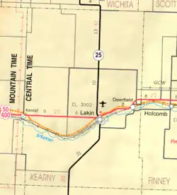 KDOT map of Kearny County (legend) | |
| Coordinates: 37°58′55″N 101°8′5″W | |
| Country | United States |
| State | Kansas |
| County | Kearny |
| Founded | 1885 |
| Incorporated | 1907 |
| Area | |
| • Total | 0.48 sq mi (1.25 km2) |
| • Land | 0.48 sq mi (1.25 km2) |
| • Water | 0.00 sq mi (0.00 km2) |
| Elevation | 2,946 ft (898 m) |
| Population | |
| • Total | 700 |
| • Estimate (2019)[3] | 690 |
| • Density | 1,434.51/sq mi (553.97/km2) |
| Time zone | UTC-6 (CST) |
| • Summer (DST) | UTC-5 (CDT) |
| ZIP code | 67838 |
| Area code | 620 |
| FIPS code | 20-17225 [4] |
| GNIS ID | 0471602 [5] |
| Website | deerfieldkansas.com |
History
The first settlement was made at Deerfield in 1885. Deerfield was incorporated as a city in 1907.[7]
Geography
Deerfield is located at 37°58′55″N 101°8′5″W (37.982081, -101.134848).[8] According to the United States Census Bureau, the city has a total area of 0.47 square miles (1.22 km2), all of it land.[9]
Climate
According to the Köppen Climate Classification system, Deerfield has a semi-arid climate, abbreviated "BSk" on climate maps.[10]
Demographics
| Historical population | |||
|---|---|---|---|
| Census | Pop. | %± | |
| 1910 | 152 | — | |
| 1920 | 284 | 86.8% | |
| 1930 | 325 | 14.4% | |
| 1940 | 356 | 9.5% | |
| 1950 | 440 | 23.6% | |
| 1960 | 442 | 0.5% | |
| 1970 | 474 | 7.2% | |
| 1980 | 538 | 13.5% | |
| 1990 | 677 | 25.8% | |
| 2000 | 884 | 30.6% | |
| 2010 | 700 | −20.8% | |
| 2019 (est.) | 690 | [3] | −1.4% |
| U.S. Decennial Census | |||
2010 census
As of the census[2] of 2010, there were 700 people, 235 households, and 180 families residing in the city. The population density was 1,489.4 inhabitants per square mile (575.1/km2). There were 249 housing units at an average density of 529.8 per square mile (204.6/km2). The racial makeup of the city was 81.0% White, 1.1% African American, 1.1% Native American, 0.3% Asian, 14.6% from other races, and 1.9% from two or more races. Hispanic or Latino of any race were 48.7% of the population.
There were 235 households, of which 46.4% had children under the age of 18 living with them, 57.0% were married couples living together, 14.9% had a female householder with no husband present, 4.7% had a male householder with no wife present, and 23.4% were non-families. 19.1% of all households were made up of individuals, and 6.8% had someone living alone who was 65 years of age or older. The average household size was 2.98 and the average family size was 3.41.
The median age in the city was 32 years. 31.4% of residents were under the age of 18; 10% were between the ages of 18 and 24; 26.1% were from 25 to 44; 21.1% were from 45 to 64; and 11.6% were 65 years of age or older. The gender makeup of the city was 49.0% male and 51.0% female.
2000 census
As the 2000 census,[4] there were 884 people, 270 households and 221 families residing in the city. The population density was 1,843.3 per square mile (711.1/km2). There were 284 housing units at an average density of 592.2 per square mile (228.4/km2). The racial makeup of the city was 65.27% White, 0.34% African American, 0.23% Native American, 0.45% Pacific Islander, 30.54% from other races, and 3.17% from two or more races. Hispanic or Latino of any race were 51.58% of the population.
There were 270 households, of which 50.0% had children under the age of 18 living with them, 65.2% were married couples living together, 10.7% had a female householder with no husband present, and 17.8% were non-families. 16.3% of all households were made up of individuals, and 5.6% had someone living alone who was 65 years of age or older. The average household size was 3.27 and the average family size was 3.66.
39.1% of the population were under the age of 18, 8.4% from 18 to 24, 26.8% from 25 to 44, 17.4% from 45 to 64, and 8.3% who were 65 years of age or older. The median age was 27 years. For every 100 females, there were 114.0 males. For every 100 females age 18 and over, there were 102.3 males.
The median household income was $31,944 and the median family income was $36,111. Males had a median income of $23,182 compared with $18,667 for females. The per capita income for the city was $12,802. About 11.8% of families and 14.5% of the population were below the poverty line, including 14.1% of those under age 18 and 7.7% of those age 65 or over.
Education
Deerfield is part of Deerfield USD 216 public school district.
See also
References
- "2019 U.S. Gazetteer Files". United States Census Bureau. Retrieved July 24, 2020.
- "U.S. Census website". United States Census Bureau. Retrieved 2012-07-06.
- "Population and Housing Unit Estimates". United States Census Bureau. May 24, 2020. Retrieved May 27, 2020.
- "U.S. Census website". United States Census Bureau. Retrieved 2008-01-31.
- "US Board on Geographic Names". United States Geological Survey. 2007-10-25. Retrieved 2008-01-31.
- "2010 City Population and Housing Occupancy Status". U.S. Census Bureau. Retrieved August 31, 2011.
- Blackmar, Frank Wilson (1912). Kansas: A Cyclopedia of State History, Embracing Events, Institutions, Industries, Counties, Cities, Towns, Prominent Persons, Etc. Standard Publishing Company. pp. 504.
- "US Gazetteer files: 2010, 2000, and 1990". United States Census Bureau. 2011-02-12. Retrieved 2011-04-23.
- "US Gazetteer files 2010". United States Census Bureau. Archived from the original on 2012-01-25. Retrieved 2012-07-06.
- Climate Summary for Deerfield, Kansas
Further reading
External links
| Wikimedia Commons has media related to Deerfield, Kansas. |
- City
- Schools
- USD 216, local school district
- Maps
- Deerfield City Map, KDOT
Municipalities and communities of Kearny County, Kansas, United States | ||
|---|---|---|
| Cities | 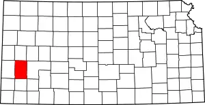 Map of Kansas highlighting Kearny County | |
| Townships | ||
| ||