Det Udom District
Det Udom (Thai: เดชอุดม) is a district (amphoe) in the southern part of Ubon Ratchathani Province, in northeastern Thailand.
Det Udom
เดชอุดม | |
|---|---|
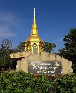 The pagoda in Junthummawas Temple, Bua Ngam sub-district. | |
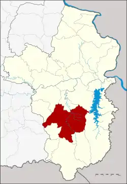 District location in Ubon Ratchathani Province | |
| Coordinates: 14°54′11″N 105°4′35″E | |
| Country | Thailand |
| Province | Ubon Ratchathani |
| Area | |
| • Total | 1,189.0 km2 (459.1 sq mi) |
| Population (2005) | |
| • Total | 169,896 |
| • Density | 142.9/km2 (370/sq mi) |
| Time zone | UTC+7 (ICT) |
| Postal code | 34160 |
| Geocode | 3407 |
Geography
Neighboring districts are (from the northwest clockwise) Samrong, Warin Chamrap, Na Yia, Phibun Mangsahan, Buntharik, Na Chaluai, Nam Yuen, Nam Khun, Thung Si Udom of Ubon Ratchathani Province, and Benchalak of Sisaket Province
Administration
The district is divided into 16 sub-districts (tambons), which are further subdivided into 229 villages (mubans). Mueang Det is a town (thesaban mueang) covering parts of the same-named tambon. There are also three townships (thesaban tambons): Na Suang and Bua Ngam each cover parts of the same-named tambon, and Kut Prathai covers tambon Kut Prathai. There are a further 10 tambon administrative organizations (TAO).
| No. | Name | Thai name | Villages | Pop. | |
|---|---|---|---|---|---|
| 1. | Mueang Det | เมืองเดช | 31 | 32,919 | |
| 2. | Na Suang | นาส่วง | 12 | 8,943 | |
| 4. | Na Charoen | นาเจริญ | 11 | 6,963 | |
| 6. | Thung Thoeng | ทุ่งเทิง | 15 | 8,180 | |
| 8. | Som Sa-at | สมสะอาด | 12 | 10,413 | |
| 9. | Kut Prathai | กุดประทาย | 20 | 12,613 | |
| 10. | Top Hu | ตบหู | 21 | 11,406 | |
| 11. | Klang | กลาง | 17 | 14,269 | |
| 12. | Kaeng | แก้ง | 11 | 7,866 | |
| 13. | Tha Pho Si | ท่าโพธิ์ศรี | 10 | 6,477 | |
| 15. | Bua Ngam | บัวงาม | 16 | 11,953 | |
| 16. | Kham Khrang | คำครั่ง | 10 | 6,180 | |
| 17. | Na Krasaeng | นากระแซง | 12 | 13,020 | |
| 20. | Phon Ngam | โพนงาม | 12 | 8,585 | |
| 21. | Pa Mong | ป่าโมง | 10 | 4,535 | |
| 23. | Non Sombun | โนนสมบูรณ์ | 9 | 5,574 |
Missing numbers are tambons which now form Districts Na Yia and Thung Si Udom.