Detroit, Texas
Detroit (DEE-troyt) is a town in Red River County, Texas, United States. The population was 732 at the 2010 census.
Detroit, Texas | |
|---|---|
.jpg.webp) U.S. Route 82 and East Garner Drive in Detroit | |
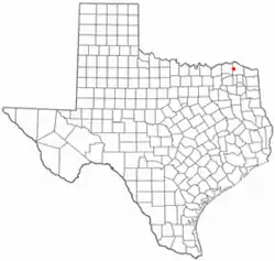 Location of Detroit, Texas | |
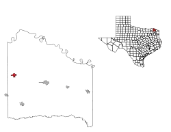 | |
| Coordinates: 33°39′42″N 95°15′52″W | |
| Country | United States |
| State | Texas |
| County | Red River |
| Area | |
| • Total | 1.58 sq mi (4.10 km2) |
| • Land | 1.58 sq mi (4.10 km2) |
| • Water | 0.00 sq mi (0.00 km2) |
| Elevation | 482 ft (147 m) |
| Population (2010) | |
| • Total | 732 |
| • Estimate (2019)[2] | 683 |
| • Density | 431.46/sq mi (166.55/km2) |
| Time zone | UTC-6 (Central (CST)) |
| • Summer (DST) | UTC-5 (CDT) |
| ZIP code | 75436 |
| Area code(s) | 903 |
| FIPS code | 48-20128[3] |
| GNIS feature ID | 1355944[4] |
John Nance Garner, 32nd Vice President of the United States, was born outside of Detroit but lived most of his life in Uvalde on the southern rim of the Texas Hill Country.
Geography
Detroit is located at 33°39′42″N 95°15′52″W (33.661703, -95.264524).[5]
According to the United States Census Bureau, the town has a total area of 1.6 square miles (4.1 km2), all of it land.
Demographics
| Historical population | |||
|---|---|---|---|
| Census | Pop. | %± | |
| 1940 | 1,064 | — | |
| 1950 | 679 | −36.2% | |
| 1960 | 576 | −15.2% | |
| 1970 | 668 | 16.0% | |
| 1980 | 805 | 20.5% | |
| 1990 | 706 | −12.3% | |
| 2000 | 776 | 9.9% | |
| 2010 | 732 | −5.7% | |
| 2019 (est.) | 683 | [2] | −6.7% |
| U.S. Decennial Census[6] | |||
As of the census[3] of 2000, there were 776 people, 315 households, and 217 families residing in the town. The population density was 490.7 people per square mile (189.6/km2). There were 359 housing units at an average density of 227.0 per square mile (87.7/km2). The racial makeup of the town was 78.35% White, 16.49% African American, 0.64% Native American, 1.68% from other races, and 2.84% from two or more races. Hispanic or Latino of any race were 2.58% of the population.
There were 315 households, out of which 33.0% had children under the age of 18 living with them, 48.6% were married couples living together, 16.2% had a female householder with no husband present, and 31.1% were non-families. 29.5% of all households were made up of individuals, and 15.6% had someone living alone who was 65 years of age or older. The average household size was 2.46 and the average family size was 3.06.
In the town, the population was spread out, with 29.4% under the age of 18, 8.5% from 18 to 24, 25.6% from 25 to 44, 20.7% from 45 to 64, and 15.7% who were 65 years of age or older. The median age was 34 years. For every 100 females, there were 83.5 males. For every 100 females age 18 and over, there were 80.3 males.
The median income for a household in the town was $25,250, and the median income for a family was $31,136. Males had a median income of $23,750 versus $17,250 for females. The per capita income for the town was $14,331. About 20.8% of families and 24.0% of the population were below the poverty line, including 34.4% of those under age 18 and 14.8% of those age 65 or over.
Education
Detroit is served by the Detroit Independent School District.
References
- "2019 U.S. Gazetteer Files". United States Census Bureau. Retrieved August 7, 2020.
- "Population and Housing Unit Estimates". United States Census Bureau. May 24, 2020. Retrieved May 27, 2020.
- "U.S. Census website". United States Census Bureau. Retrieved 2008-01-31.
- "US Board on Geographic Names". United States Geological Survey. 2007-10-25. Retrieved 2008-01-31.
- "US Gazetteer files: 2010, 2000, and 1990". United States Census Bureau. 2011-02-12. Retrieved 2011-04-23.
- "Census of Population and Housing". Census.gov. Retrieved June 4, 2015.
Municipalities and communities of Red River County, Texas, United States | ||
|---|---|---|
| Cities | 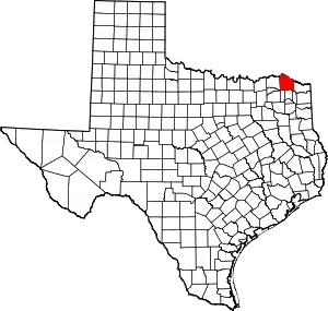 Red River County map | |
| Towns | ||
| Unincorporated communities | ||
| Ghost town | ||
| Footnotes | ‡This populated place also has portions in an adjacent county or counties | |
| ||
| Authority control |
|---|
