Dexter, Missouri
Dexter is a city in Stoddard County, Missouri, United States, founded in 1873. The population was 7,864 at the 2010 census.
Dexter, Missouri | |
|---|---|
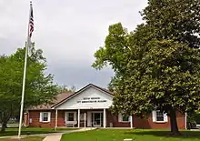
 Visitor center and grain towers along the railroad tracks | |
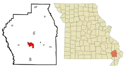 Location of Dexter, Missouri | |
| Coordinates: 36°47′48″N 89°57′45″W | |
| Country | United States |
| State | Missouri |
| County | Stoddard |
| Government | |
| • Mayor | Jason Banken[1] |
| Area | |
| • Total | 7.33 sq mi (18.98 km2) |
| • Land | 7.20 sq mi (18.65 km2) |
| • Water | 0.13 sq mi (0.34 km2) |
| Elevation | 371 ft (113 m) |
| Population | |
| • Total | 7,864 |
| • Estimate (2019)[5] | 7,815 |
| • Density | 1,085.42/sq mi (419.08/km2) |
| Time zone | UTC-6 (Central (CST)) |
| • Summer (DST) | UTC-5 (CDT) |
| ZIP code | 63841 |
| Area code(s) | 573 |
| FIPS code | 29-19396[6] |
| GNIS feature ID | 0716871[3] |
History
Dexter was platted in 1873.[7] Mr. Dex, an early settler, gave the community the name of his horse, Dexter.[8] Dexter experienced rapid growth with the arrival of the St. Louis, Iron Mountain and Southern Railway.[9] A post office called Dexter City was established in 1873, and the name was changed to Dexter in 1887.[10]
The Dexter Gymnasium was listed on the National Register of Historic Places in 2001.[11]
Geography
Dexter is located 19 miles (31 km) southwest of Sikeston. Dexter is located on what is known as Crowley's Ridge. It is at the intersection of U.S. Route 60 and Missouri Route 25.[12]
According to the United States Census Bureau, the city has a total area of 6.65 square miles (17.22 km2), of which 6.52 square miles (16.89 km2) is land and 0.13 square miles (0.34 km2) is water.[13]
Demographics
| Historical population | |||
|---|---|---|---|
| Census | Pop. | %± | |
| 1880 | 489 | — | |
| 1890 | 792 | 62.0% | |
| 1900 | 1,862 | 135.1% | |
| 1910 | 2,322 | 24.7% | |
| 1920 | 2,635 | 13.5% | |
| 1930 | 2,714 | 3.0% | |
| 1940 | 3,108 | 14.5% | |
| 1950 | 4,624 | 48.8% | |
| 1960 | 5,519 | 19.4% | |
| 1970 | 6,024 | 9.2% | |
| 1980 | 7,043 | 16.9% | |
| 1990 | 7,559 | 7.3% | |
| 2000 | 7,356 | −2.7% | |
| 2010 | 7,864 | 6.9% | |
| 2019 (est.) | 7,815 | [5] | −0.6% |
| U.S. Decennial Census[14] | |||
2010 census
As of the census[4] of 2010, there were 7,865 people, 3,359 households, and 2,108 families living in the city. The population density was 1,206.1 inhabitants per square mile (465.7/km2). There were 3,666 housing units at an average density of 562.3 per square mile (217.1/km2). The racial makeup of the city was 97.1% White, 0.5% African American, 0.5% Native American, 0.2% Asian, 0.2% from other races, and 1.4% from two or more races. Hispanic or Latino of any race were 1.9% of the population.
There were 3,359 households, of which 30.8% had children under the age of 18 living with them, 43.8% were married couples living together, 14.3% had a female householder with no husband present, 4.6% had a male householder with no wife present, and 37.2% were non-families. 32.5% of all households were made up of individuals, and 14.4% had someone living alone who was 65 years of age or older. The average household size was 2.28 and the average family size was 2.83.
The median age in the city was 40.5 years. 22.9% of residents were under the age of 18; 8.3% were between the ages of 18 and 24; 24.4% were from 25 to 44; 24.8% were from 45 to 64; and 19.8% were 65 years of age or older. The gender makeup of the city was 45.6% male and 54.4% female.
2000 census
As of the census[6] of 2000, there were 7,356 people, 3,237 households, and 2,019 families living in the city. The population density was 1,208.0 people per square mile (466.4/km2). There were 3,560 housing units at an average density of 584.6 per square mile (225.7/km2). The racial makeup of the city was 97.31% White, 0.15% African American, 0.46% Native American, 0.18% Asian, 0.50% from other races, and 1.40% from two or more races. Hispanic or Latino of any race were 1.20% of the population.
There were 3,237 households, out of which 29.4% had children under the age of 18 living with them, 47.0% were married couples living together, 12.1% had a female householder with no husband present, and 37.6% were non-families. 33.8% of all households were made up of individuals, and 17.7% had someone living alone who was 65 years of age or older. The average household size was 2.23 and the average family size was 2.83.
In the city the population was spread out, with 23.7% under the age of 18, 9.2% from 18 to 24, 25.9% from 25 to 44, 20.9% from 45 to 64, and 20.3% who were 65 years of age or older. The median age was 39 years. For every 100 females there were 82.2 males. For every 100 females age 18 and over, there were 77.3 males.
The median income for a household in the city was $23,116, and the median income for a family was $32,175. Males had a median income of $26,724 versus $17,409 for females. The per capita income for the city was $15,034. About 14.8% of families and 18.3% of the population were below the poverty line, including 23.5% of those under age 18 and 16.3% of those age 65 or over.
Climate
Dexter has a humid subtropical climate (Köppen climate classification Cfa).
| Climate data for Dexter | |||||||||||||
|---|---|---|---|---|---|---|---|---|---|---|---|---|---|
| Month | Jan | Feb | Mar | Apr | May | Jun | Jul | Aug | Sep | Oct | Nov | Dec | Year |
| Average high °F (°C) | 43 (6) |
50 (10) |
60 (16) |
71 (22) |
80 (27) |
89 (32) |
92 (33) |
90 (32) |
83 (28) |
73 (23) |
58 (14) |
47 (8) |
70 (21) |
| Average low °F (°C) | 26 (−3) |
31 (−1) |
39 (4) |
48 (9) |
58 (14) |
66 (19) |
70 (21) |
68 (20) |
60 (16) |
49 (9) |
39 (4) |
30 (−1) |
49 (9) |
| Average precipitation inches (mm) | 3.47 (88) |
3.64 (92) |
4.89 (124) |
4.27 (108) |
4.86 (123) |
4.21 (107) |
3.81 (97) |
3.22 (82) |
3.07 (78) |
3.08 (78) |
4.56 (116) |
4.83 (123) |
47.91 (1,217) |
| Source: [15] | |||||||||||||
Government
Education
Dexter R-XI School District operated two elementary schools, one middle school and one high school.[16]
The town has a lending library, the Keller Public Library Of Dexter.[17]
Notable people
- George K. Sisler, Medal of Honor recipient
- Clyde A. Vaughn, United States Army Lieutenant General and Director of the Army National Guard
- James P. Walker, politician. member of the House of Representatives.
- Max West, baseball player, member of Pacific Coast League Hall of Fame
- Orville Zimmerman, United States Representative for Missouri's 10th congressional district, was principal of Dexter High School, 1904-1908
See also
References
- "City Officials - Visit Dexter-Dexter, MO". visitdexter.com. Retrieved December 30, 2019.
- "2019 U.S. Gazetteer Files". United States Census Bureau. Retrieved July 26, 2020.
- U.S. Geological Survey Geographic Names Information System: Dexter, Missouri
- "U.S. Census website". United States Census Bureau. Retrieved 2012-07-08.
- "Population and Housing Unit Estimates". United States Census Bureau. May 24, 2020. Retrieved May 27, 2020.
- "U.S. Census website". United States Census Bureau. Retrieved 2008-01-31.
- Eaton, David Wolfe (1918). How Missouri Counties, Towns and Streams Were Named. The State Historical Society of Missouri. p. 366.
- "Stoddard County Place Names, 1928–1945". The State Historical Society of Missouri. Archived from the original on June 24, 2016. Retrieved December 26, 2016.
- History of Southeast Missouri: A Narrative Account of Its Historical Progress, Its People and Its Principal Interests, Volume 1. Lewis Publishing Company. 1912. pp. 389–390. ISBN 9780722207536.
- "Post Offices". Jim Forte Postal History. Retrieved 26 December 2016.
- "National Register Information System". National Register of Historic Places. National Park Service. July 9, 2010.
- Missouri Atlas & Gazetteer, DeLorme, 1st ed., 1998, P.67, ISBN 0899332242
- "US Gazetteer files 2010". United States Census Bureau. Archived from the original on 2012-07-02. Retrieved 2012-07-08.
- "Census of Population and Housing". Census.gov. Retrieved June 4, 2015.
- "Average weather for Dexter, Missouri". Weather.com. Retrieved December 21, 2008.
- "Dexter R-Xi School District". Great Schools. Retrieved 1 June 2019.
- "Missouri Public Libraries". PublicLibraries.com. Archived from the original on 10 June 2017. Retrieved 1 June 2019.
External links
- Historic maps of Dexter in the Sanborn Maps of Missouri Collection at the University of Missouri
Municipalities and communities of Stoddard County, Missouri, United States | ||
|---|---|---|
| Cities |  Map of Missouri highlighting Stoddard County | |
| Villages | ||
| Townships | ||
| CDP | ||
| Other unincorporated communities | ||
| Ghost towns | ||
| ||
| Authority control |
|---|