Dindori, Madhya Pradesh
Dindori, formerly known as Ramgarh, is a district head office and a nagar panchayat in Dindori district in the state of Madhya Pradesh, India. Dindori (डिंडोरी) has many historical as well as spiritual places. Some of the spiritual places are Laxman Madva, Kukarramath, Kalchuri Kali Mandir etc. The Kanha Tiger National Park is 180 km & Bandhavgarh National Park is 140 Km away from the district headquarter.
Dindori | |
|---|---|
Town | |
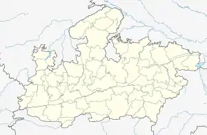
 Dindori Location in Madhya Pradesh, India  Dindori Dindori (India) | |
| Coordinates: 22.95°N 81.08°E | |
| Country | |
| State | Madhya Pradesh |
| District | Dindori |
| Elevation | 640 m (2,100 ft) |
| Population (2001) | |
| • Total | 17,413 |
| Languages | |
| • Official | Hindi |
| Time zone | UTC+5:30 (IST) |
| Vehicle registration | MP-52 |
| Website | www |
Geography
Dindori is located at 22.95°N 81.08°E.[1] It has an average elevation of 640 metres (2,099 feet).
Demographics
As of 2001 India census,[2] Dindori had a population of 580,730. Males constitute 52% of the population and females 48%. Dindori has an average literacy rate of 71%, higher than the national average of 59.5%: male literacy is 79% and, female literacy is 62%. In Dindori, 13% of the population is under 6 years of age.
Places to visit
There are various places in and around Dindori with domestic as well as foreign tourism.
- Devnala water fall, Dindori
- Jagatpur trek
- Chanda Forest village
- Dagona waterfall
See also
References
- Falling Rain Genomics, Inc - Dindori
- "Census of India 2001: Data from the 2001 Census, including cities, villages and towns (Provisional)". Census Commission of India. Archived from the original on 16 June 2004. Retrieved 1 November 2008.
http://dindori.nic.in/Profile.html