Djambala
Djambala is the main town of Djambala District and the Plateaux Region of the Republic of Congo. It lies north of Brazzaville and lies near the Léfini Faunal Reserve.
Djambala | |
|---|---|
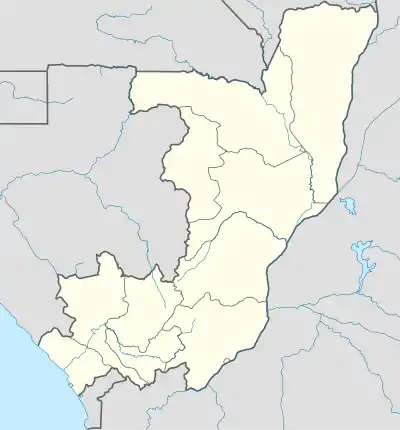 Djambala Location in the Republic of the Congo | |
| Coordinates: 2°32′41″S 14°45′12″E | |
| Country | |
| Region | Plateaux Region |
| District | Djambala District |
| Elevation | 622 m (2,041 ft) |
| Population (2007 census) | |
| • Total | 17,265 |
Climate
Djambala has a tropical savanna climate (Köppen climate classification Aw).
| Climate data for Djambala (extremes 1941–present) | |||||||||||||
|---|---|---|---|---|---|---|---|---|---|---|---|---|---|
| Month | Jan | Feb | Mar | Apr | May | Jun | Jul | Aug | Sep | Oct | Nov | Dec | Year |
| Record high °C (°F) | 31.5 (88.7) |
32.7 (90.9) |
33.0 (91.4) |
33.7 (92.7) |
39.6 (103.3) |
30.8 (87.4) |
37.2 (99.0) |
35.4 (95.7) |
33.6 (92.5) |
35.0 (95.0) |
37.1 (98.8) |
31.5 (88.7) |
39.6 (103.3) |
| Average high °C (°F) | 27.6 (81.7) |
27.8 (82.0) |
28.4 (83.1) |
28.5 (83.3) |
27.6 (81.7) |
26.9 (80.4) |
26.2 (79.2) |
27.0 (80.6) |
27.0 (80.6) |
26.6 (79.9) |
27.1 (80.8) |
27.1 (80.8) |
27.3 (81.1) |
| Daily mean °C (°F) | 23.3 (73.9) |
23.2 (73.8) |
23.6 (74.5) |
23.8 (74.8) |
23.3 (73.9) |
22.2 (72.0) |
21.2 (70.2) |
22.0 (71.6) |
22.6 (72.7) |
22.7 (72.9) |
22.8 (73.0) |
22.8 (73.0) |
22.8 (73.0) |
| Average low °C (°F) | 19.2 (66.6) |
19.2 (66.6) |
19.3 (66.7) |
19.6 (67.3) |
19.5 (67.1) |
17.9 (64.2) |
16.8 (62.2) |
17.0 (62.6) |
18.3 (64.9) |
18.9 (66.0) |
19.0 (66.2) |
19.1 (66.4) |
18.6 (65.5) |
| Record low °C (°F) | 15.0 (59.0) |
12.8 (55.0) |
14.9 (58.8) |
16.0 (60.8) |
15.3 (59.5) |
12.5 (54.5) |
12.1 (53.8) |
12.6 (54.7) |
15.1 (59.2) |
15.4 (59.7) |
14.8 (58.6) |
12.8 (55.0) |
12.1 (53.8) |
| Average precipitation mm (inches) | 211 (8.3) |
190 (7.5) |
265 (10.4) |
252 (9.9) |
200 (7.9) |
27 (1.1) |
11 (0.4) |
37 (1.5) |
144 (5.7) |
277 (10.9) |
264 (10.4) |
244 (9.6) |
2,122 (83.5) |
| Average precipitation days (≥ 0.1 mm) | 17 | 15 | 19 | 19 | 15 | 3 | 1 | 4 | 11 | 20 | 21 | 19 | 164 |
| Average relative humidity (%) | 80 | 83 | 83 | 83 | 84 | 82 | 80 | 76 | 80 | 85 | 86 | 86 | 82 |
| Mean monthly sunshine hours | 151.9 | 146.9 | 158.1 | 156.0 | 167.4 | 168.0 | 158.1 | 151.9 | 129.0 | 130.2 | 129.0 | 139.5 | 1,786 |
| Mean daily sunshine hours | 4.9 | 5.2 | 5.1 | 5.2 | 5.4 | 5.6 | 5.1 | 4.9 | 4.3 | 4.2 | 4.3 | 4.5 | 4.9 |
| Source 1: Deutscher Wetterdienst[1] | |||||||||||||
| Source 2: Meteo Climat (record highs and lows)[2] | |||||||||||||
Transport
In April 2007, a deal was signed with a Korean consortium to build a railway mainly for timber traffic from the main port to Djambala.[3][4]
Djambala is also served by Djambala Airport.
See also
References
- "Klimatafel von Djambala / Kongo" (PDF). Baseline climate means (1961-1990) from stations all over the world (in German). Deutscher Wetterdienst. Retrieved 24 October 2016.
- "Station Djambala" (in French). Meteo Climat. Retrieved 24 October 2016.
- Djambala railway Archived September 13, 2008, at the Wayback Machine
- AfricaNews Archived October 2, 2007, at the Wayback Machine
This article is issued from Wikipedia. The text is licensed under Creative Commons - Attribution - Sharealike. Additional terms may apply for the media files.