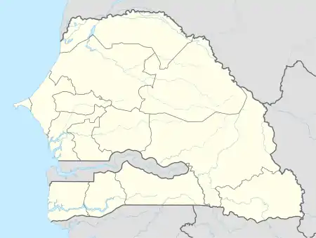
Djifer
Djifer is a coastal village in Fatick Department in Fatick Region, Senegal. It is located 10 km south of Palmarin at the end of the Point of Sangomar.
Djifer | |
|---|---|
 Djifer Location in Fatick Region and Senegal | |
| Coordinates: 13°56′6.2772″N 16°45′46.656″W | |
| Country | |
| Region | Fatick Region |
| Department | Fatick Department |
| Elevation | 13 ft (4 m) |
| Population | |
| • Total | ~2,000 |
| Time zone | UTC+0 (GMT) |
Climate
Djifer has a hot semi-arid climate (BSh) with no rainfall from November to May and moderate to heavy rainfall from June to September.
| Climate data for Djifer | |||||||||||||
|---|---|---|---|---|---|---|---|---|---|---|---|---|---|
| Month | Jan | Feb | Mar | Apr | May | Jun | Jul | Aug | Sep | Oct | Nov | Dec | Year |
| Average high °C (°F) | 31.7 (89.1) |
33.0 (91.4) |
34.1 (93.4) |
33.7 (92.7) |
33.3 (91.9) |
33.3 (91.9) |
31.9 (89.4) |
31.1 (88.0) |
31.7 (89.1) |
33.3 (91.9) |
33.9 (93.0) |
31.9 (89.4) |
32.7 (90.9) |
| Daily mean °C (°F) | 23.9 (75.0) |
24.8 (76.6) |
26.0 (78.8) |
26.4 (79.5) |
26.9 (80.4) |
28.2 (82.8) |
27.8 (82.0) |
27.2 (81.0) |
27.4 (81.3) |
28.0 (82.4) |
27.0 (80.6) |
24.5 (76.1) |
26.5 (79.7) |
| Average low °C (°F) | 16.1 (61.0) |
16.7 (62.1) |
18.0 (64.4) |
19.1 (66.4) |
20.6 (69.1) |
23.1 (73.6) |
23.8 (74.8) |
23.4 (74.1) |
23.2 (73.8) |
22.8 (73.0) |
20.1 (68.2) |
17.1 (62.8) |
20.3 (68.6) |
| Average precipitation mm (inches) | 1 (0.0) |
0 (0) |
0 (0) |
0 (0) |
1 (0.0) |
41 (1.6) |
143 (5.6) |
291 (11.5) |
205 (8.1) |
52 (2.0) |
3 (0.1) |
1 (0.0) |
738 (28.9) |
| Source: Climate-Data.org[1] | |||||||||||||
References
- "Climate: Djifer". Climate-Data.org. Retrieved August 6, 2020.
This article is issued from Wikipedia. The text is licensed under Creative Commons - Attribution - Sharealike. Additional terms may apply for the media files.