Dnieper estuary
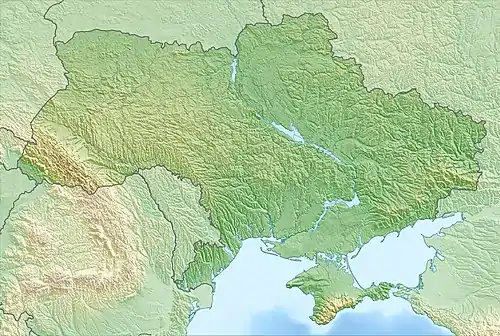
The Dnieper estuary or Dnieper liman (Ukrainian: Дніпровський лиман) is an open, brackish estuary on the north coast of the Black Sea, in southern Ukraine. The main port is Ochakiv. The estuary is 55 km long and 17 km wide. Its average depth is 6 m to 7 m; it is at its deepest (12 m) at Stanislav hole.
| Dnieper estuary | |
|---|---|
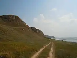 Dnieper estuary coast near Ochakiv | |
 Dnieper estuary | |
| Location | Ukraine |
| Coordinates | 46°34′N 31°57′E |
| Type | estuary |
| Primary inflows | Dnieper |
| Basin countries | Ukraine |
| Max. length | 55 km (34 mi) |
| Max. width | 17 km (11 mi) |
| Average depth | 6–7 m (20–23 ft) |
| Max. depth | 12 m (39 ft) |
| Settlements | Ochakiv |
The estuary is connected to the Black Sea by the 3.6-km wide strait (between Ochakiv Cape and Kinburn Spit). The southern coast of the estuary is low and sandy; the northern coast is mainly cliffs (about 20 m to 35 m high).
The Dnieper estuary and the Bug estuary together make the Dnieper–Bug estuary.
This article is issued from Wikipedia. The text is licensed under Creative Commons - Attribution - Sharealike. Additional terms may apply for the media files.
