Dohňany
Dohňany (Hungarian: Donány) is a village and municipality in Púchov District in the Trenčín Region of north-western Slovakia.
Dohňany | |
|---|---|
Municipality | |
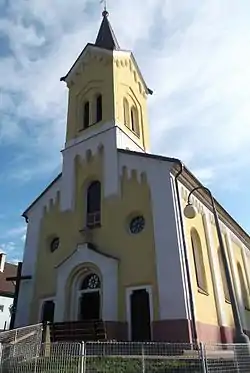 Church of Saints Cyril and Methodius | |
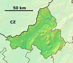 Dohňany Location of Dohňany in the Trenčín Region  Dohňany Location of Dohňany in Slovakia | |
| Coordinates: 49°09′N 18°18′E | |
| Country | |
| Region | Trenčín |
| District | Púchov |
| First mentioned | 1471 |
| Area | |
| • Total | 28.752 km2 (11.101 sq mi) |
| Elevation | 289 m (948 ft) |
| Population | |
| • Total | 1,753 |
| • Density | 61/km2 (160/sq mi) |
| Time zone | UTC+1 (CET) |
| • Summer (DST) | UTC+2 (CEST) |
| Postal code | 020 51 |
| Area code(s) | +421-42 |
| Car plate | PU |
| Website | www |
History
In historical records the village was first mentioned in 1471.
Geography
The municipality lies at an altitude of 289 metres and covers an area of 28.752 km². It has a population of about 1753 people.
Genealogical resources
The records for genealogical research are available at the state archive "Statny Archiv in Bytca, Slovakia"
- Roman Catholic church records (births/marriages/deaths): 1865-1897 (parish A)
- Lutheran church records (births/marriages/deaths): 1784-1909 (parish B)
External links
 Media related to Dohňany at Wikimedia Commons
- Official website

- https://web.archive.org/web/20080111223415/http://www.statistics.sk/mosmis/eng/run.html
- Surnames of living people in Dohnany
- https://web.archive.org/web/20080531070620/http://www.ckmtbdohnany.sk/
Municipalities of Púchov District | ||
|---|---|---|
This article is issued from Wikipedia. The text is licensed under Creative Commons - Attribution - Sharealike. Additional terms may apply for the media files.