Dollars Corner, Washington
Dollars Corner is a census-designated place (CDP) in Clark County, Washington, United States. The population was 1,108 at the 2010 census.[3]
Dollars Corner, Washington | |
|---|---|
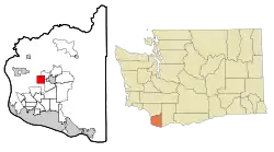 Location of Dollars Corner, Washington | |
| Coordinates: 45°46′44″N 122°35′26″W | |
| Country | United States |
| State | Washington |
| County | Clark |
| Area | |
| • Total | 3.9 sq mi (10.2 km2) |
| • Land | 3.9 sq mi (10.2 km2) |
| • Water | 0.0 sq mi (0.0 km2) |
| Elevation | 220 ft (67 m) |
| Population (2010) | |
| • Total | 1,108 |
| • Density | 280/sq mi (108.1/km2) |
| Time zone | UTC-8 (Pacific (PST)) |
| • Summer (DST) | UTC-7 (PDT) |
| FIPS code | 53-18195[1] |
| GNIS feature ID | 1512155[2] |
History
In 1917, Mr. and Mrs. S. L. Dollar purchased a farm in what would later be named Dollars Corner. The couple reportedly exchanged $150 and two cows for the land.[4] They opened a small store and service station on one corner in 1924, which became a local landmark. One story claims that the name was coined by local sheriff's deputies, who would report to their superiors that they traveled "as far as Dollar's Corner."[5]
The landscape of Dollars Corner began to change drastically in 2012 as a result of the realignment of Washington State Route 502. Historical buildings situated directly on the corner were razed, with the exception of the former O'Brady's Drive-In restaurant, which became the center of a protracted compensation dispute.[6][7]
Geography
Dollars Corner is located in west-central Clark County at 45°46′44″N 122°35′26″W (45.778847, -122.590475).[8] It is bordered to the northeast by Cherry Grove, to the east by the city of Battle Ground, to the southeast by Meadow Glade, and to the west by Duluth. Washington State Route 502 passes through the center of the community, leading east 3 miles (5 km) to the center of Battle Ground and west 3 miles (5 km) to Interstate 5's Exit 11. Dollars Corner is located around 15 miles (24 km) northeast of Vancouver, Washington.
According to the United States Census Bureau, the Dollars Corner CDP has a total area of 3.9 square miles (10.2 km2), all of it land.[3]
Demographics
As of the census[1] of 2000, there were 1,039 people, 373 households, and 299 families residing in the CDP. The population density was 260.8 people per square mile (100.8/km2). There were 391 housing units at an average density of 98.1/sq mi (37.9/km2). The racial makeup of the CDP was 94.90% White, 1.06% African American, 0.77% Native American, 0.48% Asian, 0.87% from other races, and 1.92% from two or more races. Hispanic or Latino of any race were 2.89% of the population. 22.7% were of German, 13.4% Finnish, 12.0% Irish, 11.9% American, 8.0% English, 7.2% European and 6.1% Swedish ancestry according to Census 2000.
There were 373 households, out of which 30.0% had children under the age of 18 living with them, 68.4% were married couples living together, 7.8% had a female householder with no husband present, and 19.8% were non-families. 15.0% of all households were made up of individuals, and 5.9% had someone living alone who was 65 years of age or older. The average household size was 2.79 and the average family size was 3.09.
In the CDP, the age distribution of the population shows 26.8% under the age of 18, 5.8% from 18 to 24, 26.3% from 25 to 44, 28.3% from 45 to 64, and 12.9% who were 65 years of age or older. The median age was 40 years. For every 100 females, there were 102.5 males. For every 100 females age 18 and over, there were 100.8 males.
The median income for a household in the CDP was $56,875, and the median income for a family was $58,090. Males had a median income of $40,242 versus $27,569 for females. The per capita income for the CDP was $21,025. About 6.5% of families and 5.5% of the population were below the poverty line, including 7.4% of those under age 18 and 13.2% of those age 65 or over.
References
- "U.S. Census website". United States Census Bureau. Retrieved 2008-01-31.
- "US Board on Geographic Names". United States Geological Survey. 2007-10-25. Retrieved 2008-01-31.
- "Geographic Identifiers: 2010 Demographic Profile Data (G001): Dollars Corner CDP, Washington". U.S. Census Bureau, American Factfinder. Retrieved August 28, 2015.
- Vance, Ken (19 March 2014). "Vern and Rene Dollar to celebrate 50th". The Reflector. Retrieved 15 October 2019.
- "Dollars Corner". Clark History. Retrieved 15 October 2019.
- Florip, Eric (13 July 2013). "WSDOT delays Highway 502 project". The Columbian. Retrieved 15 October 2019.
- Case, Marvin (30 April 2013). "O'Brady's issue still not settled". The Reflector. Retrieved 15 October 2019.
- "US Gazetteer files: 2010, 2000, and 1990". United States Census Bureau. 2011-02-12. Retrieved 2011-04-23.
Municipalities and communities of Clark County, Washington, United States | ||
|---|---|---|
| Cities | 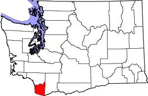 Map of Washington highlighting Clark County | |
| Town | ||
| CDPs | ||
| Other unincorporated communities | ||
| Footnotes | ‡This populated place also has portions in an adjacent county or counties | |
| ||