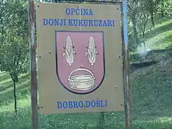
Donji Kukuruzari
Donji Kukuruzari (Serbian Cyrillic: Доњи Кукурузари[1]) is a village and a municipality in Croatia in the Sisak-Moslavina County. Donji Kukuruzari is underdeveloped municipality which is statistically classified as the First Category Area of Special State Concern by the Government of Croatia.[3]
Donji Kukuruzari
| |
|---|---|
| Općina Donji Kukuruzari Municipality of Donji Kukuruzari | |
 | |
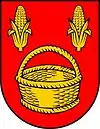 Coat of arms | |
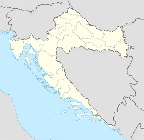 Donji Kukuruzari Location of Donji Kukuruzari in Croatia | |
| Coordinates: 45.264602°N 16.483845°E | |
| Country | |
| Region | Continental Croatia (Banovina) |
| County | |
| Area | |
| • Total | 113.78 km2 (43.93 sq mi) |
It has a population of 1,634 (census 2011), in the following settlements:[4]
- Babina Rijeka, population 127
- Borojevići, population 119
- Donja Velešnja, population 261
- Donji Bjelovac, population 43
- Donji Kukuruzari, population 297
- Gornja Velešnja, population 73
- Gornji Bjelovac, population 53
- Gornji Kukuruzari, population 51
- Knezovljani, population 81
- Komogovina, population 126
- Kostreši Bjelovački, population 43
- Lovča, population 19
- Mečenčani, population 148
- Prevršac, population 120
- Umetić, population 73
Demographics
Religion
Serbian Orthodox Church of the Dormition of the Theotokos
Serbian Orthodox Church of the Dormition of the Theotokos in Donji Kukuruzari was completed in 1838 while its iconostasis was painted in 1871 by painter Mihail Kutlija from Jasenovac.[7] The church was devastated by the Ustashe regime during the World War II Genocide of Serbs in the Independent State of Croatia.[7] The church's ring-bell was reconstructed just before the beginning of the Croatian War of Independence and it contained some of the icons originating from the nearby prominent Komogovina School of Orthodox art.[7]
References
- Government of Croatia (October 2013). "Peto izvješće Republike Hrvatske o primjeni Europske povelje o regionalnim ili manjinskim jezicima" (PDF) (in Croatian). Council of Europe. p. 36. Retrieved 30 November 2016.
- "Općine na područjima posebne državne skrbi Republike Hrvatske" (PDF). Croatian Chamber of Economy. Retrieved 15 April 2020.
- Lovrinčević, Željko; Davor, Mikulić; Budak, Jelena (June 2004). "AREAS OF SPECIAL STATE CONCERN IN CROATIA- REGIONAL DEVELOPMENT DIFFERENCES AND THE DEMOGRAPHIC AND EDUCATIONAL CHARACTERISTICS". Ekonomski pregled, Vol.55 No.5-6. Archived from the original on 18 August 2018. Retrieved 25 August 2018.
- "Population by Age and Sex, by Settlements, 2011 Census: Donji Kukuruzari". Census of Population, Households and Dwellings 2011. Zagreb: Croatian Bureau of Statistics. December 2012.
- Izdanje Državnog zavoda za statistiku RH: Narodnosni sastav stanovništva RH od 1880-1991. godine.
- "Population by Ethnicity, by Towns/Municipalities, 2011 Census: County of Sisak-Moslavina". Census of Population, Households and Dwellings 2011. Zagreb: Croatian Bureau of Statistics. December 2012.
- Škiljan, Filip (2008). Kulturno – historijski spomenici Banije s pregledom povijesti Banije od prapovijesti do 1881 [Cultural and historical monuments of Banija with an overview of history Banija from prehistory to 1881.] (in Serbian). Zagreb, Croatia: Serb National Council. ISBN 978-953-7442-04-0.
Subdivisions of Sisak-Moslavina County | ||
|---|---|---|
| Cities and towns | Coat of arms of Sisak-Moslavina County | |
| Municipalities | ||
| Authority control |
|
|---|