Dos Vientos Open Space
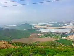
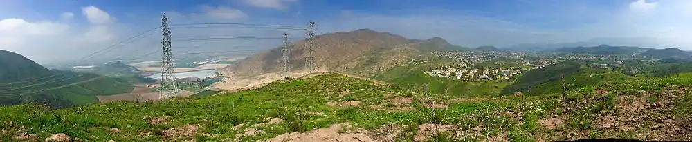
Dos Vientos Open Space is a 1,216 acres (492 ha) open space area in western Newbury Park, California. It contains more than 41 miles (66 km) of trails used for cycling, hiking and equestrians. Originally a part of the Rancho Guadalasca Spanish Land Grant of 1836,[1] the area is now an important wildlife movement corridor into the Santa Monica Mountains through the Point Mugu State Park.[2] It provides a habitat for a variety of wildlife, including bobcats, mule deer, coyotes, eagles, hawks, barn owls, mountain lions, and more.[3] It provides regional and internal trail connections, many trails offering panoramic views of the Conejo Valley, Oxnard Plain, Topatopa Mountains, Channel Islands, and the Pacific Ocean. Some of the endangered plant species found here include Conejo buckwheat, Verity's liveforever, and Conejo dudleya.[4] The landscape is undeveloped,[5] and dominated by coastal sage scrub, grassy hillsides, oak woodlands, and chaparral habitats.[6]
| Dos Vientos Open Space | |
|---|---|
 Twin Ponds by the Dos Vientos Ranch neighborhood | |
| Type | Open-space park |
| Location | Newbury Park, CA |
| Area | 1,216 acres (492 ha) |
| Operated by | Conejo Open Space Foundation (COSF) |
| Status | Open |
The only developed area by Dos Vientos is the adjoining Dos Vientos Ranch neighborhood, which was a 2,350-unit housing development approved by the Thousand Oaks City Council in April 1988.[7] It is a master-planned[8] and upscale community.[9][10] The master plan for the neighborhood was approved in the 1980s, but took off after major infrastructure was built to support the homes in 1998.[11] Wildfires in the area led to evacuation of homes in 2013.[12][13]
Recreation
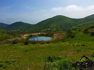
Besides numerous trail access points from the Dos Vientos Ranch neighborhood, the primary trailhead and parking lot are located at the Dos Vientos Community Park. Following the Park View Trail at the far end of the community park, one can either cross Via Ricardo to access the Powerline Trail (Edison Road Trail) across the road, which leads to the Conejo Mountain,[14] or one can follow Via Ricardo to the left for 0.1 miles (160 m) before entering the Vista Del Mar Trailhead. The Vista Del Mar Trail climbs up the Conejo Hills with overlook points with panoramic views of the Santa Monica Mountains, Boney Peak, Camarillo, Topatopa Mountains, Pacific Ocean, and the Channel Islands. It leads to Twin Ponds, which is two secluded ponds functioning as a designated conservation area for various migrating waterfowl species, birds such as mallards and ducks, freshwater fish species, as well as the western pond turtle and the two-striped garter snake. The ponds were originally built in the 1920s as part of an irrigation system for ranching and agriculture.[15]
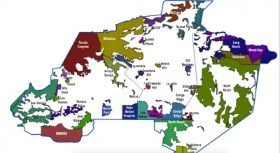
Dos Vientos Open Space is adjacent to the south with Rancho Sierra Vista (Satwiwa), Rancho Potrero, Point Mugu State Park, and the Boney Wilderness. To the east are adjacent open-space areas such as the Alta Vista Open Space, Potrero Ridge Open Space, and the Los Vientos Open Space. The adjoining open-space areas encompasses more than 16,000 acres (6,500 ha) of open-space land.[4] The weather here is cooler compared to most areas in the Conejo Valley, as a result of being closer to the coastal ocean breezes coming from coastal regions.[16]
References
- "Conejo Valley Trails". Conejo Valley.
- "Dos Vientos".
- Los Angeles Times (7 February 2016). "Suffering bobcats, coyotes, owls spur Thousand Oaks neighborhood to rethink war on rats". latimes.com.
- http://www.conejo-openspace.org/meeting%20Folder/13-01-09%20Agenda/8E.pdf
- http://www.crpd.org/civica/filebank/blobdload.asp?BlobID=3302 (Page 17).
- http://www.conejo-openspace.org/open_space_areas_in_TO.htm#Dos Archived 2016-02-09 at the Wayback Machine Vientos
- Bidwell, Carol A. (1989). The Conejo Valley: Old and New Frontiers. Windsor Publications. Page 86. ISBN 9780897812993.
- "Fears of rodenticide use in Dos Vientos stoked by mislabeled boxes".
- "Poison traps persist - February 11, 2016 - www.toacorn.com - Thousand Oaks Acorn".
- "Not all pleased with mudslide fix - February 12, 2015 - www.toacorn.com - Thousand Oaks Acorn".
- "Amgen retrenches despite surge in stock - August 14, 2014 - www.theacorn.com - The Acorn".
- Michael Martinez, CNN (3 May 2013). "Weather improves, but California wildfire still threatens 4,000 homes". CNN.
- "SPRINGS FIRE: A YEAR LATER - May 8, 2014 - www.toacorn.com - Thousand Oaks Acorn".
- "Mother Nature rules the roost - August 20, 2015 - www.theacorn.com - The Acorn".
- Stone, Robert (2011). Day Hikes Around Ventura County: 116 Great Hikes. Day Hike Books. Pages 178-180. ISBN 9781573420624.
- Murphy, Kelly (2012). Local Multi-Use Trails. Kelly Murphy. Page 84. ISBN 9781479165599.