Dotsero
Dotsero is a 700-meter (2,300 ft) wide by 400-meter (1,300 ft) deep maar volcano located in Dotsero, Colorado near the junction of the Colorado River and the Eagle River. It is classified as a scoria cone with evaporitic rock, basaltic tephra, and oxidized sandstone. Erupting approximately 4200 years ago, it is the youngest volcano in Colorado.
| Dotsero | |
|---|---|
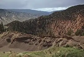
 Dotsero maar in central Colorado near the junction of the Colorado and Eagle rivers. | |
| Highest point | |
| Elevation | 6,783 ft (2,067 m) [1] |
| Coordinates | 39°39′38″N 107°2′6″W[1] |
| Geography | |
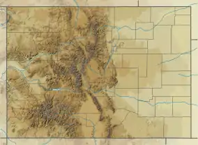
 Dotsero | |
| Topo map | USGS Dotsero |
| Geology | |
| Age of rock | Holocene[1] |
| Mountain type | maar[1] |
| Last eruption | 2200 BCE ± 300 years[1] |
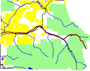
 Dotsero near the confluence of the Eagle and Colorado Rivers in Eagle County. |
Eruption information
This Holocene volcano erupted in the year 2220 ± 300 years B.C. When Dotsero did erupt, it created small scoria cones that were constructed along a NNE-SSW line on either side of the maar.[1] The eruption date is based upon radiocarbon dating of wood found underneath some of the scoria.[2] It is one of the youngest eruptions in the continental U.S. and it produced an explosion crater, a lahar, and a 3-kilometer (1.9 mi) long lava flow.[1]
Dotsero, and all volcanoes that have erupted in the past 10,000 years, are more likely to become active again. The United States Geological Survey considers it a moderate threat to impact air travel if it were to erupt.[3]
Interstate 70 cuts across the lava flow.
References
- "Dotsero". Global Volcanism Program. Smithsonian Institution. Retrieved 2008-08-20.
- Wood, Charles A.; Jurgen Kienle (1990). Volcanos of North America: United States and Canada. Cambridge University Press.
- Donna Gray (11 May 2005). "Dotsero volcano may erupt". Glenwood Spring Post Independent. Archived from the original on 2010-09-06.
