Downieville-Lawson-Dumont, Colorado
Downieville-Lawson-Dumont is a census-designated place (CDP) comprising the unincorporated communities of Downieville, Lawson, and Dumont located in and governed by Clear Creek County, Colorado, United States. The CDP is a part of the Denver–Aurora–Lakewood, CO Metropolitan Statistical Area. The Dumont post office ZIP code 80436 (post office boxes) serves the area.[3] At the United States Census 2010, the population of the Downieville-Lawson-Dumont CDP was 594, while the population of the 80436 ZIP Code Tabulation Area was 565.[4]
Downieville-Lawson-Dumont, Colorado | |
|---|---|
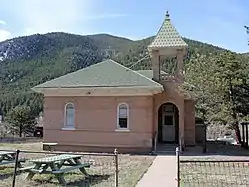 The Dumont School in Dumont. | |
Location of the Downieville-Lawson-Dumont CDP in Clear Creek County, Colorado. | |
 Downieville-Lawson-Dumont CDP Location of the Downieville-Lawson-Dumont CDP in the United States. | |
| Coordinates: 39°45′58″N 105°36′45″W[1] | |
| Country | |
| State | |
| County | Clear Creek County |
| Government | |
| • Type | unincorporated communities |
| Area | |
| • Total | 0.798 sq mi (2.068 km2) |
| • Land | 0.778 sq mi (2.014 km2) |
| • Water | 0.021 sq mi (0.054 km2) |
| Elevation | 8,035 ft (2,449 m) |
| Population (2010) | |
| • Total | 594 |
| • Density | 763/sq mi (295/km2) |
| Time zone | UTC-7 (MST) |
| • Summer (DST) | UTC-6 (MDT) |
| ZIP Code[3] | Dumont 80436 |
| Area codes | 303 & 720 |
| GNIS feature[2] | Downieville-Lawson-Dumont CDP |
Geography
Downieville, Lawson, and Dumont are adjacent in Clear Creek Canyon alongside Interstate 70.
The Downieville-Lawson-Dumont CDP has an area of 511 acres (2.068 km2), including 13 acres (0.054 km2) of water.[1]
Demographics
The United States Census Bureau initially defined the Downieville-Lawson-Dumont CDP for the United States Census 2000.
| Year | Pop. | ±% |
|---|---|---|
| 2000 | 364 | — |
| 2010 | 594 | +63.2% |
| 2020 | — | |
| Source: United States Census Bureau | ||
See also
- Outline of Colorado
- State of Colorado
- Colorado cities and towns
- Colorado counties
- Colorado metropolitan areas
References
- "State of Colorado Census Designated Places - BAS20 - Data as of January 1, 2020". United States Census Bureau. Retrieved December 21, 2020.
- "U.S. Board on Geographic Names: Domestic Names". United States Geological Survey. Retrieved December 4, 2020.
- "Look Up a ZIP Code". United States Postal Service. Retrieved December 4, 2020.
- "2010: DEC Summary File 1". United States Census Bureau. Retrieved December 21, 2020.
External links
- Downieville @ UncoverColorado.com
- Downieville @ Clear Creek County Tourism Bureau
- Lawson Adventure Park & Resort
- Dumont @ Colorado.com
- Dumont @ UncoverColorado.com
- Dumont @ Clear Creek County Tourism Bureau
- Dumont, Colorado Mining Claims And Mines
- Clear Creek County website
Municipalities and communities of Clear Creek County, Colorado, United States | ||
|---|---|---|
| Cities | Map of Colorado highlighting Clear Creek County | |
| Towns | ||
| CDPs | ||
| Unincorporated communities | ||
| Ghost towns |
| |
| Footnotes | ‡This populated place also has portions in an adjacent county or counties | |
| ||