Dudhauli
Dudhauli is a municipality of the Sindhuli District in the Janakpur Zone of south-eastern Nepal.
Dudhauli
दुधौली | |
|---|---|
 | |
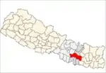
 Dudhauli Location in Nepal | |
| Coordinates: 26°58′10″N 86°16′15″E | |
| Country | |
| Region | Central |
| District | Sindhuli District |
| Government | |
| • Mayor | Ghana Shyam Raut (NCP) |
| • Deputy Mayor | Bal Kumari Adhikari Danuwar (NCP) |
| Area | |
| • Total | 390.39 km² = km2 (Formatting error: invalid input when rounding sq mi) |
| 65302 | |
| Time zone | UTC+5:45 (NST) |
| Website | http://dudhaulimun.gov.np |
Organization
It was a village development committee but later changed to a Municipality. It merged Dudhauli VDC, Ladavir VDC, and Tandi VDC and later Sirthouli, Hatpate, Harsai, Nipane, Arunthakur, Kakurthakur and Jinakhu VDCs.[1]
Dudhauli Bazar, Sankhatar, Dadatol, Khiriyani, Kartha, Bataha, Arunthakur, Kakurthakur, Hatpate, Nipane, Harsai, Dakaha, Sirthauli, Maini, Tandi etc are the main villages of Dudhauli.
Infrastructure
- Central police training center Kogati
- Maini Mela
- Major parts of Alternative Highway
- Dudhauli Bazar
- Ladavir school
- Kamala multiple campus
- Kamala H.S. School, Maini
Demographics
At the time of the 2011 Nepal census it had a population of 65,302 living in more than 4,000 households. It has in total 14 wards.
The people are mainly from Brahmin, Chhetri, Dalit, Magar, Lama, Tamang, Danuwar and other communities.
Economy
It has substantial resources such as productive soil, calcium (a raw material for cement), water and forests. After the formation of the municipality, the development of physical infrastructure and social development activities is increasing.
Problems Here
- Higher level of illiteracy, it means Lack of proper and quality of education to people. No Good higher education, no technical education facilities, Highest level of school dropouts by the lower level families' children due to their family problems and illiteracy. - No good Roads are here, access and connectivity to big cities are much poorer. Due to many rivers here much Bridges are needed. - No Hospital with Health facilities, too poor status. - Poor condition of farmers, Lack of irrigation to lands, No cashcrops production. - Unemployment - No factories, Businesses, and Entrepreneurship development . - Low development of infrastructures. - lower level of economic and social development of People inside here .
References
- "Nepal Census 2001". Nepal's Village Development Committees. Digital Himalaya. Archived from the original on 12 October 2008. Retrieved 2 November 2008.
External links