Dumra, Sitamarhi district
Dumra is a town and a notified area in Sitamarhi district in Bihar, India. Dumra is the headquarter of Sitamarhi district. It has approximately 16 wards.
Dumra | |
|---|---|
town | |
 Dumra Location in Bihar, India | |
| Coordinates: 26.5667271°N 85.5165482°E | |
| Country | |
| State | Bihar |
| District | Sitamarhi |
| Elevation | 86 m (282 ft) |
| Population (2001) | |
| • Total | 14,538 |
| Languages | |
| • Official | Maithili, Hindi |
| Time zone | UTC+5:30 (IST) |
| Vehicle registration | BR 30 |
| Lok Sabha constituency | Sitamarhi |
| Vidhan Sabha constituency | Sitamarhi |
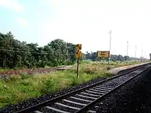
Dumra railway station
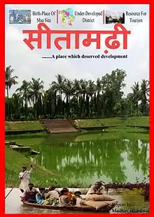
Sitamarhi
There is a small railway station situated in Dumra.
Geography
Dumra is located at 25.02°N 83.97°E. It has an average elevation of 86 metres (282 feet).
Demographics
As of 2001 India census, Dumra is a Census Town city in district of Dhanbad, Jharkhand. The Dumra Census Town has population of 326,332 of which 173,053 are males while 153,279 are females as per report released by Census India 2011.[1]
Education
- Brilliant Public School Sitamarhi
- Delhi Public School Lagma
- Hellen's School Sitamarhi
- Janki Vidya Niketan
- Kamala-Girls High School
- Kendriya Vidyalaya
- Lakshmi High School
- N.S.D.A.V.Public School
- Mathura High School
- Sacred Heart School, Sitamarhi
- Saraswati Vidya Mandir, Ring bandh
- Sitamarhi High School (MP High School)
This article is issued from Wikipedia. The text is licensed under Creative Commons - Attribution - Sharealike. Additional terms may apply for the media files.