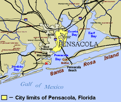
East Bay (Santa Rosa County, Florida)
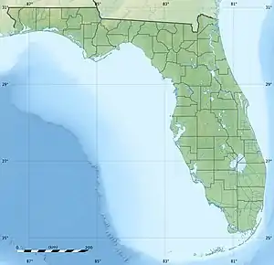
East Bay is a bay located in the far western Florida Panhandle.[1] Unusually, East Bay is connected to open waters via Pensacola Bay to its southwest. The bay is fed primarily by the Blackwater River and the East Bay River.
| East Bay | |
|---|---|
| Galvez Bay | |
 East Bay | |
| Location | Santa Rosa County, Florida |
| Type | Bay |
East Lagoon
The east side of East Bay is pinched into a wide river-like shape, called East Lagoon, until eventually becoming an actual river at East Bay River. The Lagoon starts where the bay is met by Axelson Point and Miller Point.[2][3][4]
History
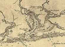
European exploration of the bay likely occurred as early as Pensacola's establishment in the early 16th century.
The bay has been included in most major maps of the bay system and harbor, dating back to that era. Between its first mapping and the present day, the bay has been listed under several different names, primarily Oyster Cove, Galvez Bay, and East Bay.[5]
During Hurricane Ivan's landfall in September 2004, the storm surge from the Gulf of Mexico came into East Bay, flooding the shoreline of the bay.
References
- "East Bay, Pensacola Bay, Florida Tide Station Location Guide". www.tide-forecast.com. Retrieved 2020-11-20.
- "Map of Pensacola Bay". Library of Congress via Explore Florida. 1781. Retrieved 2020-11-26.
- Romans, Bernard (1771). "Plan of the Harbour of Pensacola". Rare Maps. Retrieved 2020-12-01.
- Romans, Bernard (1776). "A General Map of the Southern British Colonies in America". Florida Memory.
- Apthorp (1878). "Apthorp's Standard map of Florida". Florida Memory.