East Branch Brandywine Creek
The East Branch Brandywine Creek[1][2][3] is a 27.4-mile-long (44.1 km)[4] tributary of Brandywine Creek in Chester County, Pennsylvania in the United States.
| East Branch Brandywine Creek | |
|---|---|
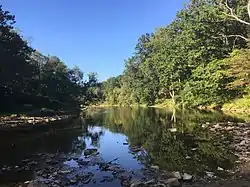 East Branch Brandywine Creek north of Downingtown | |
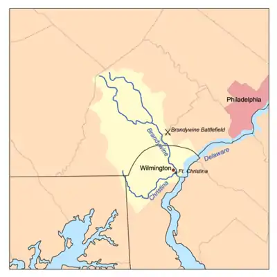 Christina River Basin, including East Branch Brandywine Creek | |
| Location | |
| Country | United States |
| State | Pennsylvania |
| County | Chester |
| City | Downingtown |
| Physical characteristics | |
| Source | |
| • location | Honey Brook Township, Chester County, Pennsylvania |
| • coordinates | 40°07′09″N 75°53′15″W |
| • elevation | 660 ft (200 m) |
| Mouth | Brandywine Creek |
• location | East Bradford Township, Chester County, Pennsylvania |
• coordinates | 39°55′21″N 75°38′58″W |
• elevation | 174 ft (53 m) |
Course
The creek starts in Suplee near Honey Brook, and joins the West Branch Brandywine Creek in Lenape. From its source, the creek flows east, then southeast, passing through the borough of Downingtown. The creek starts at an elevation of 660 feet (200 m) above sea level drops to an elevation of 174 feet (53 m) at its confluence with the West Branch.[4]
Natural history
Average annual precipitation is 43.3 inches (1,100 mm).
The East Brandywine is known for its fish. The game species are Rainbow trout, Brown trout, Brook trout, Smallmouth bass, Largemouth bass, Bluegill, Common carp. White Suckers and Creek Chub are also very common.[5]
History
The East Brandywine served as a source of energy for hundreds of years. The waters also powered many factories in Downingtown.
Gibson's Covered Bridge crosses between East Bradford Township and West Bradford Township.
See also
References
- Mouth: 39 55'21"N, 75 38'58"W, elevation: 174 ft.; Source: 40 07'09"N,75 53'15"W, U.S. Geological Survey Geographic Names Information System: East Branch Brandywine Creek
- Source elevation: 680 ft., "East Branch Brandywine Creek source from USGS-GNIS". USGS The National Map.
- United States Geological Survey Hydrological Unit Code: 02-04-02-05- Brandywine-Christina Watershed
- U.S. Geological Survey. National Hydrography Dataset high-resolution flowline data. The National Map Archived 2012-04-05 at WebCite, accessed April 1, 2011
- http://www.sportinggentleman.com/streaminformation.html