East Clare Way
The East Clare Way is a long-distance trail in County Clare, Ireland. It is a 180-kilometre (112-mile) long circular route that begins and ends in Killaloe. It is typically completed in eight days.[1] It is designated as a National Waymarked Trail by the National Trails Office of the Irish Sports Council and is managed by East & Mid Clare Way Limited and the East Clare Way Committee.[2]
| East Clare Way | |
|---|---|
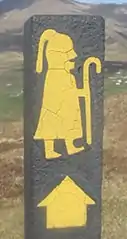
 Trail sign in O'Callaghans Mills | |
| Length | 180 km (112 mi)[1] |
| Location | County Clare, Ireland |
| Designation | National Waymarked Trail[1] |
| Trailheads | Killaloe |
| Use | Hiking |
| Elevation | |
| Elevation gain/loss | +3,060 m (10,039 ft)[1] |
| Hiking details | |
| Trail difficulty | Moderate[1] |
| Season | Any |
The circular route explores the hills and lakes to the west of Lough Derg and takes in the towns and villages of Kilbane, Broadford, O'Callaghans Mills, Tulla, Feakle, Flagmount, Mountshannon and Scarriff.[3] The northern sections of the trail cross the Slieve Aughty Mountains.[3]
A review of the National Waymarked Trails in 2010 found the proportion of road walking on the East Clare Way (53%) to be high and recommended that work be undertaken to take more of the trail off road.[4]
References
Notes
- "East Clare Way". IrishTrails. Irish Sports Council. Retrieved 2 August 2011.
- National Trails Office 2010, p. 36.
- "East Clare Way Map" (PDF). Shannon Region Trails. Archived from the original (pdf) on 28 March 2012. Retrieved 2 August 2011.
- National Trails Office 2010, pp. 36-37.
Bibliography
- National Trails Office (2010). "Setting New Directions. A review of National Waymarked Ways in Ireland" (PDF). Dublin: Irish Sports Council. Archived from the original (pdf) on 31 May 2011. Retrieved 1 August 2011.
.jpg.webp)