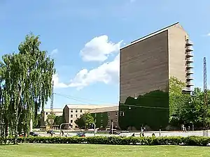
East Jutland metropolitan area
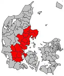
East Jutland metropolitan area (Danish: Byregion Østjylland) is a potential metropolitan area in Jutland and Funen, Denmark. [1] Aarhus is the most populated town in the region.
East Jutland Metropolitan Area
Byregion Østjylland Greater Aarhus | |
|---|---|
 Core city Aarhus from Your Rainbow Panorama | |
 East Jutland metropolitan area | |
| Established | 2006 |
| Area | |
| • Total | 11,521 km2 (4,448 sq mi) |
| Population (1. January 2016) | |
| • Total | 1,378,978 |
| • Density | 120/km2 (310/sq mi) |
The National Planning Report of 2006 published by the Danish Environment Ministry argued that “East Jutland is developing into a coherent area with high population growth and division of labour between the cities in the urban band that extends from Kolding to Randers” and foresaw “the contours of a future million city”. The report recommended dialogue about future development between the state, the region and the municipalities. [2][3]
In the next National Planning Report of 2013, the area was split into East Jutland North (Danish: Østjylland Nord) and the Triangle Region (Danish: Trekantsområdet). The municipalities in the two subregions cooperate as Business Region Aarhus and the Triangle Region respectively.[4][5]
With about 1.4 million people living in the area, it represents approximately 25% of the population of Denmark and is the second largest urban area after Greater Copenhagen.[6] The area has 19 municipalities as of 2016.[7]
Economy
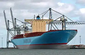
The metropolitan area is a major hub for education and is home to many large companies; in particular in the sectors of food production, agriculture, renewable energy and green tech. Major companies include Vestas Wind Systems A/S and Arla Foods. Vestas is a Danish manufacturer, seller, installer, and servicer of wind turbines and the largest in the world of its kind; and Arla is a Swedish-Danish dairy cooperative with headquarters in Aarhus and is the largest producer of dairy products in Scandinavia and the seventh largest dairy company in the world, measured by turnover. Among cooperative dairy companies, Arla is the third largest in the world.
The primary harbour of the region is Aarhus harbour. It is the largest industrial harbour in Denmark and among largest in Northern Europe, only surpassed by the Swedish industrial harbour in Gothenburg in the Kattegat sea area. With modern facilities, it handles approximately 12 million tonnes of cargo (2006) per year and is therefore among the 100 biggest container ports in the world.[8]
Greater Aarhus boasts a unique position in the global wind energy market. It is home to some of the world's biggest manufacturers of wind turbines and constitutes the world's most advanced knowledge center. An array of suppliers and subcontractors, covers the entire supply chain and the sector benefits from a solid political backing of wind energy on local, regional and national level. The wind business cluster here has a long legacy of cooperation between manufacturers, suppliers, scientific communities and public authorities. As a knowledge hub and gathering point for the wind industry, Aarhus is likely to play a vital role in developing the wind energy systems of the future:
· 87% of Denmark's combined turnover from wind energy is generated by businesses in the Greater Aarhus area
· 53% of Denmark's high-skill wind employees work in the Greater Aarhus area
· 57% of all top executives in the Danish wind industry work in the Greater Aarhus area
· 14,000 employees in the Danish wind industry work within Central Region Denmark – 11,000 of them within one hour drive from Aarhus.[9]
Colleges and universities
Notable universities and educational institutions within the area includes:
- Aarhus University
- University of Southern Denmark
- Aarhus School of Architecture
- Aarhus School of Business
- Aarhus Technical College
- Engineering College of Aarhus
- The Danish School of Journalism
- VIA University College
Infrastructure

There are two primary commercial international airports serving the area:
- Aarhus Airport (in the north)
- Billund Airport (in the south)

The area has several motorways but the European route E45 goes from the south to the north and is central to the area's growth.
Statistics

|
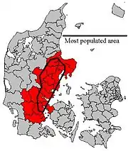
The core area around Aarhus is the most populated area in East Jutland, and that area is much smaller in km² - 6,182 km² - (2386 sq. mi) and with a population of more than one million.
The figures below are for the core area centered on Aarhus and most populous area in the East Jutland metropolitan area as of 1 January 2016.[10]
| Municipality | Population | Area¹ | Density² |
|---|---|---|---|
| Århus municipality | 330,639 | 468 | 698 |
| Vejle municipality | 111,743 | 1,058 | 103 |
| Randers municipality | 97,520 | 746 | 129 |
| Kolding municipality | 91,695 | 607 | 145 |
| Silkeborg municipality | 90,719 | 850 | 102 |
| Horsens municipality | 87,736 | 519 | 166 |
| Skanderborg municipality | 59,481 | 416 | 141 |
| Fredericia municipality | 50,689 | 134 | 376 |
| Favrskov municipality | 47,655 | 540 | 87 |
| Hedensted municipality | 46,206 | 551 | 83 |
| Odder municipality | 22,131 | 223 | 98 |
| East jutland core area | 1,036,214 | 6,182 | 168 |
The figures below are for the whole East Jutland metropolitan area as of 1 January 2016.[10]
| Municipality | Population | Area¹ | Density² |
|---|---|---|---|
| Århus municipality | 330,639 | 468 | 698 |
| Vejle municipality | 111,743 | 1,058 | 103 |
| Randers municipality | 97,520 | 746 | 129 |
| Viborg municipality | 95,776 | 1,409 | 68 |
| Kolding municipality | 91,695 | 607 | 145 |
| Silkeborg municipality | 90,719 | 850 | 102 |
| Horsens municipality | 87,736 | 515 | 163 |
| Skanderborg municipality | 59,481 | 416 | 140 |
| Haderslev municipality | 56,029 | 815 | 69 |
| Fredericia municipality | 50,689 | 134 | 376 |
| Favrskov municipality | 47,655 | 540 | 87 |
| Hedensted municipality | 46,206 | 551 | 83 |
| Vejen municipality | 42,869 | 812 | 53 |
| Syddjurs municipality | 41,889 | 689 | 59 |
| Norddjurs municipality | 38,144 | 721 | 53 |
| Middelfart municipality | 37,913 | 299 | 126 |
| Billund municipality | 26,434 | 540 | 49 |
| Odder municipality | 22,131 | 223 | 97 |
| Samsø municipality | 3,710 | 113 | 32 |
| Total East jutland metropolitan area | 1,378,978 | 11,521 | 119 |
Subregions
In the National Planning Report of 2013 (Danish: Landsplanredegørelse 2013), the term East Jutland metropolitan area was replaced by the two subregions of East Jutland North (Danish: Østjylland Nord) and the Triangle Region (Danish: Trekantsområdet).[4][11] The municipalities of the two subregions cooperate as Business Region Aarhus and the Triangle Region.
Business Region Aarhus
Business Region Aarhus is a partnership between the 12 municipalities of Favrskov, Hedensted, Horsens, Norddjurs, Odder, Randers, Samsø, Silkeborg, Skanderborg, Syddjurs, Viborg, and Aarhus, all in the Central Denmark Region.[12] The partnership began in 1994, before the Danish municipal reform of 2007.[13] The region originally formed the northernmost part of the East Jutland metropolitan area and Samsø Municipality, but since 24 February 2016, Viborg municipality was also included.[14] The Aarhus area was classified in a 2005 ESPON (European Spatial Planning Observation Network) report as a Category 3 MEGA. MEGAs are Metropolitan European Growth Areas, of which the report identified 76 in Europe.[15][16]
The term Greater Aarhus is used indistinctly in various contexts, but according to Aarhus Municipality it includes the 9 municipalities of Aarhus, Randers, Norddjurs, Syddjurs, Viborg, Silkeborg, Odder, Horsens and Samsø.[17]
Triangle Region
The Triangle Region is a partnership between the 7 municipalities of Billund, Fredericia, Haderslev, Kolding, Middelfart, Vejen and Vejle, all in the Southern Denmark Region.[18] Vejle is the most populated town in the Triangle Region.
Gallery
- Towns
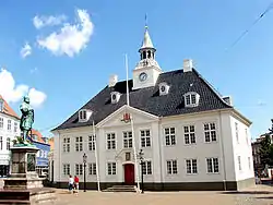 Randers, old city hall.
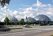
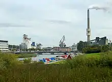 Randers harbour
 Norddjurs, Grenå
 Norddjurs, Grenå
 Norddjurs, Grenå harbour
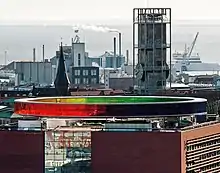 Aarhus
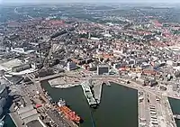 Aarhus harbour
.jpg.webp) Aarhus harbour
Aarhus harbour Silkeborg town, riverboat.
 Silkeborg, old rural house.
 Vejle City Hall
 Vejle, high street
%252C_Vejle%252C_Denmark.jpg.webp) Vejle, modern architecture
Vejle, modern architecture Vejle harbour
 Billund, amusement park Legoland
.jpg.webp) Billund, waterworld Lalandia
Billund, waterworld Lalandia Vejen, troll fountain.
- Landscapes and nature
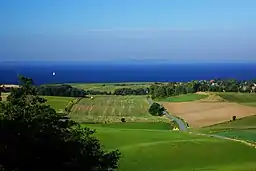 Djursland, landscape.
 Djursland, coastal landscape
 Djursland, one of many coves
.Bro_og_forsvarst%C3%A5rn.1.125359.ajb.jpg.webp) Syddjurs, Kalø Castle ruin.
Syddjurs, Kalø Castle ruin. Aarhus Bay
 Silkeborg Municipality, landscape
 Silkeborg Forests
 Vejle Fjord
.jpg.webp) Billund, heathland
Billund, heathland
See also
- Metropolitan areas of Denmark
- Largest urban areas in the Nordic countries
Sources
- Henrik Mølgaard Frandsen (2017). "Aarhus Kommune og etableringen af en politisk ramme-struktur for den østjyske byregion" [Aarhus Municipality and the establishment of a political frame-structure for the East Jutland Metropolitan Region]. Erhvervshistorisk Årbog. Historical account on the foundation and establishment of the region.
- Tom Nielsen and Boris Brorman Jensen (2017). Den Østjyske Millionby [The East Jutland Metropolis] (PDF) (in Danish). Dansk Byplanlaboratorium. Account and discussion on the idea of an East Jutland Metropolis (2006 to 2017).
- "Landsplanredegørelse 2013" [National Planning Report 2013] (in Danish). Danish Nature Agency. 2013.
- "Landsplanredegørelse 2006" [National Planning Report 2006] (in Danish). Danish Nature Agency. 2006.
- "Befolkningsforhold i Østjylland" [Demographics of East Jutland] (in Danish). By- og Landskabsstyrelsen. August 2008.
- Styregruppen for projekt Byudvikling i Østjylland (August 2008). "Vision Østjylland" (PDF) (in Danish). By- og Landskabsstyrelsen. Archived from the original (PDF) on 25 February 2009.
- Kristian Olesen (January 2008). "Den østjyske byregion" [The East Jutland city region]. Byplan (in Danish). Aalborg University. pp. 18–20.
- Peter Bro and Henrik Harder (2007). "Fremtidens byudvikling i Østjylland" [Future urban development in East Jutland] (PDF). Trafikdage på Aalborg Universitet 2007 (in Danish). Aalborg University. Archived from the original (PDF) on 28 September 2007.
References
- "Information.dk: En stor by holder stor fest i storbyen – kan det blive større?, 2012". Information.dk.
- See "Aarhus Kommune og etableringen af en politisk ramme-struktur for den østjyske byregion".
- See "Landsplanredegørelse 2006", p. 20.
- See "Den Østjyske Millionby", p. 13-15.
- See "Landsplanredegørelse 2013", p. 23.
- "Danish Befolkningsforhold i Østjylland, Miljøministeriet, august 2008
- "Befolkningsforhold i Østjylland - Erhvervs- og Befolkningsforhold i Østjylland - Bidrag til samarbejdsprojektet om Byudvikling i Østjyllandl". www2.blst.dk.
- XII.Godsomsætning Archived 27 August 2001 at the Wayback Machine, Århus Havn, 2000 (in Danish)
- "Archived copy". Archived from the original on 19 July 2012. Retrieved 25 November 2011.CS1 maint: archived copy as title (link)
- "Archived copy". Archived from the original on 6 December 2010. Retrieved 18 November 2010.CS1 maint: archived copy as title (link)
- See "Landsplanredegørelse 2013".
- "What is Business Region Aarhus?". businessregionaarhus.com. Retrieved 8 January 2019.
- "Business Region Aarhus". aarhuswiki.dk. Retrieved 8 January 2019.
- "Archived copy". Archived from the original on 28 April 2016. Retrieved 22 April 2016.CS1 maint: archived copy as title (link)
- See "Landsplanredegørelse 2013", p. 36-37.
- "ESPON 111 Potentials for polycentric development in Europe" (PDF). espon.eu. Retrieved 18 January 2019.
- "Greater Aarhus". Aarhus Municipality. Retrieved 11 January 2019.
- "The Triangle Region". trekantomraadet.com. Retrieved 9 January 2019.
External links
Official website, from 2010-2016
