Edgewood, Texas
Edgewood is a town in Van Zandt County, Texas, United States. The population was 1,441 at the 2010 census. The town draws its name from its location on the far western edge of the East Texas timberline on U.S. Highway 80, approximately 60 miles east of Dallas.
Edgewood, Texas | |
|---|---|
.jpg.webp) Downtown Edgewood | |
 Location of Edgewood, Texas | |
| Coordinates: 32°41′49″N 95°53′6″W | |
| Country | United States |
| State | Texas |
| County | Van Zandt |
| Area | |
| • Total | 1.38 sq mi (3.56 km2) |
| • Land | 1.36 sq mi (3.52 km2) |
| • Water | 0.02 sq mi (0.05 km2) |
| Elevation | 459 ft (140 m) |
| Population (2010) | |
| • Total | 1,441 |
| • Estimate (2019)[2] | 1,525 |
| • Density | 1,122.97/sq mi (433.62/km2) |
| Time zone | UTC-6 (Central (CST)) |
| • Summer (DST) | UTC-5 (CDT) |
| ZIP code | 75117 |
| Area code(s) | 903 |
| FIPS code | 48-22612[3] |
| GNIS feature ID | 1335087[4] |
| Website | edgewoodtexas |
Geography
Edgewood is located at 32°41′49″N 95°53′6″W (32.696860, -95.885036).[5]
According to the United States Census Bureau, the town has a total area of 1.4 square miles (3.5 km2), all of it land.
Demographics
| Historical population | |||
|---|---|---|---|
| Census | Pop. | %± | |
| 1880 | 83 | — | |
| 1920 | 820 | — | |
| 1930 | 761 | −7.2% | |
| 1940 | 738 | −3.0% | |
| 1950 | 834 | 13.0% | |
| 1960 | 887 | 6.4% | |
| 1970 | 1,176 | 32.6% | |
| 1980 | 1,413 | 20.2% | |
| 1990 | 1,284 | −9.1% | |
| 2000 | 1,348 | 5.0% | |
| 2010 | 1,441 | 6.9% | |
| 2019 (est.) | 1,525 | [2] | 5.8% |
| U.S. Decennial Census[6] | |||
As of the census[3] of 2000, there were 1,348 people, 548 households, and 389 families residing in the town. The population density was 987.4 people per square mile (379.9/km2). There were 599 housing units at an average density of 438.8 per square mile (168.8/km2). The racial makeup of the town was 86.80% White, 8.46% African American, 0.52% Native American, 0.07% Asian, 0.07% Pacific Islander, 2.45% from other races, and 1.63% from two or more races. Hispanic or Latino of any race were 4.53% of the population.
There were 548 households, out of which 33.4% had children under the age of 18 living with them, 52.0% were married couples living together, 16.1% had a female householder with no husband present, and 29.0% were non-families. 26.6% of all households were made up of individuals, and 16.6% had someone living alone who was 65 years of age or older. The average household size was 2.46 and the average family size was 2.96.
In the town, the population was spread out, with 27.8% under the age of 18, 9.8% from 18 to 24, 23.4% from 25 to 44, 19.9% from 45 to 64, and 19.1% who were 65 years of age or older. The median age was 37 years. For every 100 females, there were 82.4 males. For every 100 females age 18 and over, there were 77.6 males.
The median income for a household in the town was $27,250, and the median income for a family was $36,850. Males had a median income of $31,364 versus $25,272 for females. The per capita income for the town was $14,331. About 15.6% of families and 17.1% of the population were below the poverty line, including 21.3% of those under age 18 and 14.5% of those age 65 or over.
In 1989 the Edgewood High School Basketball Team won the AA State Championship. Edgewood won back to back State Championships in Boys Golf winning the 2006 and 2007 Texas Class AA State Championship.
In 1996 Edgewood was thrown into the national spotlight when a year-long drought forced the city into water rationing and closing local schools. Local pastors prompted church members and other citizens of Edgewood to display "Pray for Rain" signs, and to always keep an umbrella at hand. ABC News 20/20 reported on the story interviewing city councilman Danny Eason. A pipeline was built from Lake Tawakoni to the Edgewood City Lake.
Bob Hall, a conservative Republican member of the Texas State Senate resides in the Tailwind Airpark community in Edgewood.
Politics
The city of Edgewood is a Republican stronghold, like the rest of Van Zandt County. The city of Edgewood's limits are coterminous with Van Zandt County voter precinct 1E.
| Year | Democratic | Republican | Third Parties |
|---|---|---|---|
| 2020 | 20.00% 121 | 79.17% 479 | 0.83% 5 |
| 2016 | 20.37% 109 | 77.38% 414 | 2.24% 12 |
| 2012 | 25.55% 139 | 73.35% 399 | 1.10% 6 |
Education
The Town of Edgewood is served by the Edgewood Independent School District.
Notable Person
- Chad Morris -College Football Coach
Newspapers and publications
- Edgewood Enterprise
- Van Zandt County News
References
- "2019 U.S. Gazetteer Files". United States Census Bureau. Retrieved August 7, 2020.
- "Population and Housing Unit Estimates". United States Census Bureau. May 24, 2020. Retrieved May 27, 2020.
- "U.S. Census website". United States Census Bureau. Retrieved 2008-01-31.
- "US Board on Geographic Names". United States Geological Survey. 2007-10-25. Retrieved 2008-01-31.
- "US Gazetteer files: 2010, 2000, and 1990". United States Census Bureau. 2011-02-12. Retrieved 2011-04-23.
- "Census of Population and Housing". Census.gov. Retrieved June 4, 2015.
- "2020 Election Results" (PDF). vanzandtcounty.org.
External links
Municipalities and communities of Van Zandt County, Texas, United States | ||
|---|---|---|
| Cities | 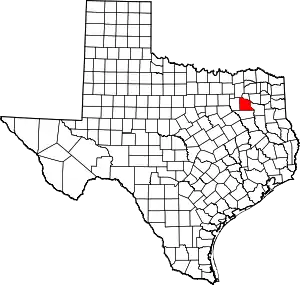 Van Zandt County map | |
| Town | ||
| CDPs | ||
| Other unincorporated communities | ||
| Ghost towns | ||
| ||