El Agustino
El Agustino is a district of the Lima Province in Peru. It is part of city of Lima. Officially established as a district on January 6, 1965, the current mayor (alcalde) of El Agustino is Víctor Modesto Salcedo Ríos. The district's postal code is 10.
El Agustino | |
|---|---|
 Flag  Coat of arms | |
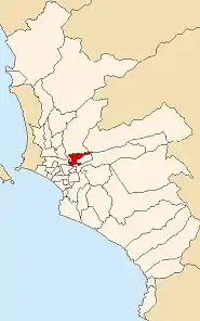 Location of El Agustino in the Lima province | |
| Coordinates: 12°04′S 77°01′W | |
| Country | |
| Region | Lima |
| Province | Lima |
| Founded | January 6, 1965 |
| Government | |
| • Mayor | Víctor Modesto Salcedo Ríos (2019-2022) |
| Area | |
| • Total | 12.54 km2 (4.84 sq mi) |
| Elevation | 197 m (646 ft) |
| Population (2017) | |
| • Total | 198,862 |
| • Density | 16,000/km2 (41,000/sq mi) |
| Time zone | UTC-5 (PET) |
| UBIGEO | 150111 |
| Website | munielagustino.gob.pe |
Geography
The district has a total land area of 12.54 km². Its administrative center is located 197 meters above sea level. Originally the boundary with Ate was marked by the Río Surco irrigation ditch, but in 1989 the eastern part of El Agustino (east of the El Agustino hill, which gave the district its name) broke away to form Santa Anita district with the Santa Anita section of Ate and surrounding areas.
Boundaries
- North: San Juan de Lurigancho and Lurigancho
- East: Ate and Santa Anita
- South: Ate, San Luis, La Victoria
- West: Downtown Lima
Demographics
According to a 2002 estimate by the INEI, the district has 166,177 inhabitants and a population density of 13,251.8 persons/km². In 1999, there were 32,910 households in the district. It is the 25th most populated district in Lima.
External links
- Municipalidad Distrital de El Agustino - El Agustino District Council Official Website (in Spanish)
