Ella, Sri Lanka
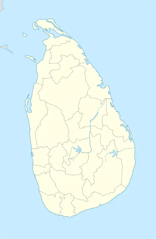
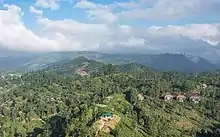
Ella (Sinhala: ඇල්ල; Lit. "water fall"; Tamil: எல்ல) is a small town in the Badulla District of Uva Province, Sri Lanka governed by an Urban Council. It is approximately 200 kilometres (120 mi) east of Colombo and is situated at an elevation of 1,041 metres (3,415 ft) above sea level.[2] The area has a rich bio-diversity, dense with numerous varieties of flora and fauna. Ella is surrounded by hills covered with cloud forests and tea plantations. The town has a cooler climate than surrounding lowlands, due to its elevation. The Ella Gap allows views across the southern plains of Sri Lanka.[3]
Ella
ඇල්ල எல்ல | |
|---|---|
 Ella Railway Station | |
 Ella | |
| Coordinates: 6°52′31″N 81°2′18″E | |
| Country | Sri Lanka |
| Province | Uva Province |
| District | Badulla District |
| Elevation | 1,041 m (3,415 ft) |
| Population (2012) | |
| • Total | 44,763[1] |
| Time zone | UTC+5:30 (Sri Lanka Standard Time Zone) |
| • Summer (DST) | UTC+6 (Summer time) |
| Post Code | 90090 |
Transport
Road
Located on the Colombo-Badulla railway line, and the A16 highway (Beragala-Hali Ela) a part of the Colombo-Badulla road.
Facilities
Notable government institutions are :
- Police station
- Railway station
- Main post office
Attractions
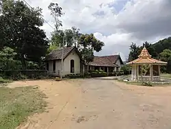
- Dhowa temple, a 2,000-year-old rock temple, is located on the Badulla-Bandarawela Road. It contains a 12 metres (39 ft) unfinished Buddha statue carved into the surrounding rock.
- Bambaragala Peak
- Ella Rock, a lookout point
- Little Adam's Peak, a 1,141 m (3,743 ft) pyramidal-shaped hill, located to the south-east of the town. Named after the larger Adam's Peak.
- Ravana Ella Falls, a 25 m (82 ft) waterfall, located approximately 6 km (4 mi) away from the town
- Nine Arches Bridge, Demodara
- Diyaluma Falls, a 220 m (720 ft) waterfall
- Yahalamadiththa temple
- Mahamevnawa Buddhist Monastery
- Ravana cave
Demographics
| Ethnicity | Population[5] | % Of Total |
|---|---|---|
| Sinhalese | 29,822 | 66.62 |
| Indian Tamils | 12,084 | 27 |
| Sri Lankan Tamils | 802 | 1.8 |
| Sri Lankan Moors | 1,994 | 4.45 |
| Other (including Burgher, Malay) | 61 | 0.14 |
| Total | 44,763 | 100 |
See also
References
- Brinkhoff, Thomas (13 October 2012). "Ella (Divisional Secretariat)". City Population. Retrieved 2 July 2014.
- "Ella". Sri Lanka Heritages Foundation. Retrieved 17 April 2016.
- Cook, Elsie Kathleen (1953). Ceylon: Its Geography, Its Resources and Its People. MacMillan. p. 90.
- Perera, G. F. (1925). The Ceylon Railway: The Story of Its Inception and Progress. Ceylon Observer. p. 284.
- "Population by ethnicity and district according to Divisional Secretary's Division, 2012" (PDF). Department of Census and Statistics - Sri Lanka. 2012. Retrieved 17 April 2016.
External links
| Wikivoyage has a travel guide for Ella. |
| Wikimedia Commons has media related to Ella, Sri Lanka. |
| ||