Ellis Cliffs, Mississippi
Ellis Cliffs is a ghost town in Adams County, Mississippi, United States.[1]
Ellis Cliffs, Mississippi | |
|---|---|
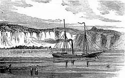 A view of Ellis Cliffs in 1896 | |
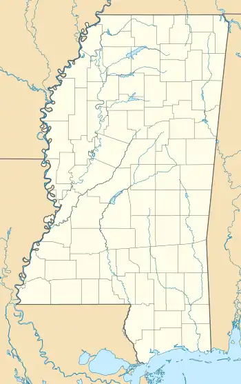 Ellis Cliffs, Mississippi Location within the state of Mississippi | |
| Coordinates: 31°24′06″N 91°27′07″W | |
| Country | United States |
| State | Mississippi |
| County | Adams |
| Elevation | 66 ft (20 m) |
| Time zone | UTC-6 (Central (CST)) |
| • Summer (DST) | UTC-5 (CDT) |
| GNIS feature ID | 691838[1] |
Situated atop a high chalky bluff overlooking the Mississippi River, the white cliffs were frequently mentioned by early river voyagers.[2]
The settlement was located approximately 14 mi (23 km) south of Natchez, and approximately 1 mi (1.6 km) northeast of Hutchins Landing.
History
The settlement is named for Richard Ellis, a native of Virginia who moved to the area with his family around 1785.[2][3]
The Ellis family were one of the first to permanently settle in southwestern Mississippi, which was then still under Spanish rule.[2]
Ellis established a plantation known as "White Cliffs", where "towering cliffs lined the east side of the river, providing a floodproof access to the water and vast acres of virgin land and timber".[4]:8[1][2] The foundations of the family's first home were still visible in the early 1900s.[4]
When Ellis died in 1792, he had accumulated 6,000 acres (2,400 ha) of land, and more than 150 slaves.[2]
By 1800, both the settlement and the cliffs were known as "Ellis Cliffs".[2]
British artist William Constable visited America between 1806–08 and painted View Down the Mississippi from Ellis's Cliffs, 28 Feby. 1807.[5][6] Artist John Rowson Smith traveled the Mississippi River before the Civil War and painted The Cotton Region, which included a scene of "the house of a colored slave owner at Ellis Cliffs".[7]:87 Henry Lewis also painted the river, and described Ellis Cliffs as "strikingly bold, wild, and picturesque".[7]:87
During the Civil War, Confederate batteries were installed at the top of Ellis Cliffs.[8]
The former settlement is today covered by forest, and bordered to the north by the St. Catherine Creek National Wildlife Refuge.
References
- U.S. Geological Survey Geographic Names Information System: Ellis Cliffs
- Bragg, Marion (1977). "Historic Names and Places on the Lower Mississippi River" (PDF). Mississippi River Commission. Archived from the original (PDF) on 2016-03-04. Retrieved 2015-05-04.
- Biographical and Historical Memoirs of Mississippi. Goodspeed. 1891. pp. 473.
- Miller, Mary Carol (2010). Lost Mansions of Mississippi. 2. University Press of Mississippi. p. 8. ISBN 9781604737875.
- Black, Patti Carr (2007). The Mississippi Story. University Press of Mississippi. p. 43. ISBN 9781887422147.
- "William Constable (1783-1861)". Spartacus Educational. April 9, 2004.
- Black, Patti Carr (1998). Art in Mississippi, 1720-1980. University Press of Mississippi. pp. 87.
- "Two Narrow Escapes on the Mississippi". Civil War Daily Gazette. Retrieved May 4, 2015.
Municipalities and communities of Adams County, Mississippi, United States | ||
|---|---|---|
| Cities | 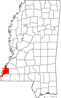 Map of Mississippi highlighting Adams County | |
| CDPs | ||
| Other unincorporated communities | ||
| Ghost towns | ||
| ||