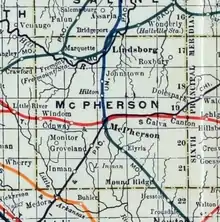
Elyria, Kansas
Elyria is an unincorporated community in McPherson County, Kansas, United States, and located 4 miles (6.4 km) south of McPherson.
Elyria, Kansas | |
|---|---|
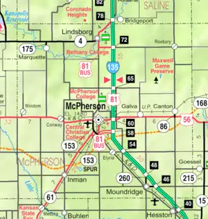 KDOT map of McPherson County (legend) | |
 Elyria  Elyria | |
| Coordinates: 38°17′26″N 97°37′37″W[1] | |
| Country | United States |
| State | Kansas |
| County | McPherson |
| Time zone | UTC-6 (CST) |
| • Summer (DST) | UTC-5 (CDT) |
| Area code | 620 |
History
Early history
For many millennia, the Great Plains of North America was inhabited by nomadic Native Americans. From the 16th century to 18th century, the Kingdom of France claimed ownership of large parts of North America. In 1762, after the French and Indian War, France secretly ceded New France to Spain, per the Treaty of Fontainebleau. In 1802, Spain returned most of the land to France, but keeping title to about 7,500 square miles.
19th century
In 1803, most of the land for modern day Kansas was acquired by the United States from France as part of the 828,000 square mile Louisiana Purchase for 2.83 cents per acre. In 1848, after the Mexican–American War, the Treaty of Guadalupe Hidalgo with Spain brought into the United States all or part of land for ten future states, including southwest Kansas. In 1854, the Kansas Territory was organized, then in 1861 Kansas became the 34th U.S. state. In 1867, McPherson County was established within the Kansas Territory, which included the land for modern day Elyria.
Elyria was a shipping point on the Missouri Pacific Railroad.[2] It was named after Elyria, Ohio.[3]
A post office was moved from King City to Elyria in 1887 then it existed until 1954.[4]
Education
The community is served by Moundridge USD 423 public school district.
Elyria is home of the Elyria Christian School, a private elementary and secondary school.
References
- Geographic Names Information System (GNIS) details for Elyria, Kansas; United States Geological Survey (USGS); October 13, 1978.
- Blackmar, Frank Wilson (1912). Kansas: A Cyclopedia of State History, Embracing Events, Institutions, Industries, Counties, Cities, Towns, Prominent Persons, Etc. Standard Publishing Company. pp. 585.
- "Profile for Elyria, Kansas". ePodunk. Retrieved 14 June 2014.
- "Kansas Post Offices, 1828-1961 (archived)". Kansas Historical Society. Archived from the original on October 9, 2013. Retrieved 14 June 2014.
Further reading
External links
- McPherson County Map, KDOT
Municipalities and communities of McPherson County, Kansas, United States | ||
|---|---|---|
| Cities | 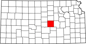 Map of Kansas highlighting McPherson County | |
| Unincorporated communities | ||
| Townships |
| |
| Footnotes | †This populated place is designated a Census-Designated Place (CDP) by the United States Census Bureau | |
| ||
