Emmet Township, Emmet County, Iowa
Emmet Township is one of twelve townships in Emmet County, Iowa, USA. As of the 2000 census, its population was 178.[1]
Emmet Township | |
|---|---|
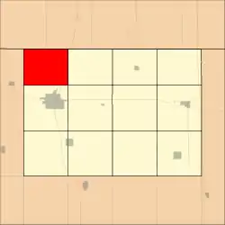 Location in Emmet County | |
| Coordinates: 43°27′43″N 94°51′23″W | |
| Country | |
| State | |
| County | Emmet |
| Area | |
| • Total | 73.6 km2 (28.42 sq mi) |
| • Land | 72.78 km2 (28.1 sq mi) |
| • Water | 0.82 km2 (0.32 sq mi) 1.11% |
| Elevation | 405 m (1,329 ft) |
| Population (2000) | |
| • Total | 178 |
| • Density | 2.4/km2 (6.3/sq mi) |
| Time zone | UTC-6 (CST) |
| • Summer (DST) | UTC-5 (CDT) |
| ZIP code | 51334 |
| GNIS feature ID | 0467791 |
History
Emmet Township is named from the county. It was created prior to 1876, but the exact date is unknown because records were lost in a courthouse fire.[2]
Geography
According to the United States Census Bureau, Emmet Township covers an area of 28.42 square miles (73.6 square kilometers); of this, 28.1 square miles (72.78 square kilometers, 98.89 percent) is land and 0.32 square miles (0.82 square kilometers, 1.11 percent) is water.
Adjacent townships
- Ellsworth Township (east)
- Center Township (southeast)
- Estherville Township (south)
- Richland Township, Dickinson County (southwest)
- Superior Township, Dickinson County (west)
Major highways
Lakes
- Eagle Lake
School districts
- Estherville Lincoln Central Community School District
Political districts
- Iowa's 4th congressional district
- State House District 7
- State Senate District 4
References
- United States Census Bureau 2008 TIGER/Line Shapefiles
- United States Board on Geographic Names (GNIS)
- United States National Atlas
- "U.S. Census website". Retrieved 2009-05-07.
- History of Emmet County and Dickinson County, Iowa. Pioneer Publishing Company. 1917. pp. 115.
External links
Municipalities and communities of Emmet County, Iowa, United States | ||
|---|---|---|
| Cities | Map of Iowa highlighting Emmet County | |
| Townships | ||
| Unincorporated communities | ||
| ||
This article is issued from Wikipedia. The text is licensed under Creative Commons - Attribution - Sharealike. Additional terms may apply for the media files.