Enguinegatte
Enguinegatte (West Flemish: Ingwinegate) is a town and former commune in the Pas-de-Calais department in the Hauts-de-France region of France.
Enguinegatte
Ingwinegate | |
|---|---|
Part of Enquin-lez-Guinegatte | |
 Coat of arms | |
Location of Enguinegatte 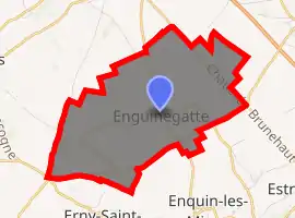
| |
 Enguinegatte  Enguinegatte | |
| Coordinates: 50°36′32″N 2°16′19″E | |
| Country | France |
| Region | Hauts-de-France |
| Department | Pas-de-Calais |
| Arrondissement | Saint-Omer |
| Canton | Fruges |
| Commune | Enquin-lez-Guinegatte |
| Area 1 | 8.92 km2 (3.44 sq mi) |
| Population (2017)[1] | 447 |
| • Density | 50/km2 (130/sq mi) |
| Time zone | UTC+01:00 (CET) |
| • Summer (DST) | UTC+02:00 (CEST) |
| Postal code | 62145 |
| Elevation | 51–132 m (167–433 ft) (avg. 92 m or 302 ft) |
| 1 French Land Register data, which excludes lakes, ponds, glaciers > 1 km2 (0.386 sq mi or 247 acres) and river estuaries. | |
The commune merged with Enquin-les-Mines on 1 January 2017 to form the commune nouvelle of Enquin-lez-Guinegatte.[2] Its population was 447 in 2017.[1]
Geography
Enguinegatte is a farming village situated 10 miles (16 km) southwest of Saint-Omer, at the D77 and D158E2 crossroads.
Population
| Year | 1962 | 1968 | 1975 | 1982 | 1990 | 1999 |
|---|---|---|---|---|---|---|
| Population | 340 | 381 | 367 | 354 | 388 | 365 |
| From the year 1962 on: No double counting—residents of multiple communes (e.g. students and military personnel) are counted only once. | ||||||
History
Known as Guinegate in medieval times, it is the site of several late 15th and early 16th century battles. The first was the Battle of Guinegate, the later and more famous, the Battle of the Spurs, in 1513.
The village was largely destroyed in the Second World War.
Places of interest
- The church of St.Jacques, dating from the eighteenth century.
References
- Téléchargement du fichier d'ensemble des populations légales en 2017, INSEE
- Arrêté préfectoral 30 June 2016 (in French)
External links
| Wikimedia Commons has media related to Enguinegatte. |
| Authority control |
|
|---|
This article is issued from Wikipedia. The text is licensed under Creative Commons - Attribution - Sharealike. Additional terms may apply for the media files.
