Evadale, Texas
Evadale is an unincorporated community and census-designated place (CDP) in Jasper County, Texas, United States. The population was 1,483 at the 2010 census.[3]
Evadale, Texas | |
|---|---|
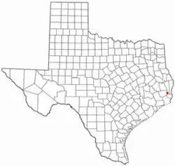 Location of Evadale, Texas | |
 | |
| Coordinates: 30°21′13″N 94°3′55″W | |
| Country | United States |
| State | Texas |
| County | Jasper |
| Area | |
| • Total | 17.7 sq mi (45.8 km2) |
| • Land | 17.0 sq mi (44.1 km2) |
| • Water | 0.7 sq mi (1.7 km2) |
| Elevation | 46 ft (14 m) |
| Population (2010) | |
| • Total | 1,483 |
| • Density | 87/sq mi (33.6/km2) |
| Time zone | UTC-6 (Central (CST)) |
| • Summer (DST) | UTC-5 (CDT) |
| ZIP code | 77615 |
| Area code(s) | 409 |
| FIPS code | 48-24840[1] |
| GNIS feature ID | 1335544[2] |
Geography
Evadale is located in southern Jasper County at 30°21′13″N 94°3′55″W (30.353492, -94.065332).[4] It is bordered to the west by the Neches River, which forms the Hardin County line.
U.S. Route 96 passes through the community, leading northeast 9 miles (14 km) to Buna and west 6 miles (10 km) to Silsbee. Farther afield, Jasper is 43 miles (69 km) north via US-96, and Beaumont is 26 miles (42 km) to the southwest.
According to the United States Census Bureau, the Evadale CDP has a total area of 17.7 square miles (45.8 km2), of which 17.0 square miles (44.1 km2) are land and 0.66 square miles (1.7 km2), or 3.78%, are water.[3]
Demographics
As of the census[1] of 2000, there were 1,430 people, 537 households, and 407 families residing in the CDP. The population density was 83.9 people per square mile (32.4/km2). There were 591 housing units at an average density of 34.7 per square mile (13.4/km2). The racial makeup of the CDP was 98.95% White, 0.07% Native American, 0.42% from other races, and 0.56% from two or more races. Hispanic or Latino of any race were 1.82% of the population.
There were 537 households, out of which 36.5% had children under the age of 18 living with them, 64.2% were married couples living together, 8.8% had a female householder with no husband present, and 24.2% were non-families. 20.9% of all households were made up of individuals, and 9.5% had someone living alone who was 65 years of age or older. The average household size was 2.66 and the average family size was 3.10.
In the CDP, the population was spread out, with 29.1% under the age of 18, 8.0% from 18 to 24, 28.3% from 25 to 44, 22.5% from 45 to 64, and 12.1% who were 65 years of age or older. The median age was 34 years. For every 100 females, there were 95.4 males. For every 100 females age 18 and over, there were 92.8 males.
The median income for a household in the CDP was $30,781, and the median income for a family was $36,813. Males had a median income of $33,438 versus $18,333 for females. The per capita income for the CDP was $13,906. About 12.7% of families and 15.6% of the population were below the poverty line, including 19.7% of those under age 18 and 11.8% of those age 65 or over.
Education
Public education in the community of Evadale is provided by the Evadale Independent School District and home to the Evadale High School Rebels. The district made news in June 2015 for refusing to change their Confederate Flag-inspired crest despite pressure to do so.[5]
Climate
The climate in this area is characterized by hot, humid summers and generally mild to cool winters. According to the Köppen Climate Classification system, Evadale has a humid subtropical climate, abbreviated "Cfa" on climate maps.[6]
References
- "U.S. Census website". United States Census Bureau. Retrieved 2008-01-31.
- "US Board on Geographic Names". United States Geological Survey. 2007-10-25. Retrieved 2008-01-31.
- "Geographic Identifiers: 2010 Census Summary File 1 (G001): Evadale CDP, Texas". American Factfinder. U.S. Census Bureau. Archived from the original on February 13, 2020. Retrieved December 7, 2018.
- "US Gazetteer files: 2010, 2000, and 1990". United States Census Bureau. 2011-02-12. Retrieved 2011-04-23.
- Trejo, Rebecca. "Evadale ISD to keep crest despite Confederate flag pushback". 12 News Now. Archived from the original on 27 June 2015. Retrieved 24 June 2015.
- Climate Summary for Evadale, Texas
Municipalities and communities of Jasper County, Texas, United States | ||
|---|---|---|
| Cities | 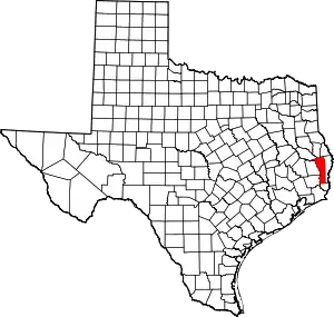 Jasper County map | |
| CDPs | ||
| Other unincorporated communities | ||
| Ghost towns | ||
| Footnotes | ‡This populated place also has portions in an adjacent county or counties | |
| ||