Fairmead, California
Fairmead is a census-designated place[3] in Madera County, California.[2] It is located 11 miles (18 km) northwest of Madera,[4] at an elevation of 253 feet (77 m).[2] The population was 1,447 at the 2010 census.[5]
Fairmead | |
|---|---|
.jpg.webp) California State Route 99 passing through Fairmead | |
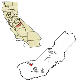 Location of Fairmead in Madera County, California. | |
 Fairmead Location in California | |
| Coordinates: 37°04′35″N 120°11′35″W | |
| Country | |
| State | |
| County | Madera County |
| Area | |
| • Total | 8.360 sq mi (21.652 km2) |
| • Land | 8.360 sq mi (21.652 km2) |
| • Water | 0 sq mi (0 km2) 0% |
| Elevation | 253 ft (77 m) |
| Population (2010) | |
| • Total | 1,447 |
| • Density | 170/sq mi (67/km2) |
| Time zone | UTC-8 (Pacific (PST)) |
| • Summer (DST) | UTC-7 (PDT) |
| GNIS feature IDs | 223335; 2583011 |
| U.S. Geological Survey Geographic Names Information System: Fairmead, California; U.S. Geological Survey Geographic Names Information System: Fairmead, California | |
A post office operated at Fairmead from 1913 to 1940.[4] The community is impacted by the California High-Speed Rail as the planned route will dislocate residents.[6]
Demographics
| Historical population | |||
|---|---|---|---|
| Census | Pop. | %± | |
| U.S. Decennial Census[7] | |||
At the 2010 census Fairmead had a population of 1,447. The population density was 173.1 people per square mile (66.8/km2). The racial makeup of Fairmead was 764 (52.8%) White, 88 (6.1%) African American, 23 (1.6%) Native American, 7 (0.5%) Asian, 0 (0.0%) Pacific Islander, 497 (34.3%) from other races, and 68 (4.7%) from two or more races. Hispanic or Latino of any race were 984 people (68.0%).[8]
The whole population lived in households, no one lived in non-institutionalized group quarters and no one was institutionalized.
There were 360 households, 192 (53.3%) had children under the age of 18 living in them, 216 (60.0%) were opposite-sex married couples living together, 55 (15.3%) had a female householder with no husband present, 24 (6.7%) had a male householder with no wife present. There were 29 (8.1%) unmarried opposite-sex partnerships, and 0 (0%) same-sex married couples or partnerships. 49 households (13.6%) were one person and 20 (5.6%) had someone living alone who was 65 or older. The average household size was 4.02. There were 295 families (81.9% of households); the average family size was 4.34.
The age distribution was 496 people (34.3%) under the age of 18, 163 people (11.3%) aged 18 to 24, 371 people (25.6%) aged 25 to 44, 311 people (21.5%) aged 45 to 64, and 106 people (7.3%) who were 65 or older. The median age was 29.0 years. For every 100 females, there were 112.5 males. For every 100 females age 18 and over, there were 109.0 males.
There were 404 housing units at an average density of 48.3 per square mile, of the occupied units 205 (56.9%) were owner-occupied and 155 (43.1%) were rented. The homeowner vacancy rate was 2.4%; the rental vacancy rate was 8.3%. 770 people (53.2% of the population) lived in owner-occupied housing units and 677 people (46.8%) lived in rental housing units.
Education
Chowchilla School District and Chowchilla Union High School District serve residents of the community.[9]
Notable people
- Bob Helm, jazz clarinetist
References
- U.S. Census Archived 2012-01-24 at WebCite
- U.S. Geological Survey Geographic Names Information System: Fairmead, California
- U.S. Geological Survey Geographic Names Information System: Fairmead, California
- Durham, David L. (1998). California's Geographic Names: A Gazetteer of Historic and Modern Names of the State. Clovis, Calif.: Word Dancer Press. p. 771. ISBN 1-884995-14-4.
- Marcum, Diana (March 2, 2019). "In Central Valley towns, California's bullet train isn't an idea: 'It's people's lives'". Los Angeles Times. Retrieved 5 March 2019.
- https://www.fresnobee.com/news/local/article245636785.html. Missing or empty
|title=(help) - "Census of Population and Housing". Census.gov. Retrieved June 4, 2016.
- "2010 Census Interactive Population Search: CA - Fairmead CDP". U.S. Census Bureau. Archived from the original on July 15, 2014. Retrieved July 12, 2014.
- "School District Reference Map (2010 Census): Madera County, CA" (PDF). U.S. Census Bureau. Retrieved 2020-06-15.
Municipalities and communities of Madera County, California, United States | ||
|---|---|---|
| Cities |  Madera County map | |
| CDPs | ||
| Unincorporated communities |
| |
| Indian reservations | ||
| Ghost towns | ||
| ||