Fargo, Oklahoma
Fargo is a town in Ellis County, Oklahoma, United States. The population was 364 at the 2010 census. Fargo, like many towns in the region, has never fully recovered from the Dust Bowl years.
Fargo, Oklahoma | |
|---|---|
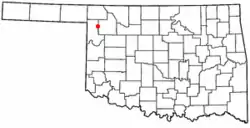 Location of Fargo, Oklahoma | |
| Coordinates: 36°22′24″N 99°37′22″W | |
| Country | United States |
| State | Oklahoma |
| County | Ellis |
| Area | |
| • Total | 0.58 sq mi (1.52 km2) |
| • Land | 0.58 sq mi (1.52 km2) |
| • Water | 0.00 sq mi (0.00 km2) |
| Elevation | 2,110 ft (643 m) |
| Population (2010) | |
| • Total | 364 |
| • Estimate (2019)[2] | 344 |
| • Density | 588.03/sq mi (226.85/km2) |
| Time zone | UTC-6 (Central (CST)) |
| • Summer (DST) | UTC-5 (CDT) |
| ZIP code | 73840 |
| Area code(s) | 580 |
| FIPS code | 40-25450[3] |
| GNIS feature ID | 1092762[4] |
Geography
Fargo is located at 36°22′24″N 99°37′22″W (36.373449, -99.622749).[5]
Fargo is northeast of Gage and southwest of Woodward off Oklahoma State Highway 15.[6]
West Woodward Airport is about 9 miles northeast of town.[7]
According to the United States Census Bureau, the town has a total area of 0.6 square miles (1.6 km2), all land.
Demographics
| Historical population | |||
|---|---|---|---|
| Census | Pop. | %± | |
| 1910 | 341 | — | |
| 1920 | 258 | −24.3% | |
| 1930 | 325 | 26.0% | |
| 1940 | 291 | −10.5% | |
| 1950 | 318 | 9.3% | |
| 1960 | 291 | −8.5% | |
| 1970 | 262 | −10.0% | |
| 1980 | 409 | 56.1% | |
| 1990 | 299 | −26.9% | |
| 2000 | 326 | 9.0% | |
| 2010 | 364 | 11.7% | |
| 2019 (est.) | 344 | [2] | −5.5% |
| U.S. Decennial Census[8] | |||
As of the census[3] of 2000, there were 326 people, 124 households, and 93 families residing in the town. The population density was 556.5 people per square mile (213.3/km2). There were 146 housing units at an average density of 249.2 per square mile (95.5/km2). The racial makeup of the town was 90.80% White, 3.07% Native American, and 6.13% from two or more races. Hispanic or Latino of any race were 1.84% of the population.
There were 124 households, out of which 40.3% had children under the age of 18 living with them, 62.9% were married couples living together, 6.5% had a female householder with no husband present, and 25.0% were non-families. 24.2% of all households were made up of individuals, and 12.9% had someone living alone who was 65 years of age or older. The average household size was 2.63 and the average family size was 3.10.
In the town, the population was spread out, with 31.3% under the age of 18, 7.4% from 18 to 24, 26.4% from 25 to 44, 24.2% from 45 to 64, and 10.7% who were 65 years of age or older. The median age was 35 years. For every 100 females, there were 90.6 males. For every 100 females age 18 and over, there were 91.5 males.
The median income for a household in the town was $29,750, and the median income for a family was $32,625. Males had a median income of $27,083 versus $16,042 for females. The per capita income for the town was $12,748. About 9.3% of families and 12.5% of the population were below the poverty line, including 25.0% of those under age 18 and none of those age 65 or over.
Parks, recreation and attractions
Fargo City Park features include a working windmill and tank, a children's playground, and a covered walking bridge.[9]
Fort Supply Lake is to the north-northeast of town.[6]
The Stock Exchange Bank on Main Street is on the National Register of Historic Places listings in Ellis County, Oklahoma.
Wind energy
The OU Spirit windfarm (a/k/a Keenan I) is east-southeast of Fargo;[10] and has 101 MW capacity.[11]
The Keenan II windfarm is southeast of Fargo,[12] and has 152 MW capacity.[11]
References
- "2019 U.S. Gazetteer Files". United States Census Bureau. Retrieved July 28, 2020.
- "Population and Housing Unit Estimates". United States Census Bureau. May 24, 2020. Retrieved May 27, 2020.
- "U.S. Census website". United States Census Bureau. Retrieved 2008-01-31.
- "US Board on Geographic Names". United States Geological Survey. 2007-10-25. Retrieved 2008-01-31.
- "US Gazetteer files: 2010, 2000, and 1990". United States Census Bureau. 2011-02-12. Retrieved 2011-04-23.
- "Fargo, Oklahoma". Google Maps. Retrieved August 11, 2020.
- "West Woodward Airport to Fargo, Oklahoma". Google Maps. Retrieved December 29, 2020.
- "Census of Population and Housing". Census.gov. Retrieved June 4, 2015.
- "Dick Hamilton". Woodward News, June 25, 2019. Retrieved August 11, 2020.
- "OU Spirit Wind Farm". Google Maps. Retrieved August 11, 2020.
- "Wind Energy Industry Impacts in Oklahoma" (PDF). State Chamber of Oklahoma Research Foundation, November 2015. Retrieved August 11, 2020.
- "Keenan II Wind Farm". Google Maps. Retrieved August 11, 2020.
External links
Municipalities and communities of Ellis County, Oklahoma, United States | ||
|---|---|---|
| Towns | 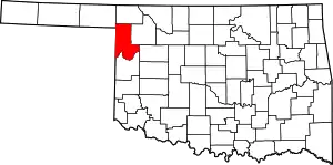 Ellis County map | |
| Unincorporated communities | ||
| Ghost town | ||
| ||