Faro, Missouri
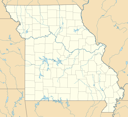
Faro is an unincorporated community in Twelvemile Township in Madison County, Missouri, United States.[1] The community was located on Captain Creek, approximately one mile northeast of the St. Francis River.[2] The community site is located on Missouri Route O between Arnett Mountain to the north and Rock Pile Mountain to the south.[3]
Faro, Missouri | |
|---|---|
 Faro, Missouri | |
| Coordinates: 37°26′50″N 90°26′15″W | |
| Country | United States |
| State | Missouri |
| County | Madison |
| Elevation | 584 ft (178 m) |
| Time zone | UTC-6 (Central (CST)) |
| • Summer (DST) | UTC-5 (CDT) |
| Area code(s) | 573 |
| GNIS feature ID | 749903[1] |
A post office called Faro was established in 1905, and remained in operation until 1942.[4] Faro is believed to be an invented name which holds no special significance.[5]
Notes
- "Faro, Missouri". Geographic Names Information System. United States Geological Survey.
- Coldwater, Missouri, 15 Minute Topographic Quadrangle, USGS, 1930 (1951 ed.)
- Missouri Atlas & Gazetteer, DeLorme, 1998, First edition, p. 57, ISBN 0-89933-224-2
- "Post Offices". Jim Forte Postal History. Retrieved 31 October 2016.
- "Madison County Place Names, 1928–1945". The State Historical Society of Missouri. Archived from the original on June 24, 2016. Retrieved October 31, 2016.
Municipalities and communities of Madison County, Missouri, United States | ||
|---|---|---|
| Cities | 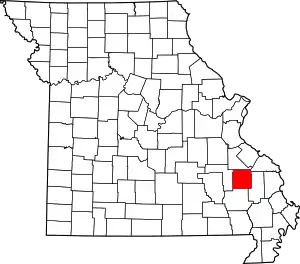 Map of Missouri highlighting Madison County | |
| Villages | ||
| Townships | ||
| CDPs | ||
| Other unincorporated communities | ||
| Abandoned villages | ||
| ||
This article is issued from Wikipedia. The text is licensed under Creative Commons - Attribution - Sharealike. Additional terms may apply for the media files.
