Faxinal
Faxinal is a municipality in the state of Paraná in the Southern Region of Brazil.[2][3][4][5]
Faxinal | |
|---|---|
Municipality | |
 Flag  Seal | |
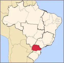
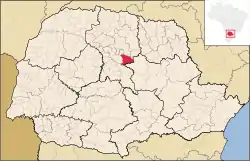 Location in Paraná | |
 Faxinal Location in Brazil | |
| Coordinates: 24°00′03″S 51°19′12″W | |
| Country | |
| Region | Southern |
| State | Paraná |
| Mesoregion | Norte Central Paranaense |
| Area | |
| • Total | 276.427 sq mi (715.943 km2) |
| Elevation | 2,690 ft (820 m) |
| Population (2020 [1]) | |
| • Total | 17,316 |
| • Density | 63/sq mi (24/km2) |
| Time zone | UTC -3 |
History
The colonization of the Faxinal region is relatively recent, although there are historical signs of Jesuit occupation on the banks of the Ivaí River. However, it was only in the twentieth century, after the 1930s, that the concession of land by the state government to an English colonizer, led to the occupation of the territory.
A small and peaceful town, the main source of income for the population is found in agriculture and retail trade. Its economy is in full development and expansion, and with the arrival of new industries in the agricultural sector, the municipality had a substantial increase in the number of job vacancies in the market. Each day, Faxinal establishes itself as the 'Capital of Tomato' due to the growing number of greenhouses growing this the tomato, thereby improving the city's economy.
See also
References
- IBGE 2020
- "Divisão Territorial do Brasil" (in Portuguese). Divisão Territorial do Brasil e Limites Territoriais, Instituto Brasileiro de Geografia e Estatística (IBGE). July 1, 2008. Retrieved December 17, 2009.
- "Estimativas da população para 1º de julho de 2009" (PDF) (in Portuguese). Estimativas de População, Instituto Brasileiro de Geografia e Estatística (IBGE). August 14, 2009. Retrieved December 17, 2009.
- "Ranking decrescente do IDH-M dos municípios do Brasil" (in Portuguese). Atlas do Desenvolvimento Humano, Programa das Nações Unidas para o Desenvolvimento (PNUD). 2000. Archived from the original on October 3, 2009. Retrieved December 17, 2009.
- "Produto Interno Bruto dos Municípios 2002-2005" (PDF) (in Portuguese). Instituto Brasileiro de Geografia e Estatística (IBGE). December 19, 2007. Archived from the original (PDF) on October 2, 2008. Retrieved December 17, 2009.