Fenny Drayton
Fenny Drayton (formerly Drayton-in-the-Clay) is an English village in the Leicestershire district of Hinckley and Bosworth.[1] The population is counted in with the civil parish of Witherley. It lies near the county border with Warwickshire, three miles north-east of Atherstone in the Coventry postcode area, just off the A444, the Roman road called Watling Street. It is crossed by another Roman road at the end of the scenic Fenn Lanes. The village is four miles from Stoke Golding, where Henry VII of England was crowned after the Battle of Bosworth in 1485. The reinterment of Richard III of England's mortal remains on 21 March 2015 started along Fenn Lanes, near the village.
| Fenny Drayton | |
|---|---|
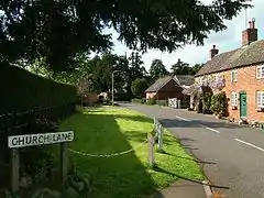 Church Lane, Fenny Drayton | |
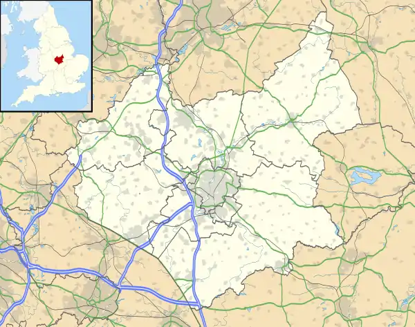 Fenny Drayton Location within Leicestershire | |
| District | |
| Shire county | |
| Region | |
| Country | England |
| Sovereign state | United Kingdom |
| Post town | NUNEATON |
| Postcode district | CV13 |
| Police | Leicestershire |
| Fire | Leicestershire |
| Ambulance | East Midlands |
| UK Parliament | |
Education
Schoolchildren mostly attend St Margaret's Church of England Primary School and St Martin's Catholic Academy in Stoke Golding or the independent Dixie Grammar School in Market Bosworth.
Church
The Grade II listed Anglican Church of St Michael and All Angels in the Diocese of Leicester is in Gothic style with 12th-century Norman features and a 13th-century bell tower. It is surrounded by one of the oldest circles of giant yew trees in the United Kingdom. There are two important monuments of the Purefoy family dating back to 1543 in the church grounds. One has an incised slab which is rare. The church is open to the public free of charge by appointment.[2]
George Fox
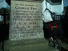
George Fox, founder of the Religious Society of Friends, was born in Drayton-on-the-Clay in July 1624. His father, Christopher, was a weaver and churchwarden.[3] Fox is reputed to have been baptised in the older of the two fonts in the church. There is a large monument to him where two roads, George Fox Lane and Old Forge Road, meet. Quakers from all over the world sign the church visitors' book.
Centre of England
In 2002, the Ordnance Survey defined Lindley Hall Farm on the outskirts of the village as the geographical centre of England.[4] (SP362964) Coordinates are 52°33′42.942″N 1°27′53.474″W Grid Reference SP36373.66 96143.05
See also
- Meriden, Warwickshire, 18 kilometres (11 mi) south, previously thought to be the geographical centre of England.
- Coton in the Elms, Derbyshire, 24 kilometres (15 mi) north, is "furthest point from the sea" in Great Britain.
References
- OS Explorer Map 232 : Nuneaton & Tamworth: (1:25 000) :ISBN 0 319 46404 0
- Listing text. Retrieved 24 October 2020.
- Nigel Smith: Introduction. In: (George Fox: The Journal, p. 3) (London: Penguin Books, 1998), p. x. "My father's name was Christopher Fox; he was by profession a weaver, an honest man; and there was a seed of God in him. The neighbours called him Righteous Christer."
- Haran, Brady (22 October 2002). "A tale of two centres". BBC News.
External links
![]() Media related to Fenny Drayton at Wikimedia Commons
Media related to Fenny Drayton at Wikimedia Commons